Issued: Tuesday, November 11, 2025 – 10:03 AM CST
Happy Veteran’s Day, North Texas!
To every veteran and active-duty service member in the DFW Metroplex and beyond – thank you. Your courage, sacrifice, and dedication keep our nation strong. Today, we honor you with gratitude that words alone can’t fully express.
Whether you’re marching in a parade, attending a ceremony, or simply spending the day with family, here’s what North Texas weather has in store.
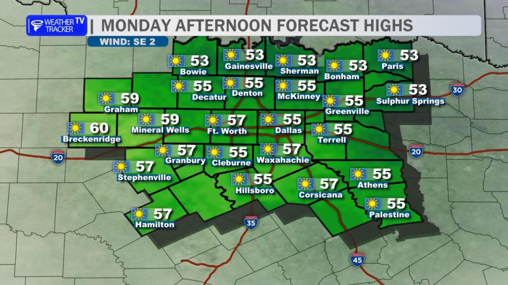
🌞 Today’s Forecast (Tuesday, Nov 11)
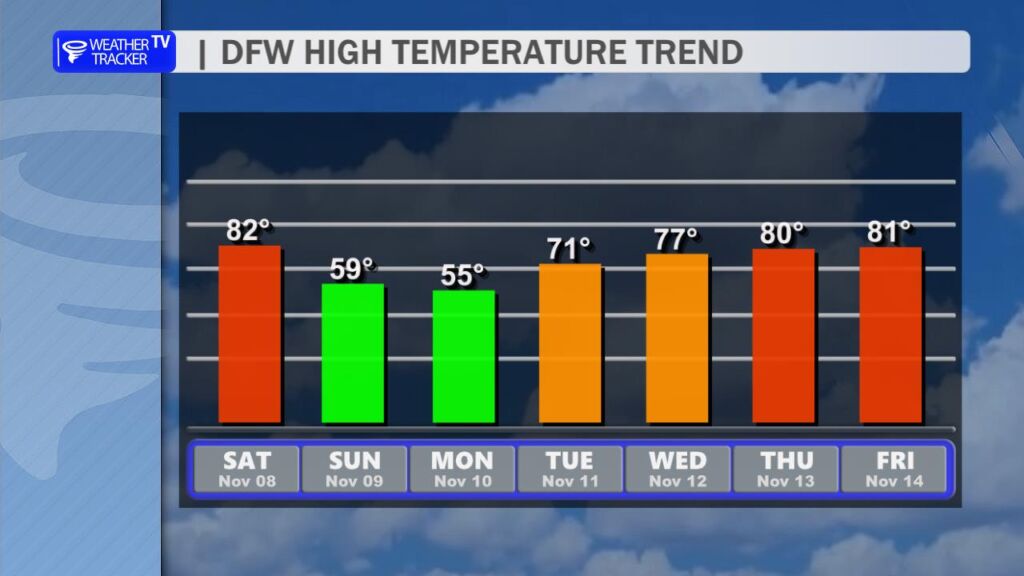
High: 71° (DFW Metroplex)
Conditions: Sunny, dry, and seasonably mild
Winds: South-southwest 15–25 mph, gusts up to 30 mph
Humidity: Very low (20–30%)
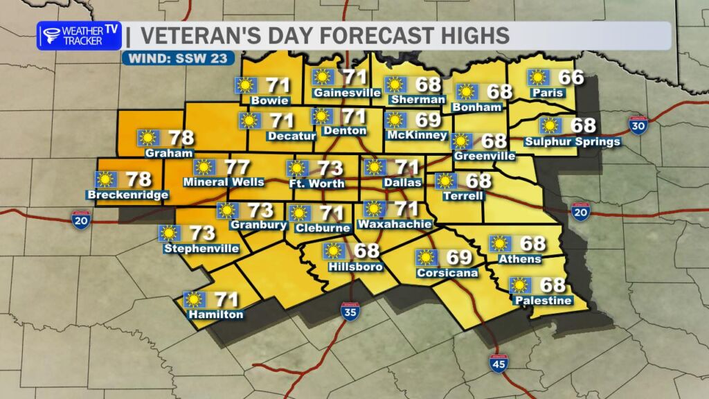
Bottom Line: A gorgeous fall day for Veteran’s Day events. Just secure loose items (flags, tents, chairs).
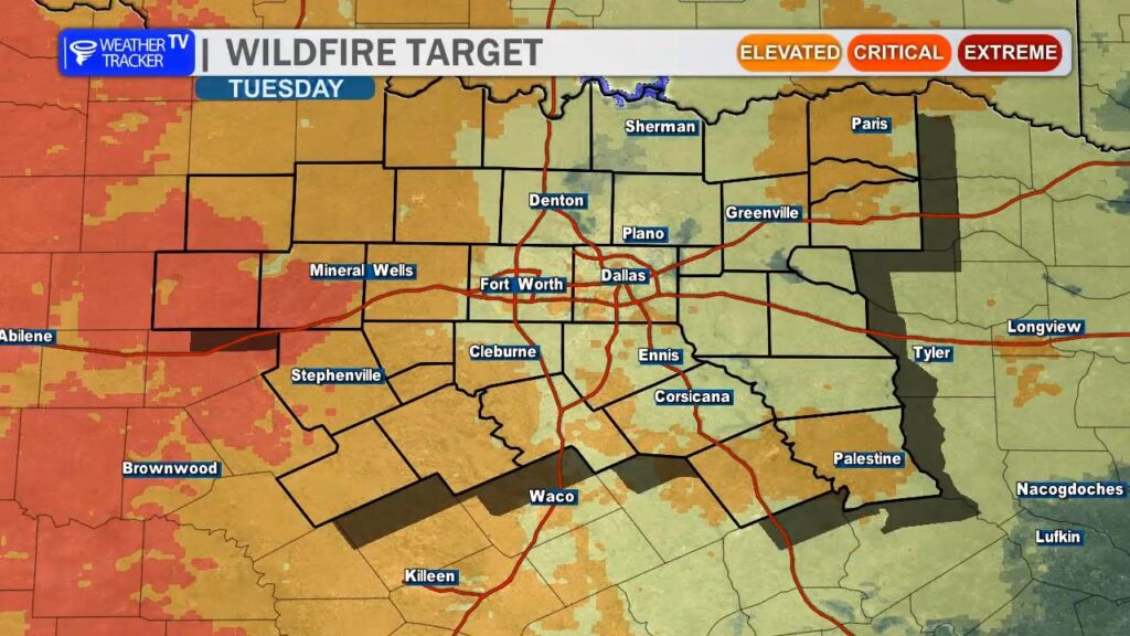
🔥 Elevated Fire Danger Today
- Peak gusts near 30 mph + low humidity = high wildfire risk
- Outdoor burning is strongly discouraged across all of North Texas
- Avoid sparks: no open flames, discard cigarettes properly, and park vehicles away from dry grass
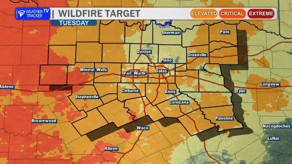
Counties under heightened concern: Dallas, Tarrant, Collin, Denton, Parker, Wise, and points west toward the Big Country.
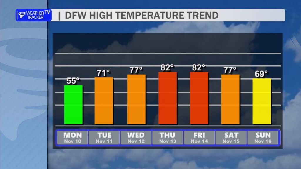
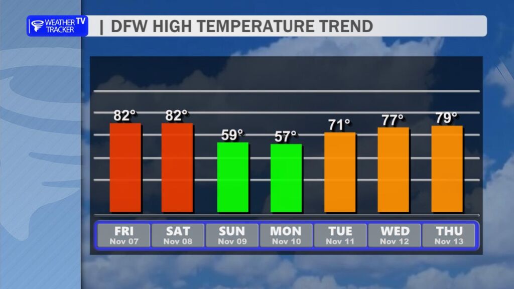
📈 Rest of the Work Week: Warming Trend Ahead
| Day | High | Low | Conditions | Notes |
|---|---|---|---|---|
| Wed | 77° | 50° | Mostly sunny | Light wind |
| Thu | 82° | 57° | Sunny, warmer | Feels like early fall |
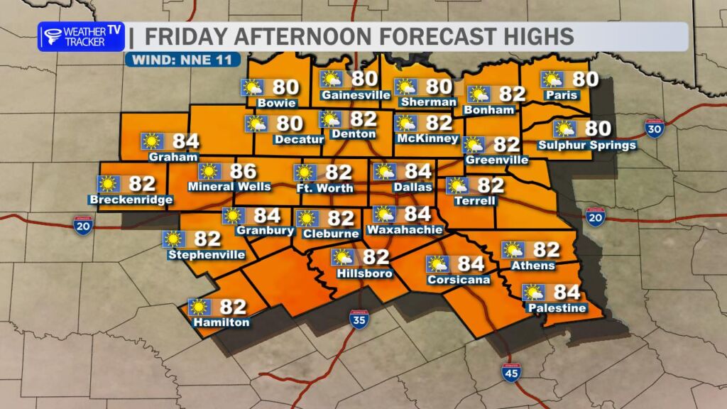
| Fri | 82° | 62° | Partly cloudy | Warmth Continues |
A slow-moving ridge of high pressure will dominate, pushing temps 5–10° above normal by late week.
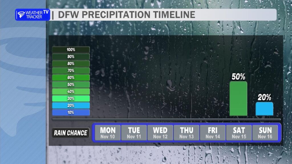
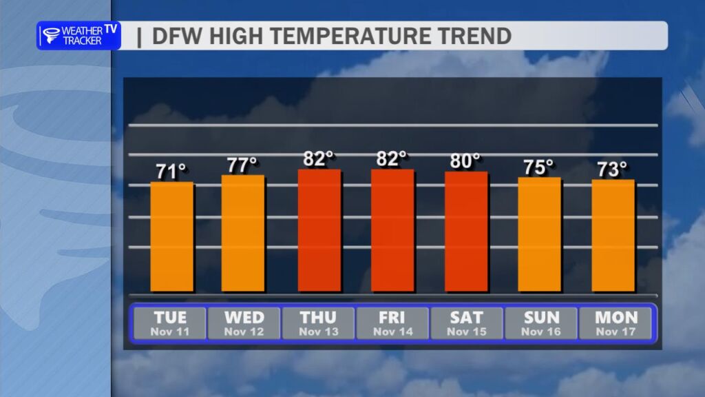
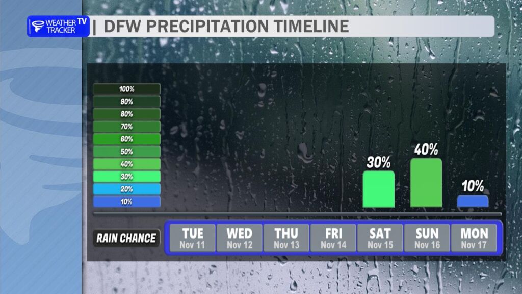
🌧️ Weekend Storm System: Rain Chances Returning
Confidence: Moderate (timing/track still uncertain)
Potential Impacts:
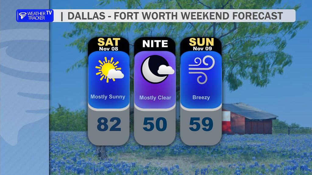
- Scattered showers/storms possible Saturday night into Sunday
- Rain totals: 0.25″–0.75″ (locally higher north/east of DFW)
- Severe threat: Low, but gusty winds possible in stronger cells
- Cooler air follows: Highs drop back into the 70s early next week
Timeline Jiggle Alert: Models do not agree on the storm’s speed and track. So the forecast will continue to change some as we get closer to the weekend.
- Earlier arrival (Sat afternoon): More widespread rain
- Later arrival (Sun Evening): Drier Saturday, wet Sunday Late
🎖️ Parade & Event Weather Highlights
- Dallas Veterans Day Parade (Downtown): Sunny, near 60 at 11 AM, winds gusting 25–30 mph
- Fort Worth Parade: 60s kickoff, gusty but dry
- Arlington Ceremony (Veterans Park): Mild & sunny – perfect for photos