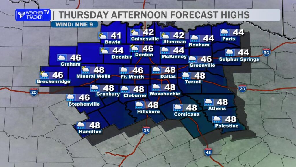
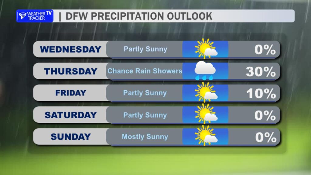
Good Thursday morning, North Texas!
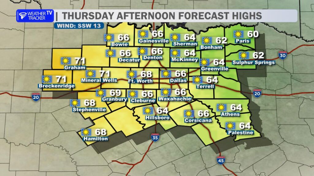
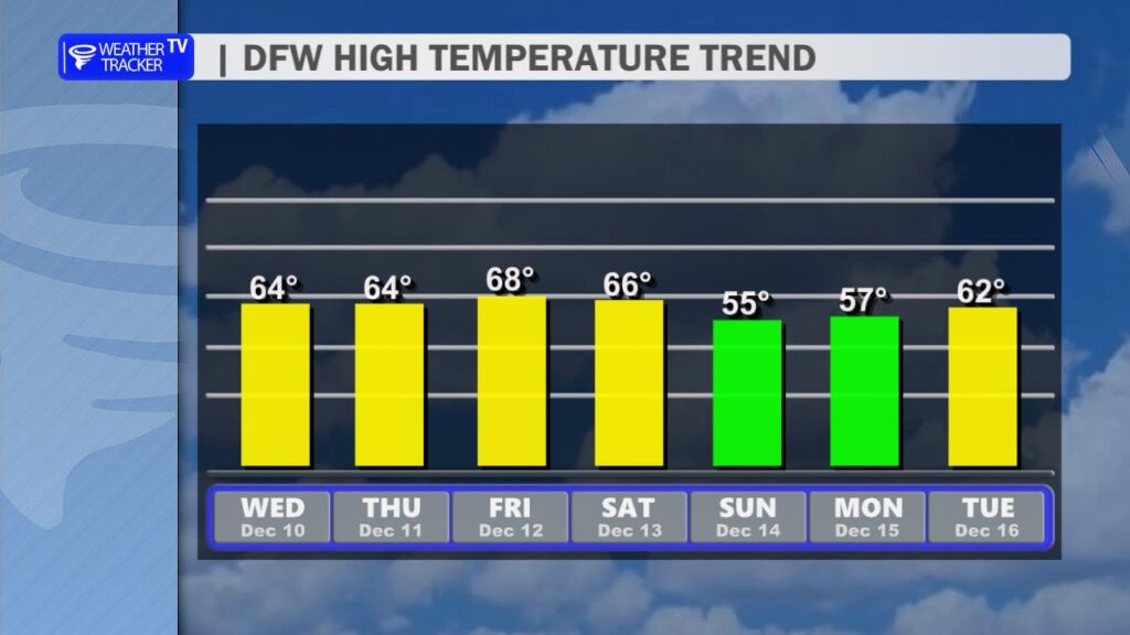
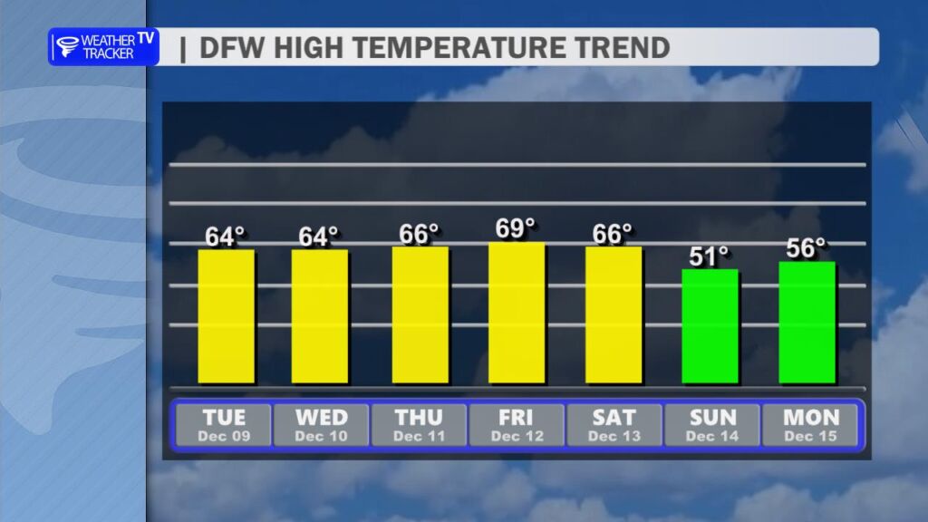
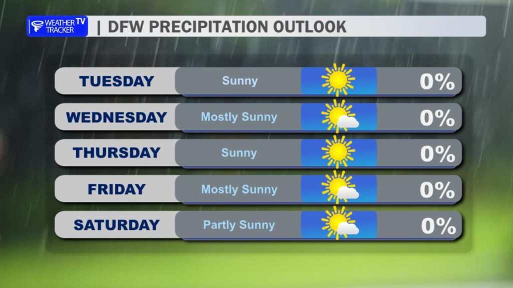
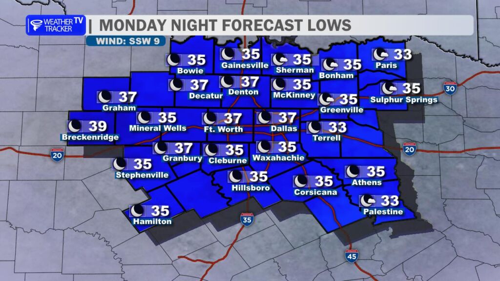
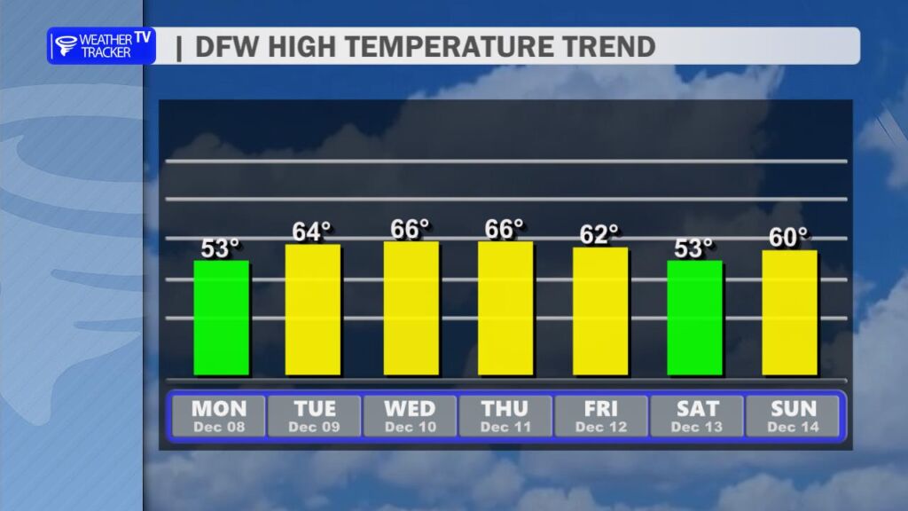
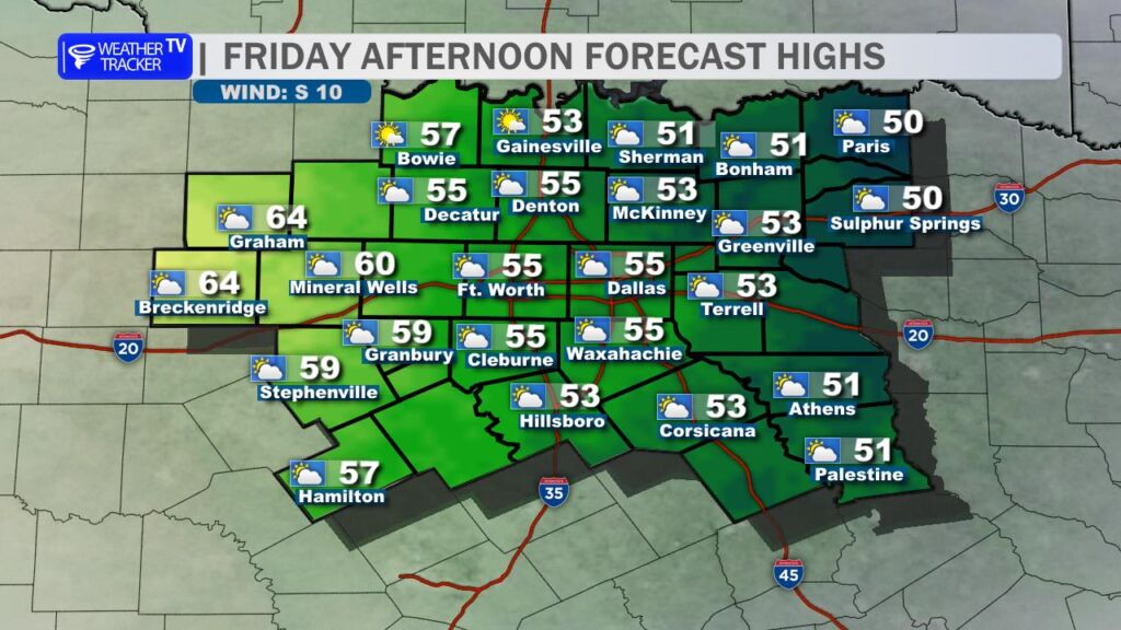
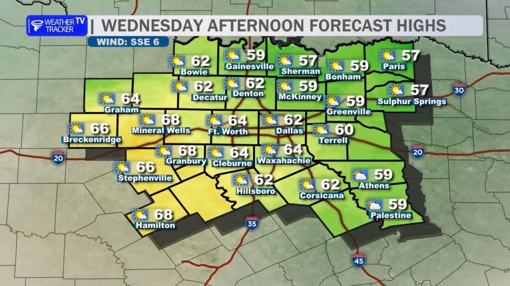
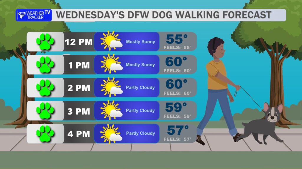
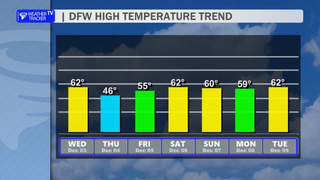
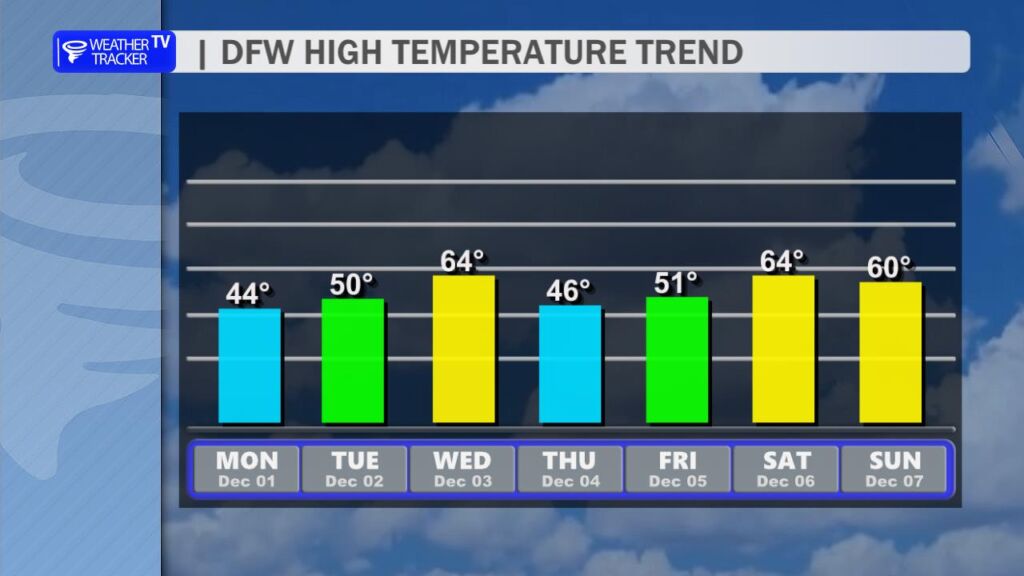
We’re off to a chilly start this morning with temperatures dipping into the 30s and 40s across the region, but don’t let that fool you – much milder conditions are on the way for the afternoon. Southerly winds will pick up under plenty of sunshine, helping temperatures rebound nicely into the mid-to-upper 60s for most areas. Out in our western counties, a few spots could even touch the lower 70s. It’s a perfect afternoon to get outside and enjoy the sunny skies.
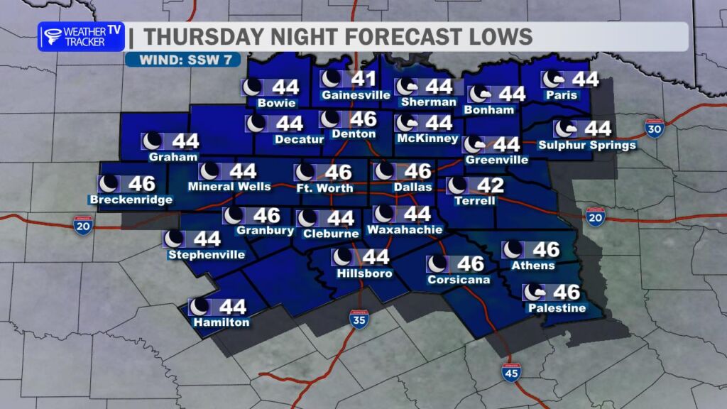
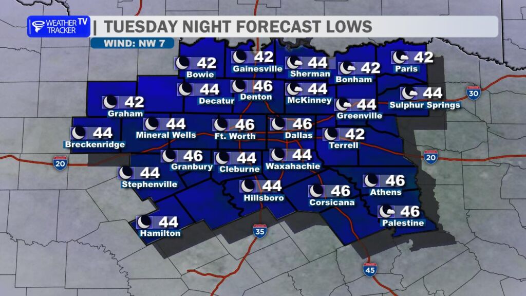
Tonight, expect a cooler drop into the 40s under fair skies and light winds.
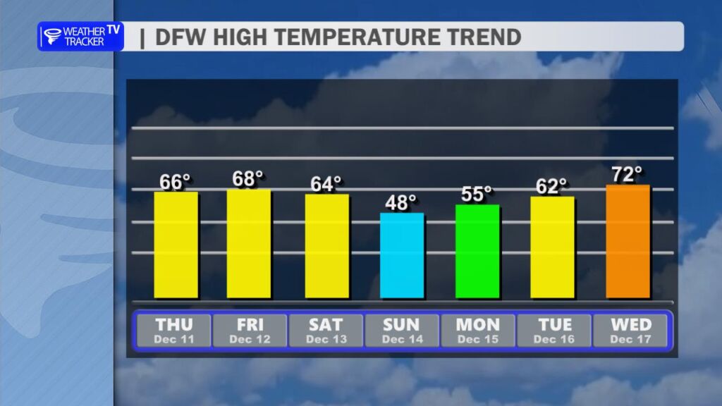
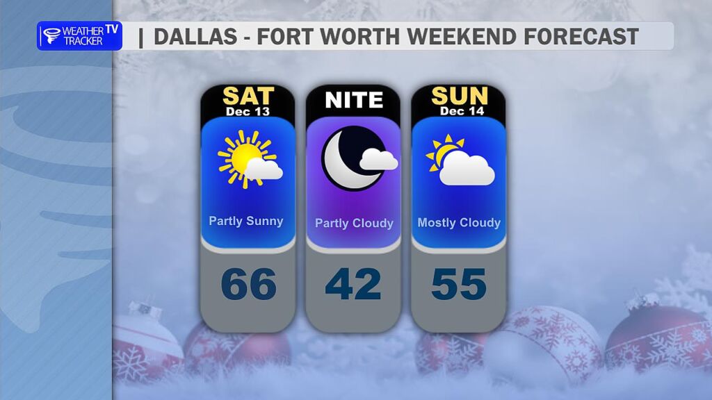
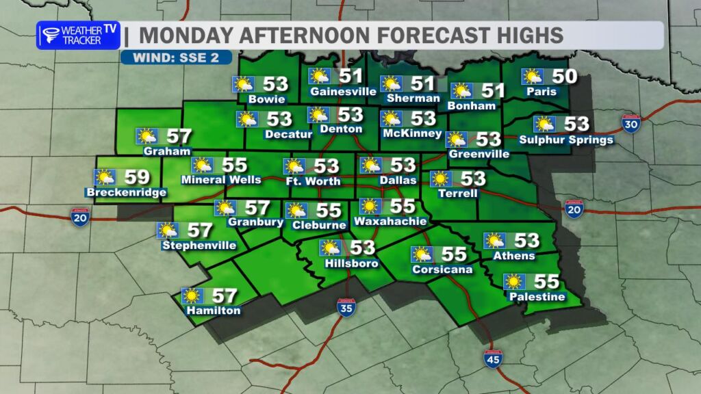
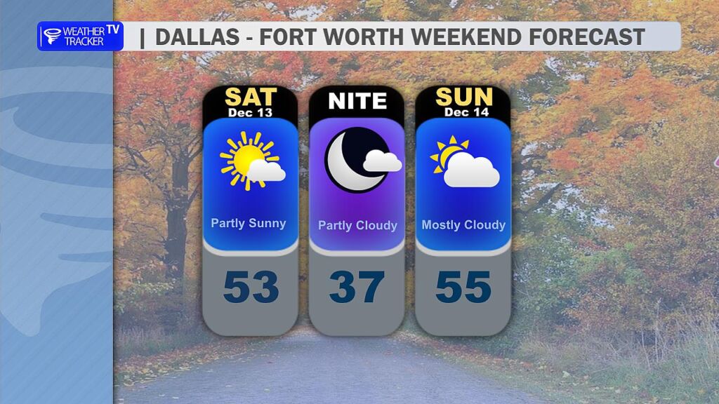
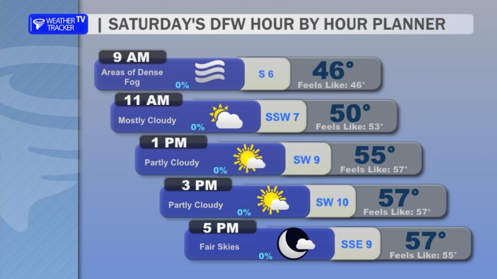
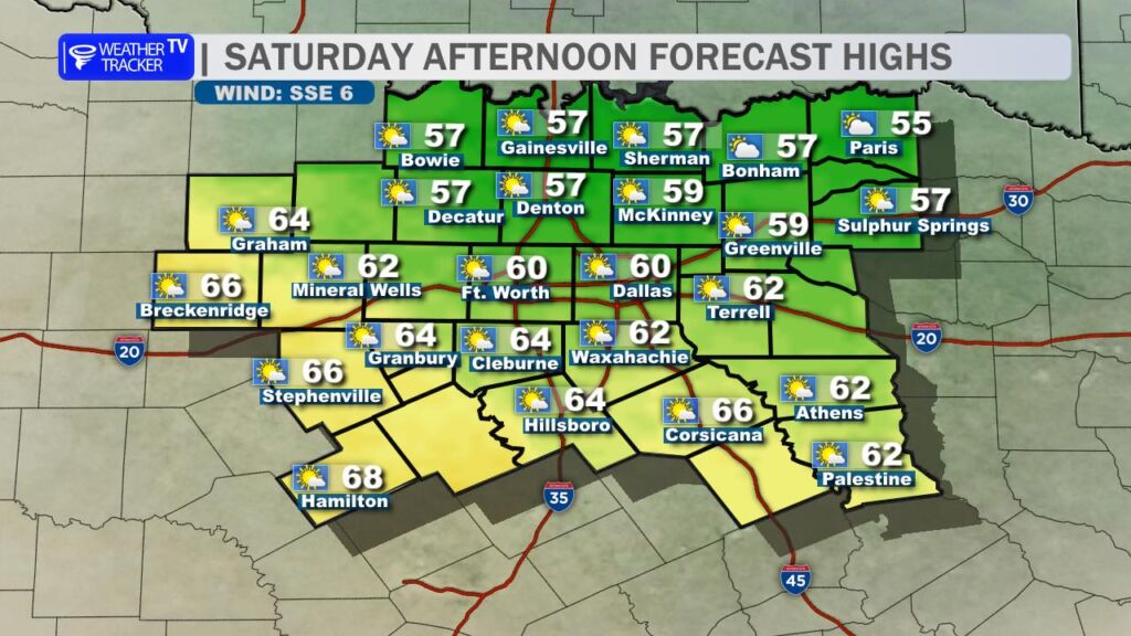
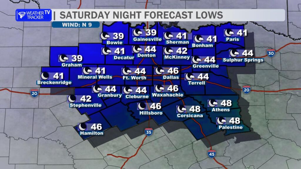
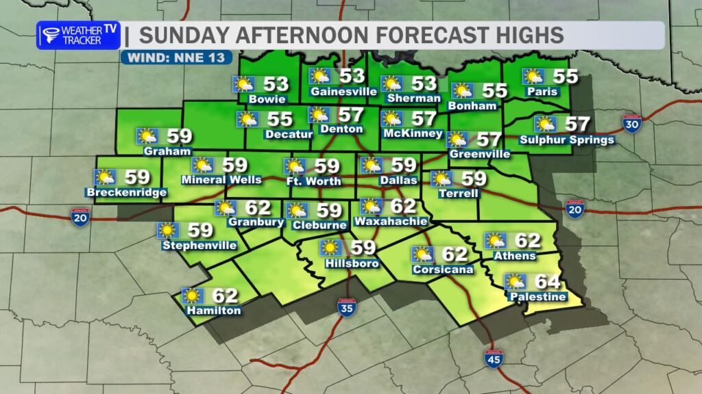
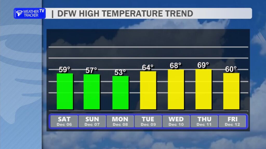
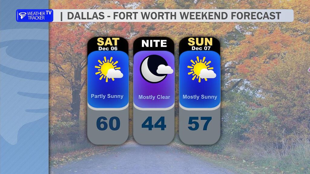
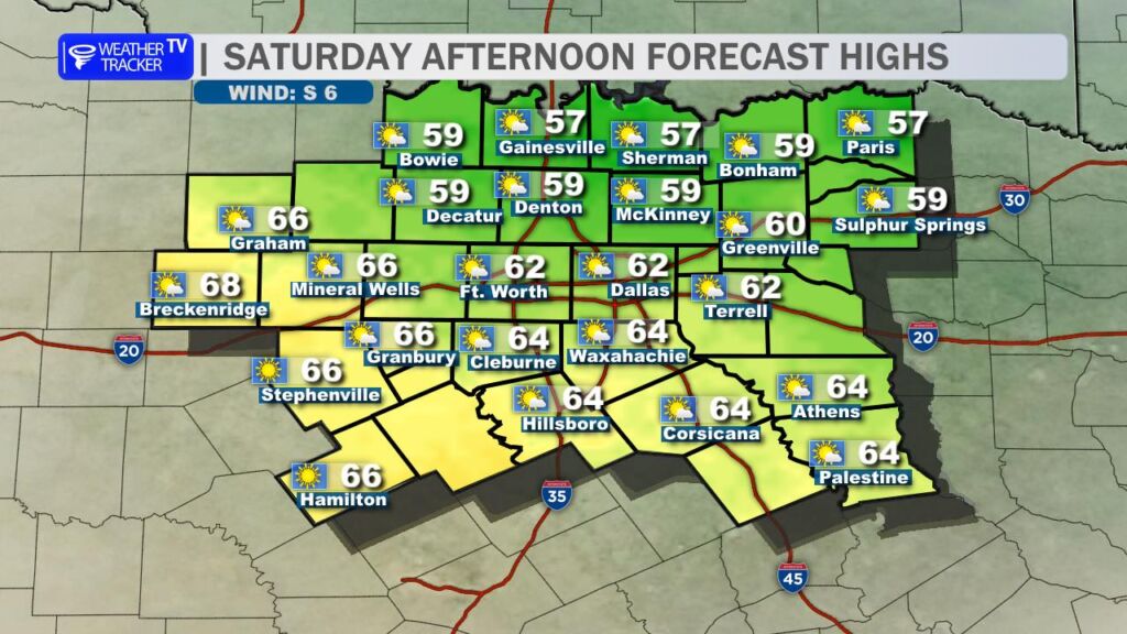
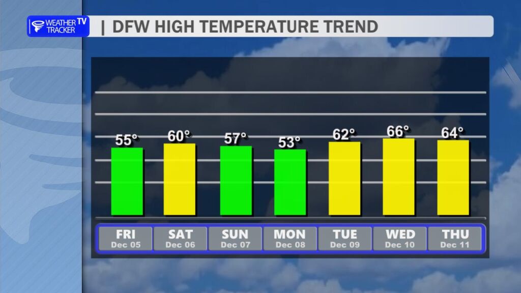
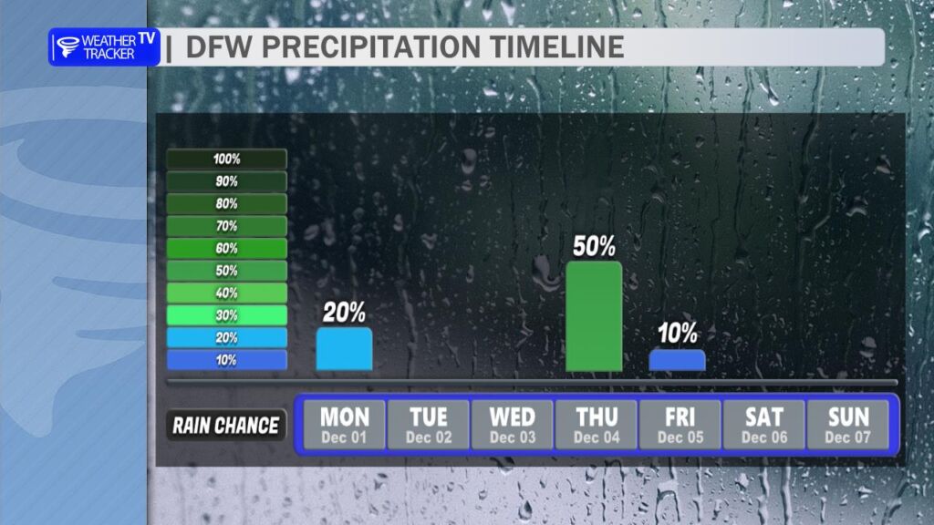
Looking ahead, those pleasant 60s for highs will stick around through Saturday. But keep an eye on Saturday evening: a strong cold front is set to sweep through the area, ushering in much colder air. Sunday will feel sharply different, with highs struggling to reach the upper 40s to near 50 degrees – a classic North Texas chilldown. There’s also a slim chance for a couple of light showers in our southeastern counties late Saturday night as the front passes.
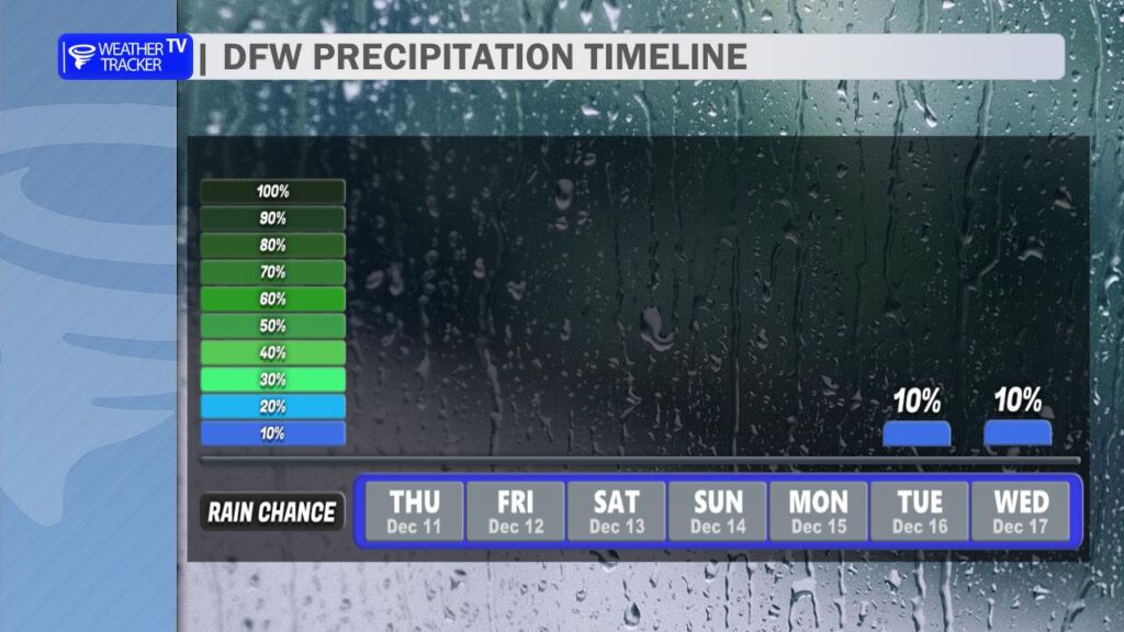
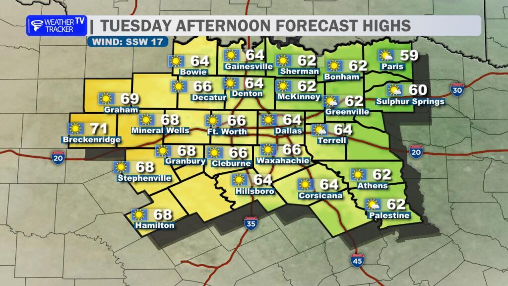
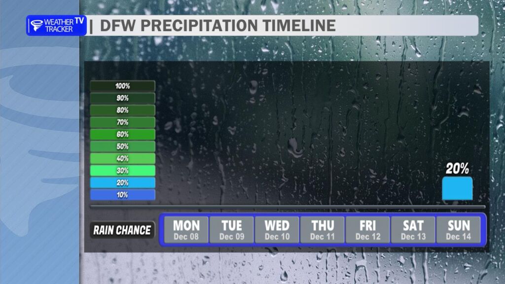
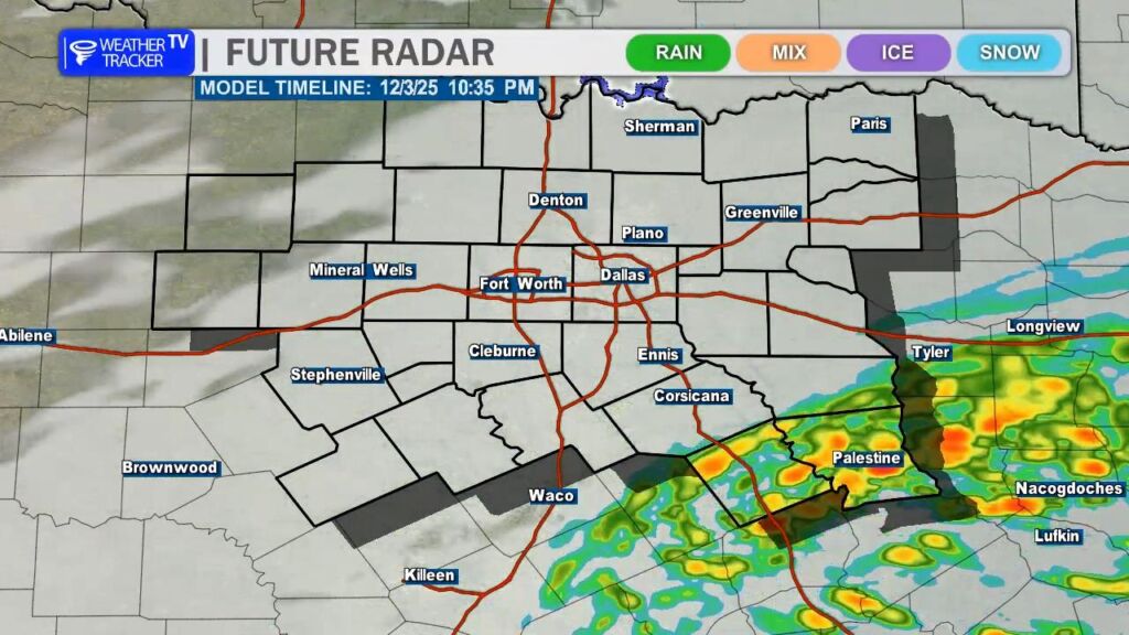
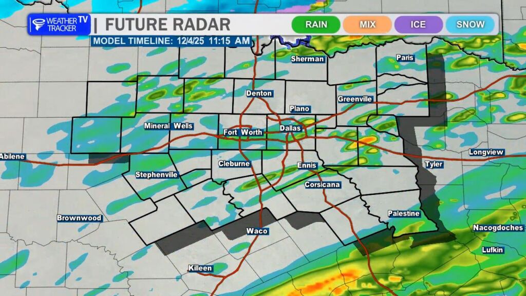
Into early next week, another disturbance approaches from the west by Tuesday, bringing low-end rain chances to the region. Nothing widespread or heavy is expected at this point, but it could add a few sprinkles.
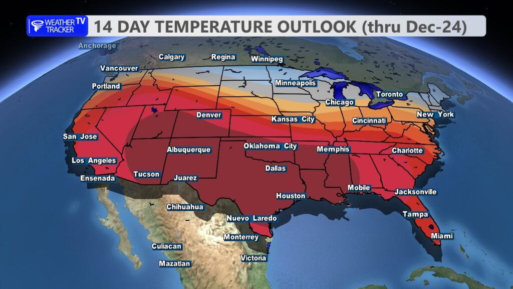
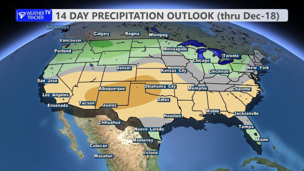
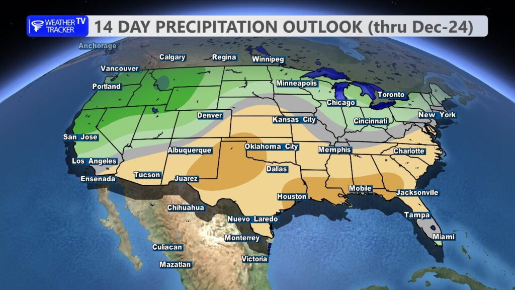
For a quick glance deeper into the extended forecast through the holidays: the latest guidance from the Climate Prediction Center points toward above-normal temperatures and generally dry conditions for North Texas heading into Christmas. That means we’re likely looking at milder weather for holiday travel and gatherings, with lower odds of any wintry precipitation. Of course, long-range forecasts can shift, so stay tuned for updates as we get closer.
Have a wonderful day, and bundle up this morning! -William