Good Sunday morning, North Texas!
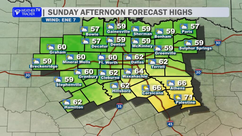
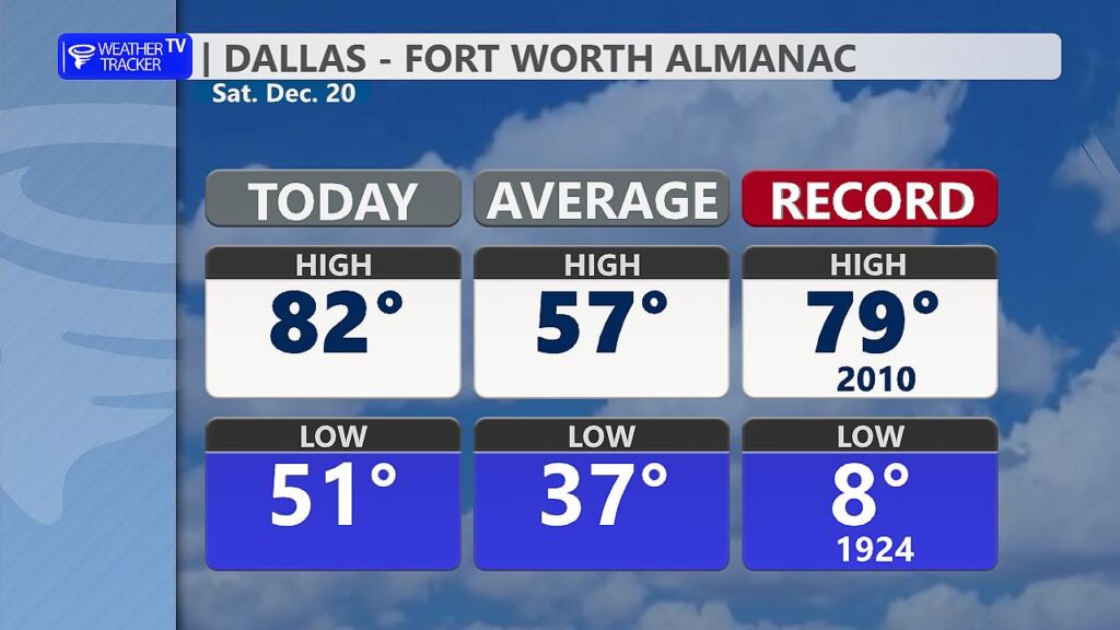
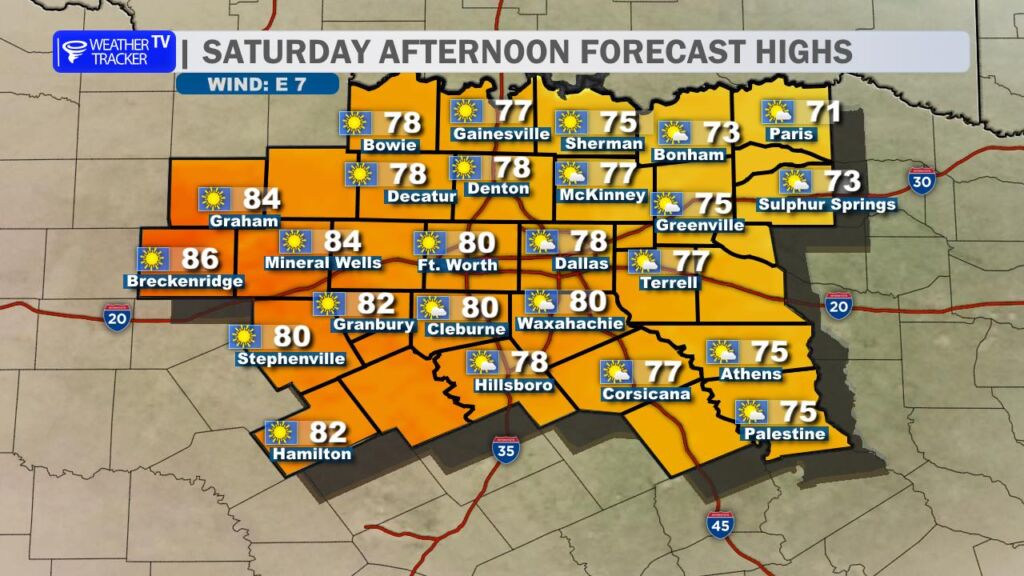
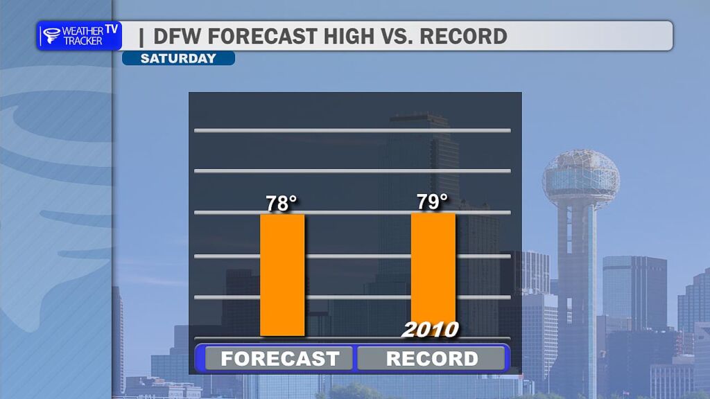
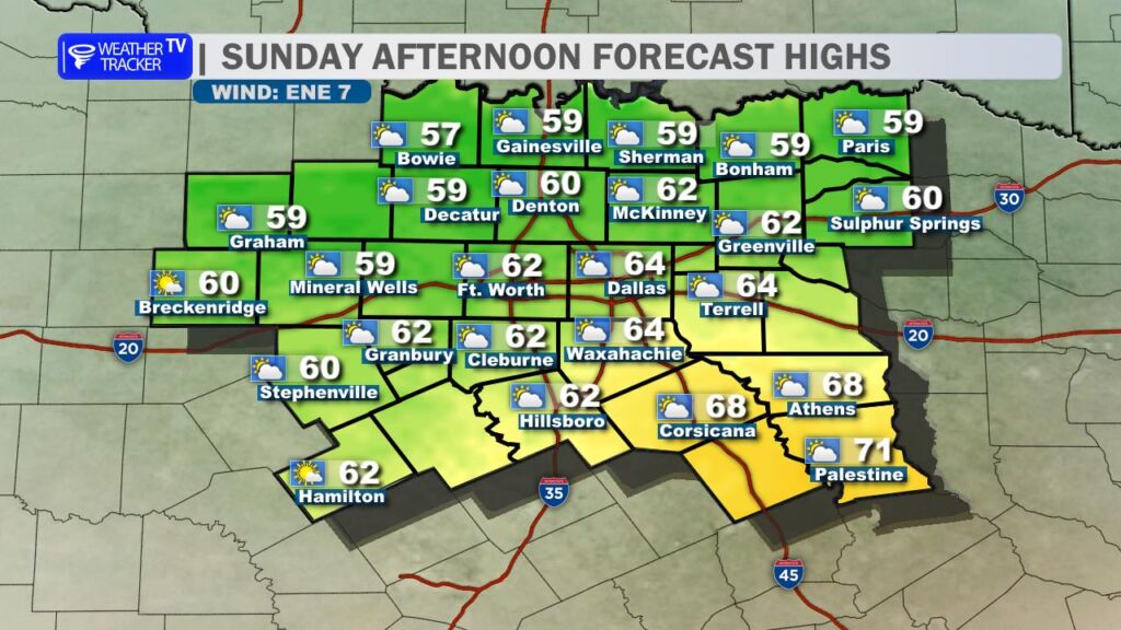
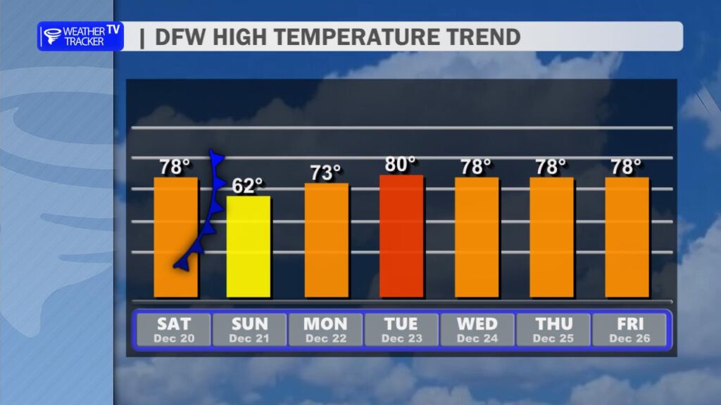
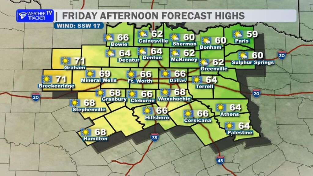
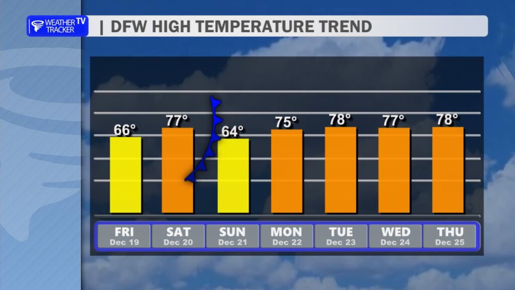
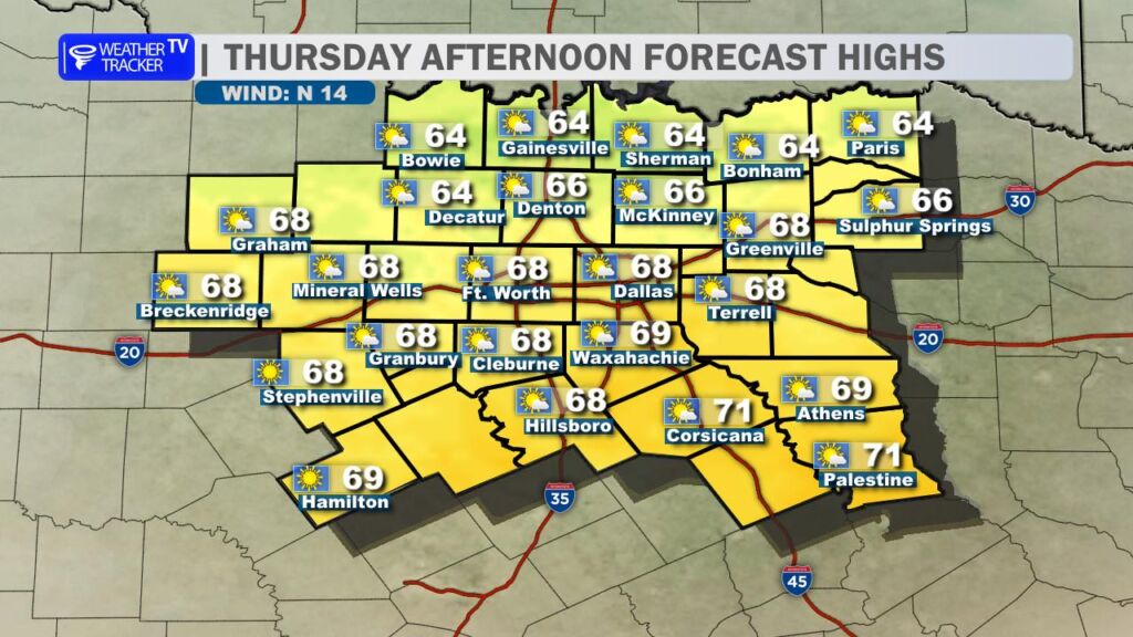
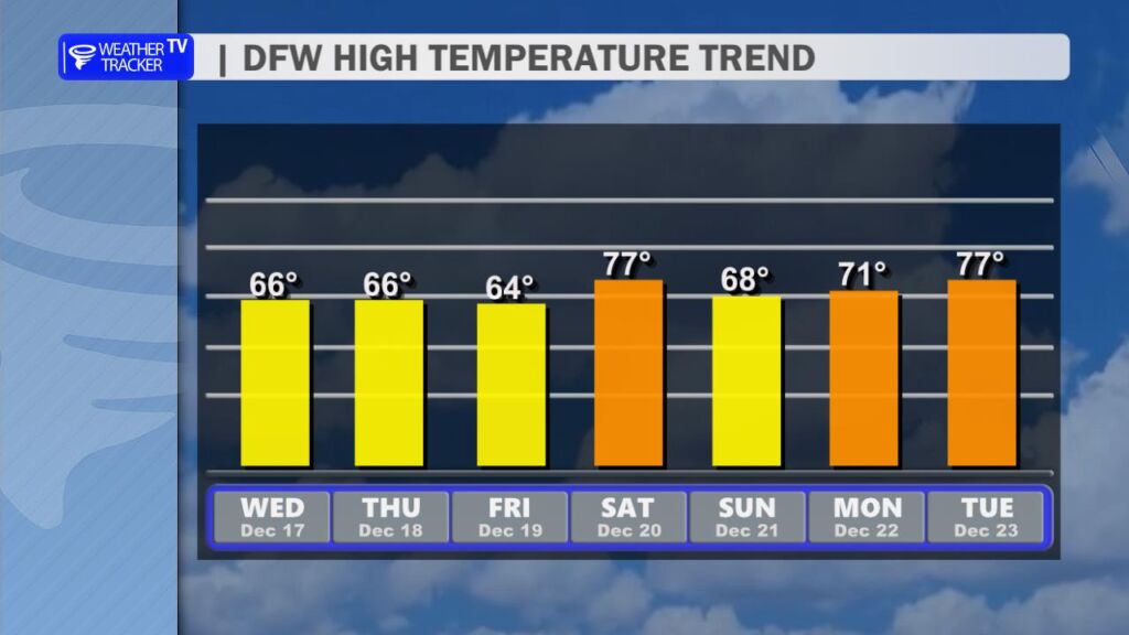
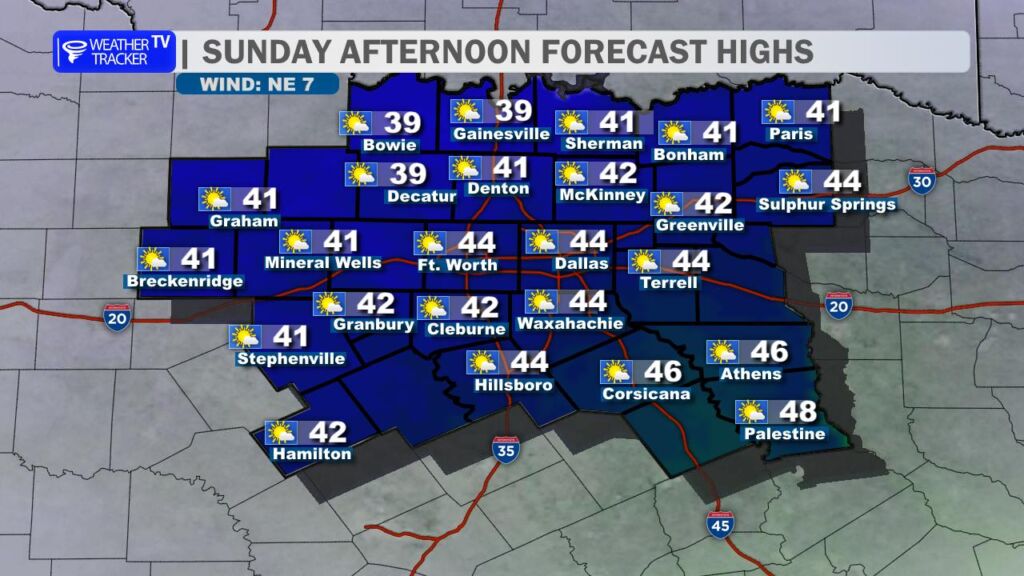
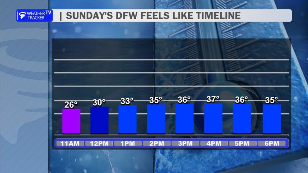
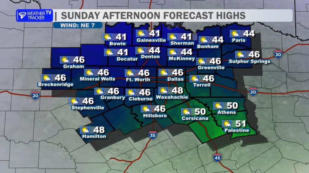
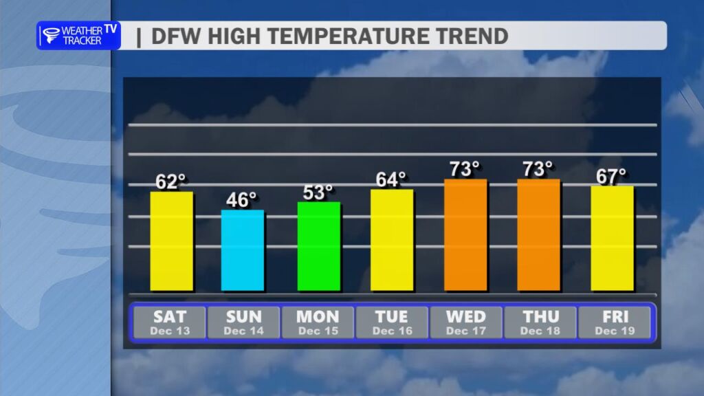
After yesterday’s record-breaking warmth at DFW Airport, we’re settling back into more seasonal conditions today. A cold front swept through overnight, bringing a noticeable change. High temperatures this afternoon will range from the mid-50s north of the Metroplex to the low to mid-60s farther south, a solid 15-20 degrees cooler than Saturday. Expect a brisk north wind at 10-20 mph with occasional gusts near 25 mph, which will make it feel even cooler.
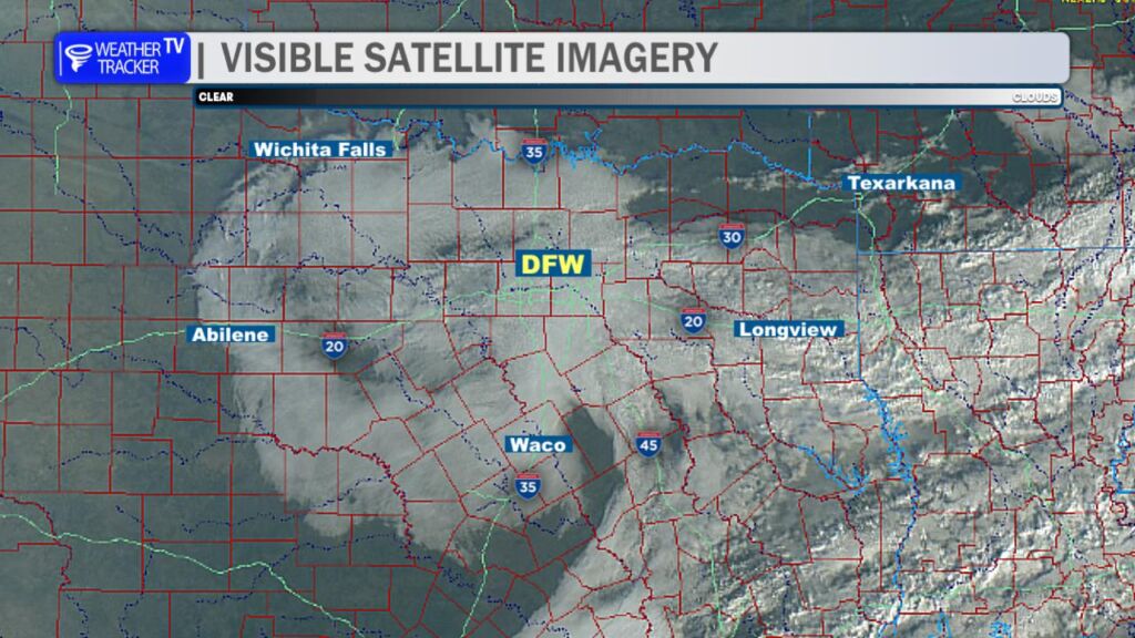
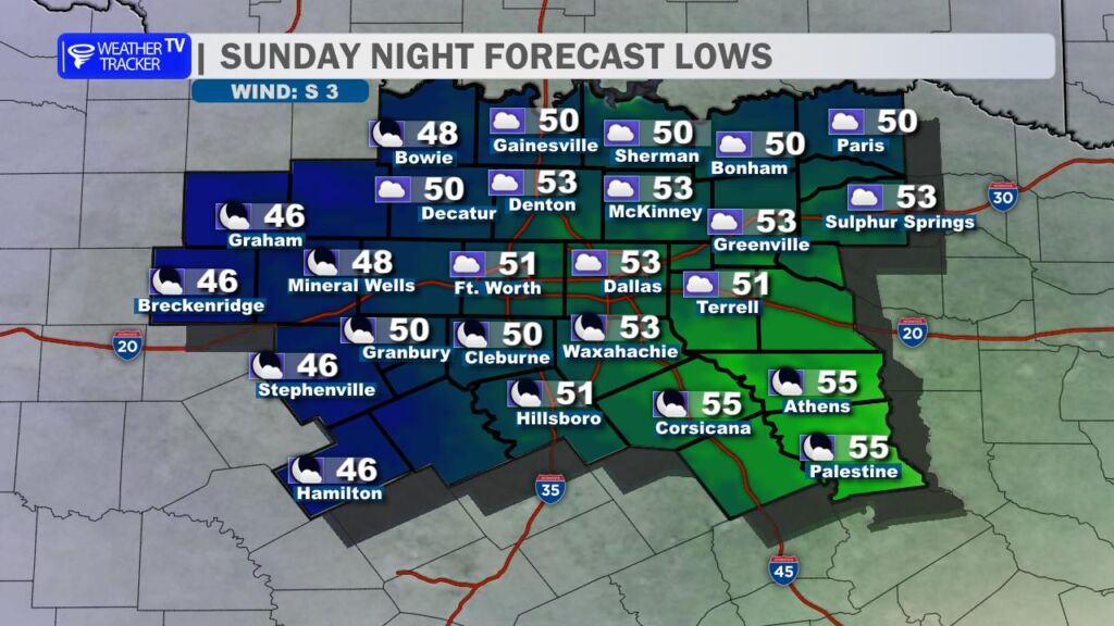
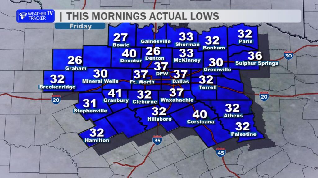
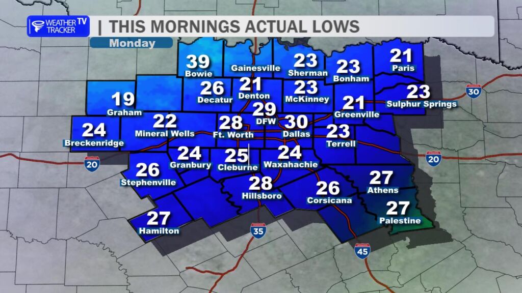
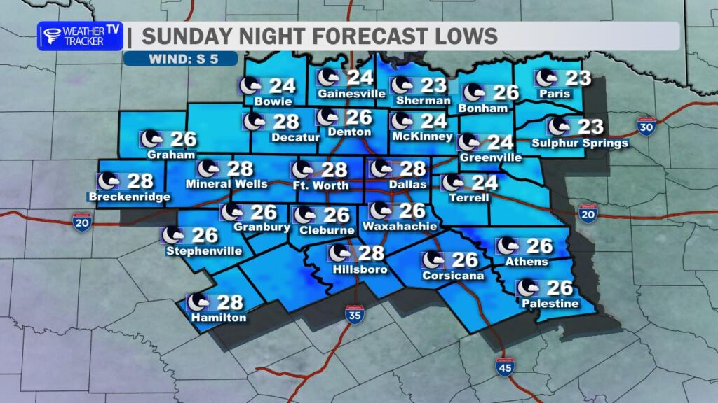
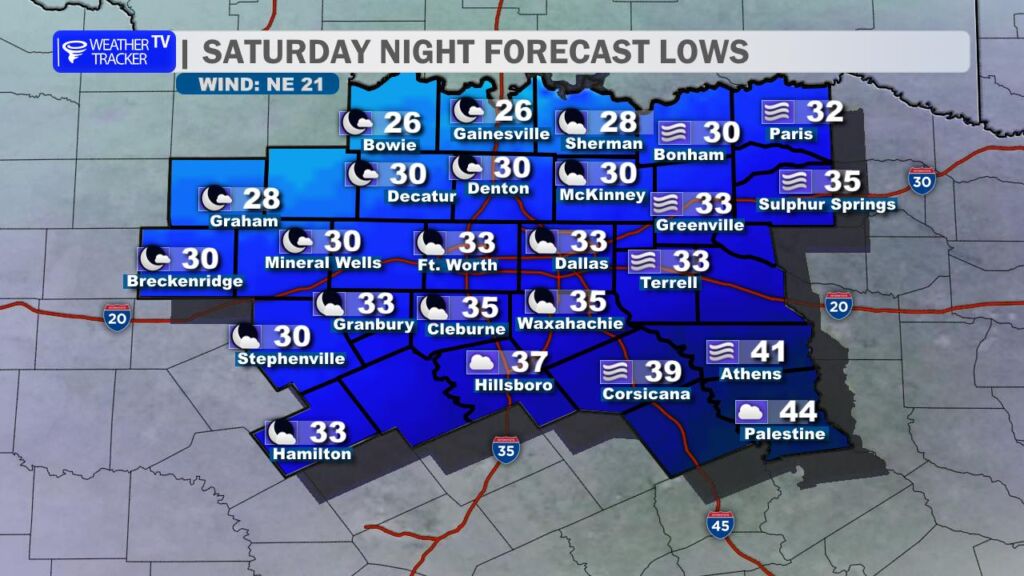
A thick deck of low clouds has spread across the region this morning, and those clouds aren’t going anywhere soon. We’ll see a mostly cloudy to overcast sky through the afternoon and into tonight. The cloud cover will act like a blanket, preventing temperatures from dropping too much overnight – look for lows mainly in the low to mid-50s by Monday morning.
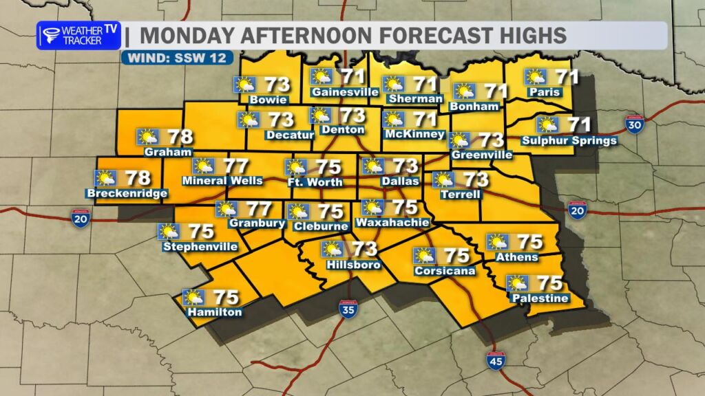
The warmup returns quickly on Monday. A south wind will pick up through the day, helping to scour out the morning clouds and bring back afternoon sunshine. Highs will climb back into the low to mid-70s.
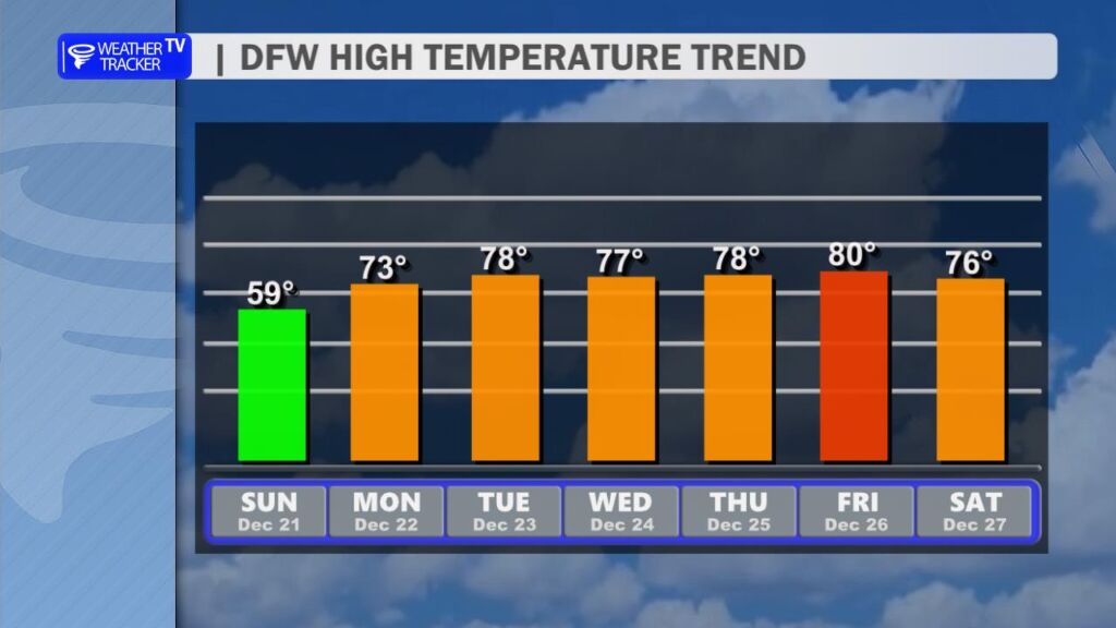
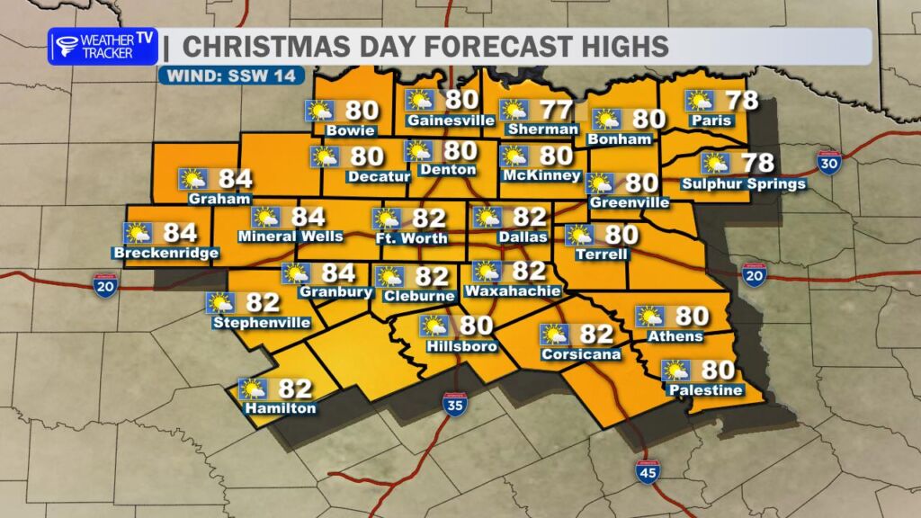
That warmer pattern holds strong right through Christmas week. We’ll see highs in the 70s Tuesday and Wednesday, pushing toward 80° on Christmas Eve and Christmas Day itself. Christmas Day currently looks mostly sunny and unseasonably warm with a high near 80° – just a couple of degrees shy of the record high of 82° set back in 2021. A very Texas-style holiday forecast.
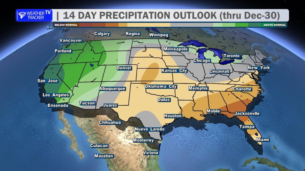
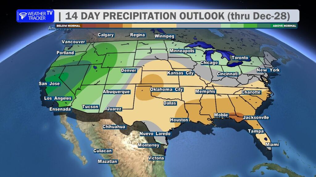
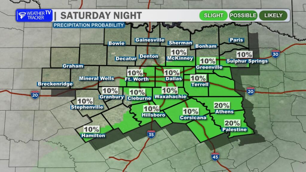
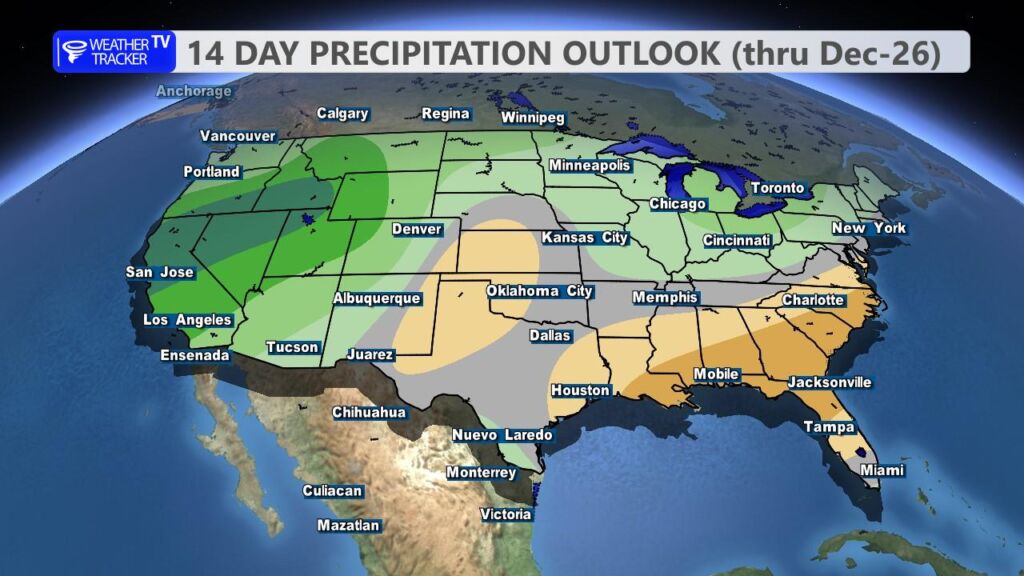
As of now, the entire period through Christmas remains dry – no precipitation is expected to interrupt your holiday plans.
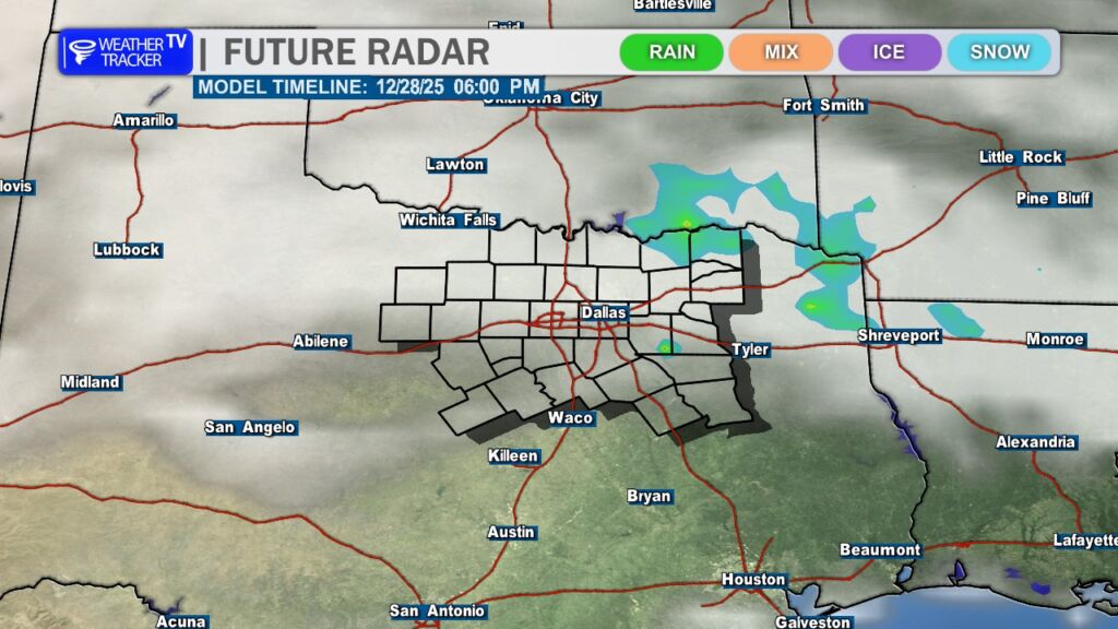
Looking ahead, there are some early signs of a pattern change around Sunday, December 28. That could open the door to our next chance for rain and possibly a few thunderstorms as we head toward the end of the month and into early 2026. We’ll keep a close eye on that and update you as the details become clearer.
Stay warm and cozy today, North Texas. -William