Good Sunday morning and Happy Easter, North Texas!
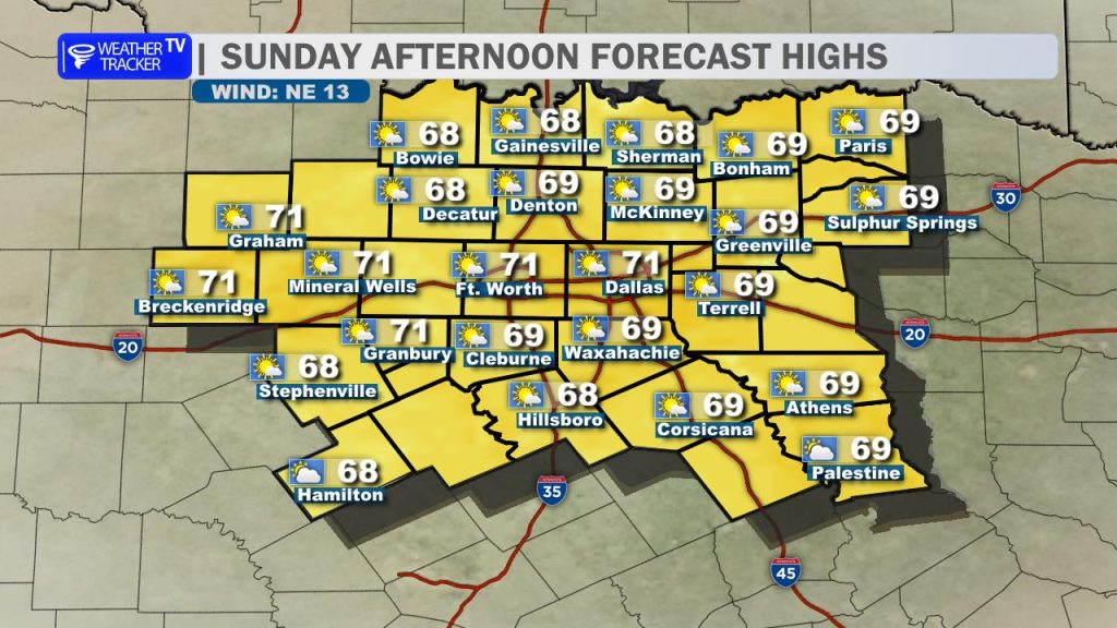
After a soggy Saturday, the weather is cooperating perfectly for Easter Sunday. We are looking at a beautiful afternoon across the area. You can expect partly cloudy skies and a refreshing breeze out of the northeast. Temperatures will be very comfortable, with afternoon highs ranging from the upper 60s to the lower 70s – ideal conditions for Easter egg hunts or any outdoor family gatherings.
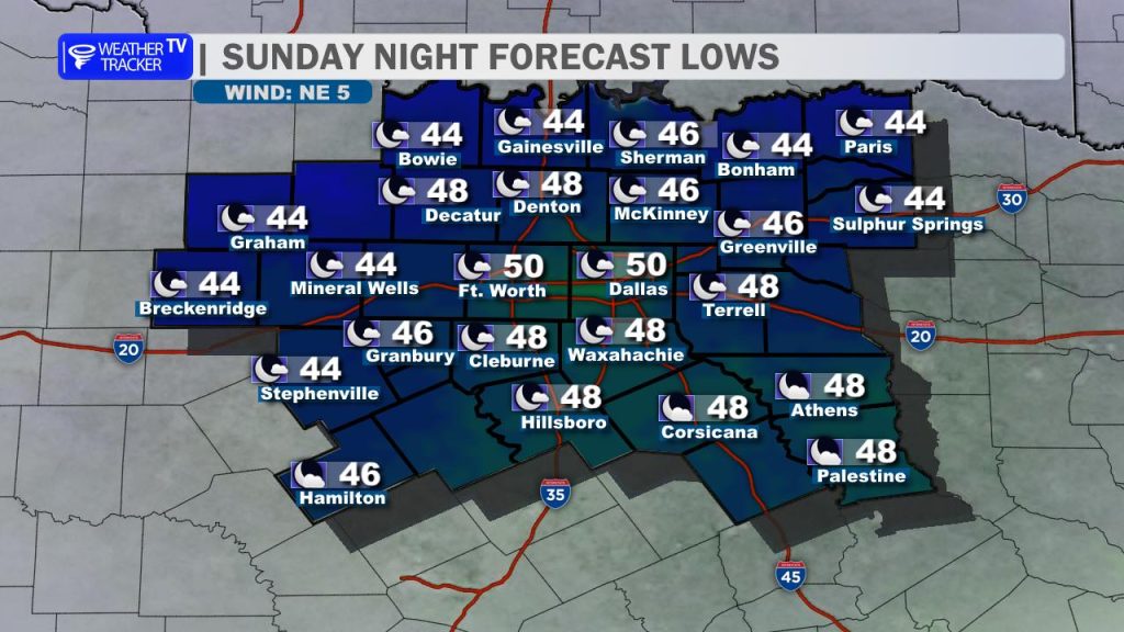
Tonight’s Outlook: If you have evening plans, keep a jacket handy. We’re looking at another chilly night as skies remain fair and winds die down. Lows will dip back into the 40s for most, with some spots in the Metroplex hovering right around 50°.
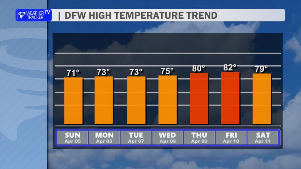
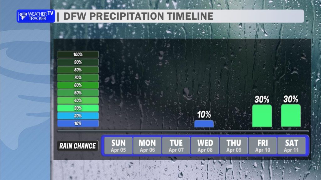
The Week Ahead: As we head into the new work week, the spring warm-up begins. Temperatures will steadily rebound, with highs easing through the 70s and approaching the 80-degree mark by late week. While we’ll enjoy a quiet and dry start to the week, keep your umbrellas close as we get closer to the weekend; rain and storm chances are slated to return by Thursday night and into next Saturday.