4:39 PM Flood Advisory

Flood concerns are easing in North Texas as this advisory is set to expire. Heavy rain has ended, but some lingering high water may continue in a few low-lying and poor-drainage areas for the next few hours.

This advisory includes Dallas and Kaufman counties.
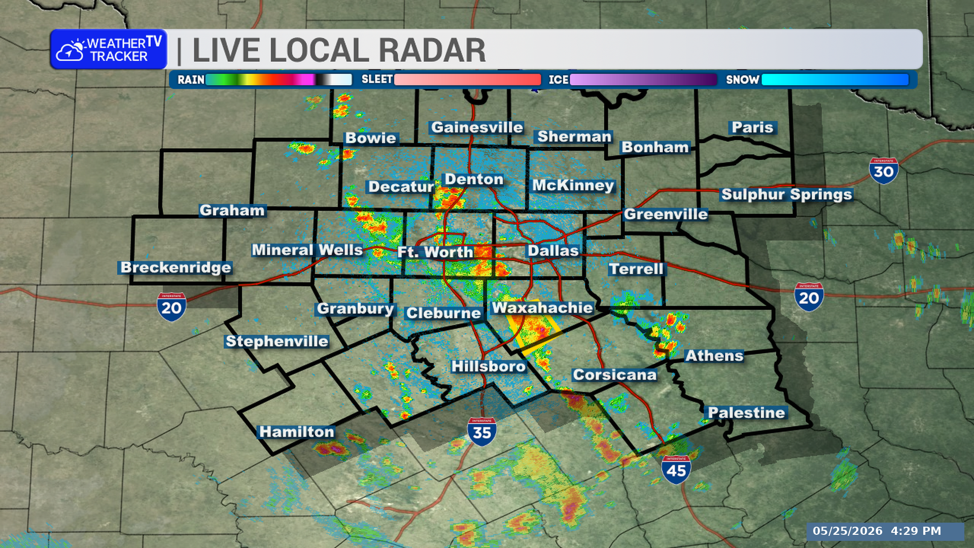
Live Local Radar

**Timing:**
– The Flood Advisory will expire at 4:45 PM this afternoon.
– Flooding in low-lying and poor-drainage areas may continue for a few hours until water recedes.

**What to Expect:**
– Heavy rain has ended.
– Some water may still be lingering in low-lying and poor-drainage areas.

**Potential Impacts:**
– Minor flooding may continue for a few hours in low-lying and poor-drainage areas.
– Some road closures may remain in place.

**What to Do Now:**
– Continue to heed remaining road closures.
– Use caution in areas with standing water until conditions improve.

Stay with William Cole and Weather Tracker TV.
Let’s stay safe together.

4:10 PM T-Storm Warning

A Severe Thunderstorm Warning is in effect for central Ellis County in North Texas until 4:45 PM. The storm was near Waxahachie at 4:09 PM and is moving southeast at 25 mph.

Warned county: Ellis County

Live Local Radar

**Timing:**
– Until 4:45 PM
– Near Ennis, Bardwell, and Bardwell Lake around 4:15 PM

**What to Expect:**
– 60 mph wind gusts
– Quarter-size hail
– Storm moving southeast at 25 mph

**Potential Impacts:**
– Hail damage to vehicles is expected
– Wind damage to roofs, siding, and trees is expected

**What to Do Now:**
– Get inside a sturdy structure
– Stay away from windows

Stay with William Cole and Weather Tracker TV.
Let’s stay safe together.

4:04 PM Flash Flood Warning

Flash flooding is happening or could begin very soon in part of North Texas as slow-moving thunderstorms continue to produce heavy rain. A Flash Flood Warning is in effect for central Tarrant County until 6:00 PM.

Live Local Radar

**Timing:**
– In effect until 6:00 PM
– At 4:03 PM, radar showed slow-moving thunderstorms producing heavy rain across the warned area, especially in northern Tarrant County

**What to Expect:**
– Central Tarrant County is under a Flash Flood Warning
– Between 1 and 2.5 inches of rain have already fallen
– An additional 1 to 2 inches of rain is forecast
– Flash flooding is ongoing or expected to begin shortly
– Locations that may experience flash flooding include Fort Worth, Arlington, Grand Prairie, Euless, Bedford, Grapevine, Haltom City, Keller, Hurst, Southlake, Watauga, Colleyville, Benbrook, Saginaw, White Settlement, Forest Hill, Richland Hills, River Oaks, Sansom Park, and Lake Worth

**Potential Impacts:**
– Flooding of small creeks and streams
– Flooding in urban areas
– Flooding on highways, streets, and underpasses
– Flooding in other poor drainage and low-lying areas

**What to Do Now:**
– Turn around, don’t drown when encountering flooded roads
– Most flood deaths occur in vehicles
– Be aware of your surroundings
– Do not drive on flooded roads

Stay with William Cole and Weather Tracker TV.
Let’s stay safe together.

3:59 PM Radar Update

A strong thunderstorm is moving through part of North Texas this afternoon. Northwestern Ellis County could see gusty winds and small hail through 4:30 PM.

Live Local Radar

**Timing:**
– Issued at 3:59 PM
– In effect through 4:30 PM
– At 3:59 PM, the storm was over Waxahachie and moving southeast at 15 mph
– Waxahachie may be impacted around 4:05 PM

**What to Expect:**
– Winds in excess of 40 mph
– Hail up to half an inch
– Radar indicated this storm

**Potential Impacts:**
– Gusty winds could knock down tree limbs
– Unsecured objects could be blown around
– Minor damage to outdoor objects is possible

**What to Do Now:**
– If outdoors, consider seeking shelter inside a building

Stay with William Cole and Weather Tracker TV.
Let’s stay safe together.