
North Texas will stay firmly in late-summer mode today, with mostly sunny skies across the Dallas–Fort Worth Metroplex and afternoon highs in the lower 90s. Light east winds offer little relief, and an Ozone Action Day is in effect, so consider limiting prolonged outdoor exertion during the hottest part of the afternoon.
Tonight stays quiet and partly cloudy, with lows settling into the upper 60s to lower 70s. Winds remain light as they gradually turn southeasterly.
Saturday starts with a few clouds but trends sunnier through the day. Highs climb into the lower to middle 90s, with light southeast winds.
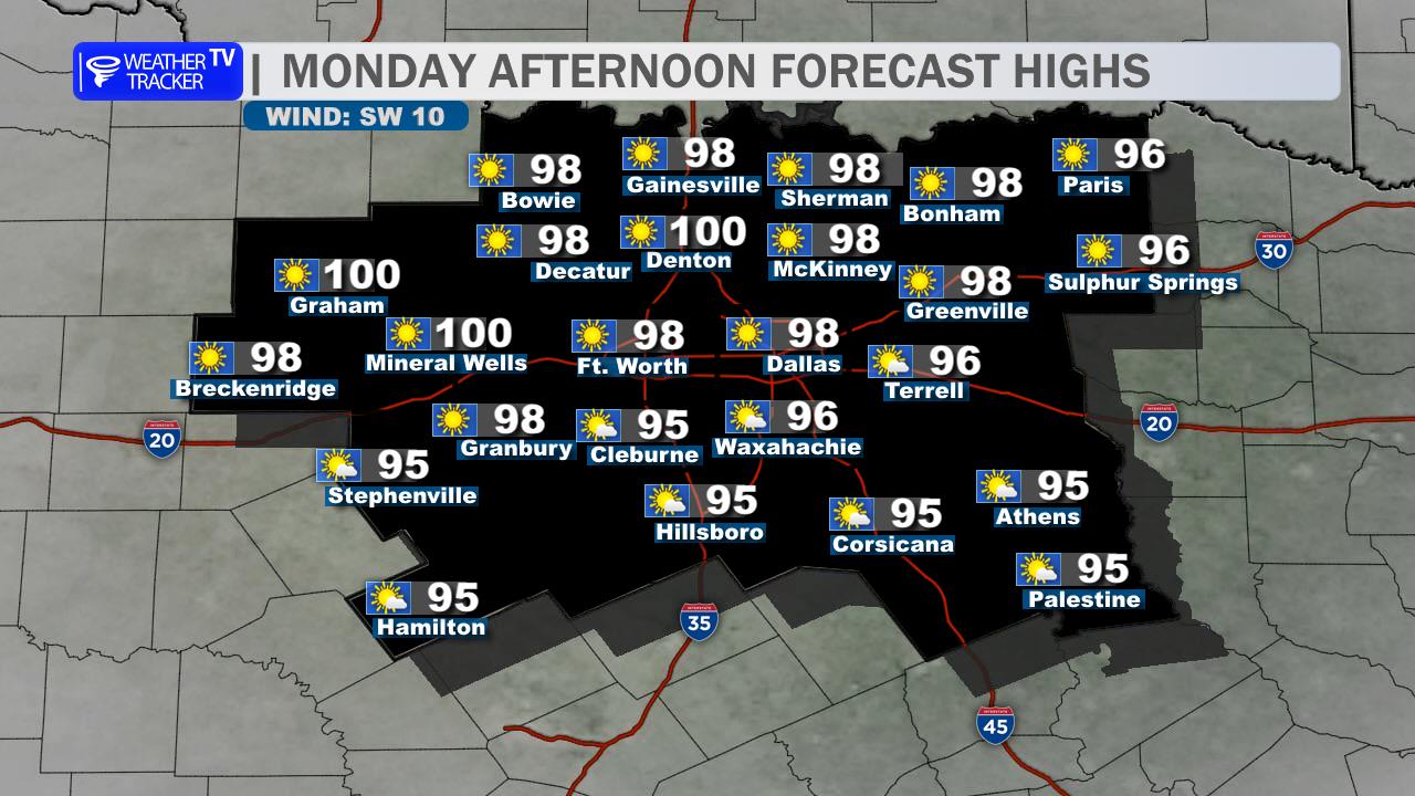
The heat builds further Sunday and Monday, when highs reach the mid to upper 90s. A few isolated morning showers or thunderstorms are possible Sunday, but most of DFW should stay dry. Better rain chances arrive Tuesday into Wednesday, along with a gradual cooldown into the 80s.
Heat and ozone are the main concerns today; pace outdoor plans and check on sensitive neighbors.
Stay with William Cole & Weather Tracker TV.
Let’s stay safe together.
Today

Today- Hourly

Today – Precipitation

Tonight

Tomorrow
You must be logged in to post a comment.