
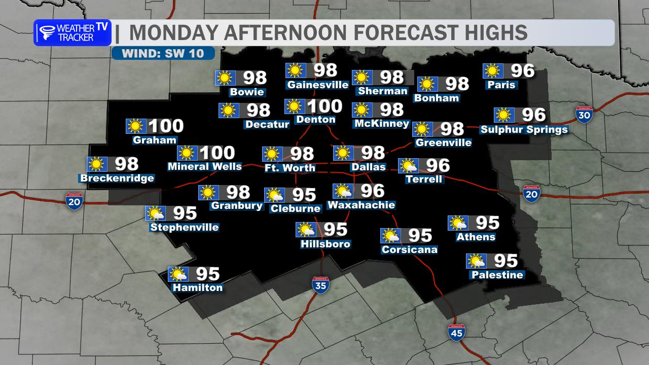
North Texas will stay locked in a late-summer heat pattern today. Expect abundant sunshine across the Dallas–Fort Worth Metroplex, light south winds, and afternoon highs in the upper 90s to near 100 degrees. An Ozone Action Day is in effect, so sensitive groups may want to limit extended outdoor activity during the hottest part of the day.
Tonight will be clear and warm, with temperatures only falling into the mid-70s by daybreak.
Saturday looks nearly identical, with full sunshine, south winds at 5 to 10 mph, and highs returning to the upper 90s. If you have outdoor plans, the morning and evening will offer the best chance to avoid the worst heat.
Rain chances begin to return Sunday afternoon, although coverage will remain isolated around DFW. Storm chances may continue Sunday night and into Monday, with slightly cooler temperatures arriving early next week.
The main concern is heat stress, especially during afternoon outdoor activities. Stay hydrated and take frequent breaks in the shade or air conditioning.
Stay with William Cole & Weather Tracker TV.
Let’s stay safe together.
Today

Today- Hourly

Today – Precipitation

Tonight

Tomorrow
You must be logged in to post a comment.