Good Thursday Morning, North Texas!
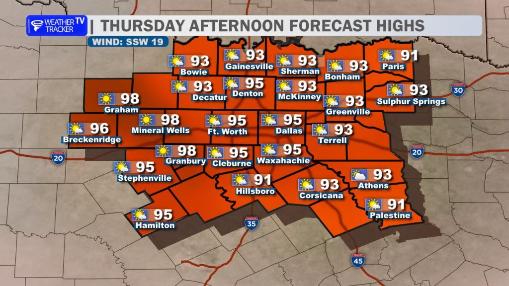
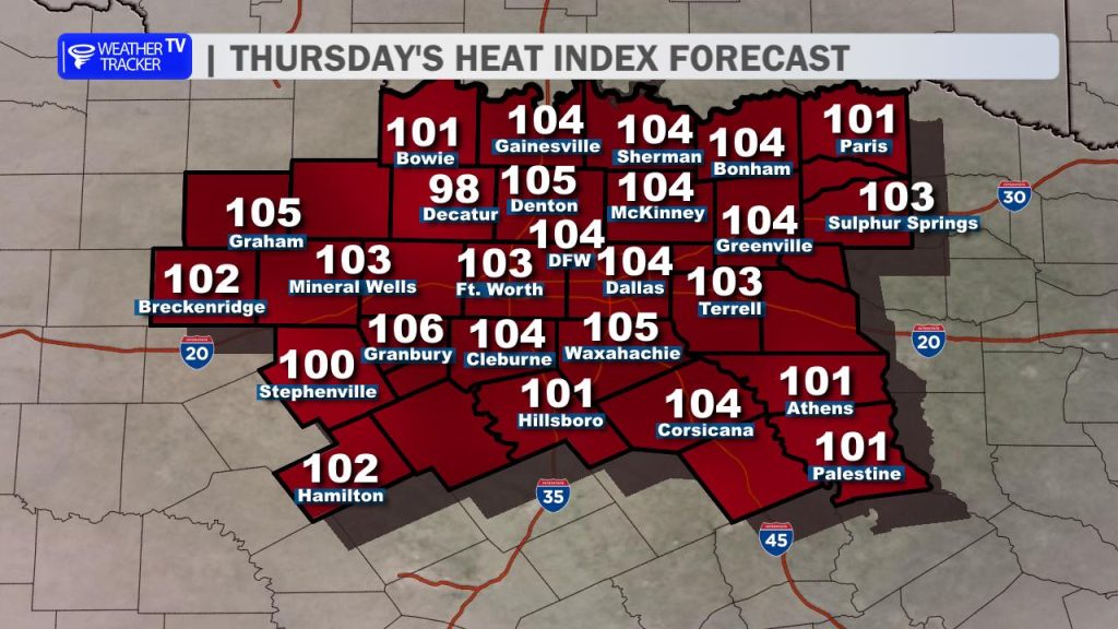
Expect another hot and humid afternoon across the region, made slightly more bearable by a breezy south wind. High temperatures today will easily climb into the mid-to-upper 90s. However, the real story remains the oppressive humidity, which will push peak heat index values well into the triple digits this afternoon – ranging from 100° to 107°. If you have outdoor plans, make sure you are practicing proper heat safety: stay hydrated, take frequent breaks in the shade, and never leave pets or children in a vehicle.
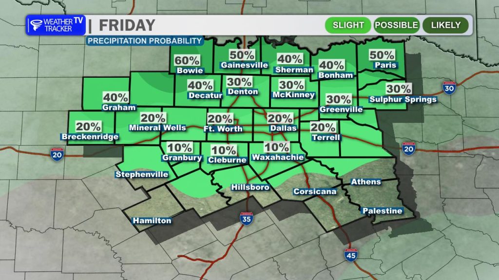
Changes are on the way by tonight. A weak cold front will drop through Oklahoma later today, serving as the focal point for a line of showers and thunderstorms. This broken complex of rain and storms is timed to push south across the Red River early Friday morning, between 3:00 AM and 5:00 AM.
The best chance for rain and storms first thing Friday will favor counties near and north of Highway 380. While an isolated afternoon storm along leftover outflow boundaries cannot be ruled out, the vast majority of the Metroplex and areas south of I-20 will likely stay completely dry.
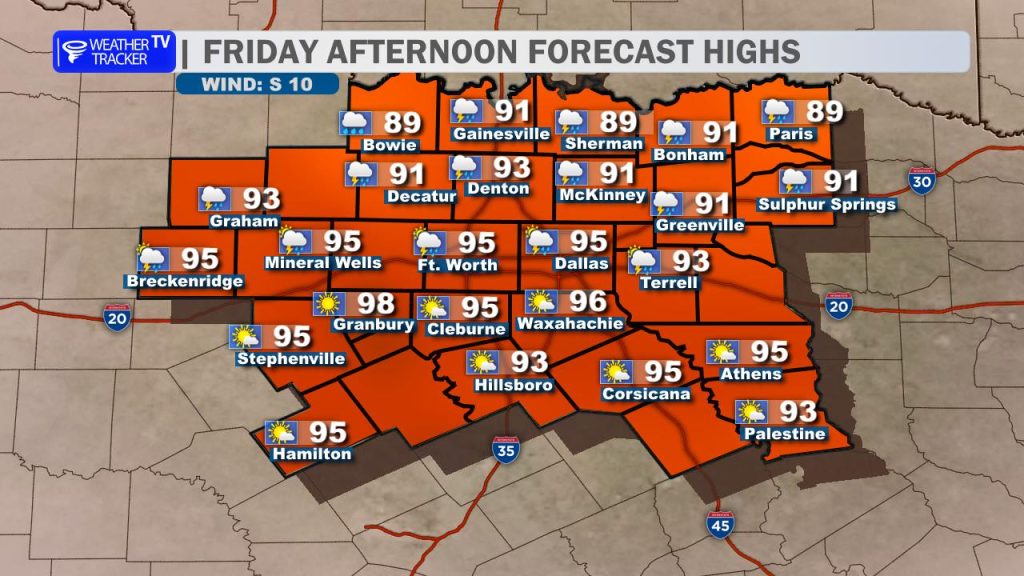
This morning rain and cloud cover will provide a brief break for our northern counties on Friday, keeping highs down just a notch in the lower 90s. The rest of North Texas won’t be so lucky – expect plenty of sunshine to push temperatures right back into the mid-90s, with heat indices flirting with the 100° mark once again.
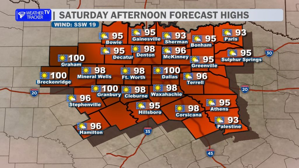

Make sure you enjoy any brief relief Friday, because Saturday is shaping up to be the hottest day of the stretch. Afternoon highs will approach 100° with feels-like temperatures soaring between 105° and 108°. This is dangerous, cumulative heat, and a Heat Advisory may be needed. Be sure to factor these extreme conditions into your Saturday weekend plans.
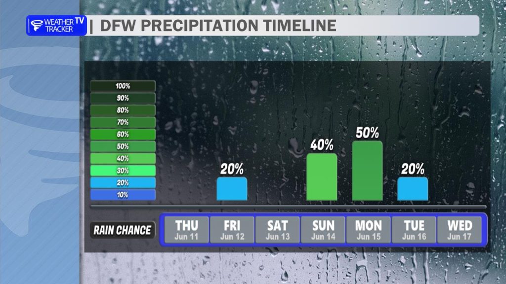
Our next major weather maker arrives late Sunday as a much stronger cold front moves into the region. This will trigger a highly active weather pattern, bringing widespread scattered rain and storm chances (60% to 80%) late Sunday night into Monday morning.
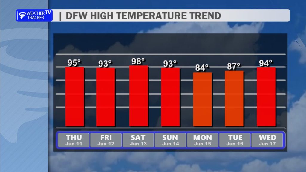
The payoff will be worth it: the front and widespread rainfall will successfully break the heat ridge, dropping our high temperatures back into the much more comfortable 80s by Monday. We will dry out and clear the skies by Monday afternoon, setting up a brief break before temperatures begin to heat right back up by the middle of next week.
You must be logged in to post a comment.