Good Wednesday Morning, North Texas!
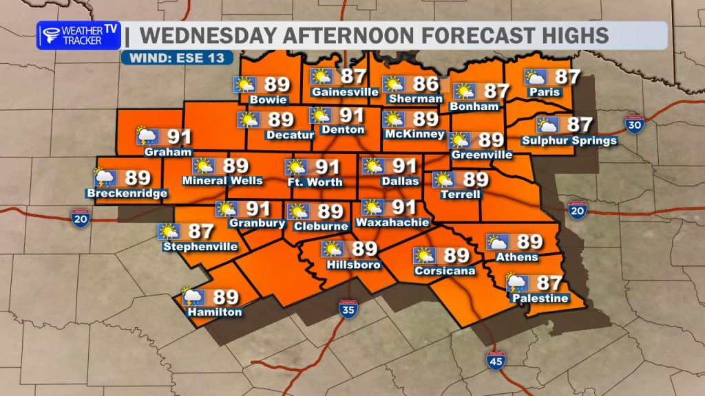
Our early summer holding pattern continues today, bringing plenty of humidity and a few “splash-and-dash” variety afternoon showers and thunderstorms. If you noticed a slight change in the air this morning, that is courtesy of a weak backdoor cold front dipping in from the northeast. While it won’t bring a dramatic autumn-style chill, it will turn our winds out of the east/southeast and shave a few degrees off yesterday’s intense heat. Expect afternoon highs to top out in the upper 80s to low 90s across the metroplex.
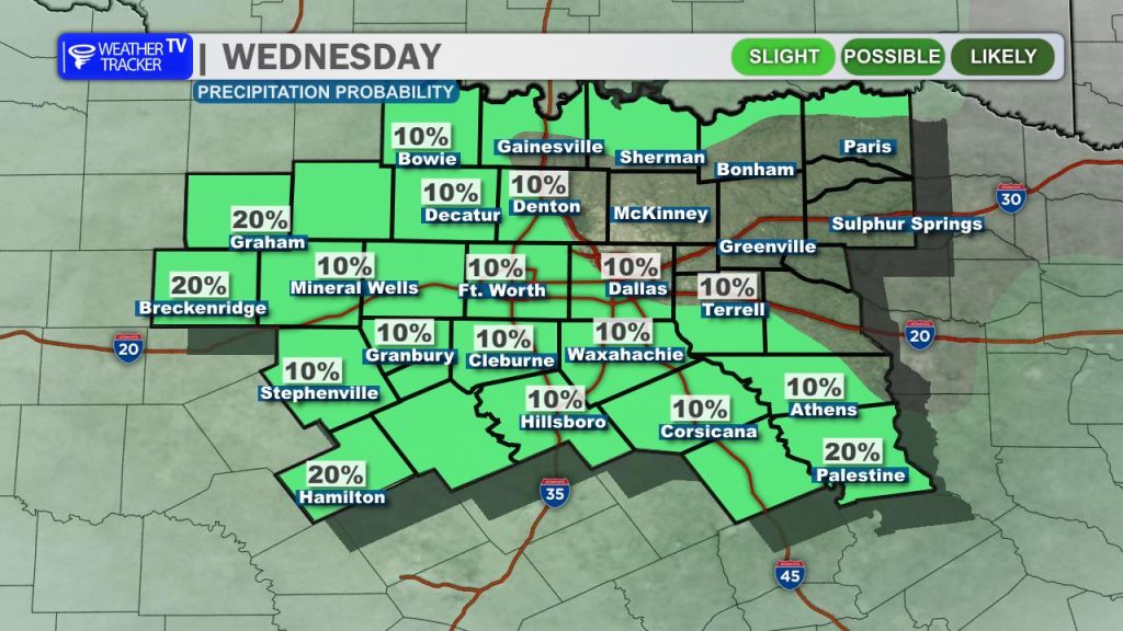
Because that boundary is washing out, our overall storm chances are down a notch from yesterday—sitting right around 20%. The vast majority of us will stay completely dry today. However, beneath a stubborn summer “cap,” intense daytime heating will trigger a few isolated, pop-up storms between 3:00 PM and 7:00 PM. Because atmospheric steering winds are incredibly weak right now, any cell that manages to bubble up will move very slowly, posing a localized threat for frequent cloud-to-ground lightning, blinding downpours, and sudden, erratic gusty winds.
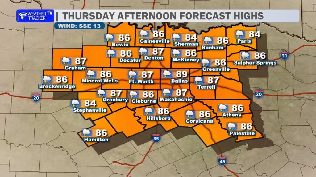
Thursday brings a very similar story, though we will begin to see a gradual shift in the overall pattern. Deep layer moisture will begin pooling back over the region from the Gulf, leading to increasing cloud cover by tomorrow afternoon. Because of the extra shade, high temperatures will trend down a bit further, holding steady in the mid-to-upper 80s. With that added moisture and a weakening cap, afternoon storm coverage will scale up slightly to around 30%.
The real headline this week is an unseasonably deep, closed upper-level low currently churning off the Southern California coast. Over the next 48 hours, this system will slowly track eastward across the Desert Southwest and advance toward the Southern Plains. As it approaches, it will encounter a highly moisture-rich atmosphere over North Texas, with precipitable water values climbing well above normal.
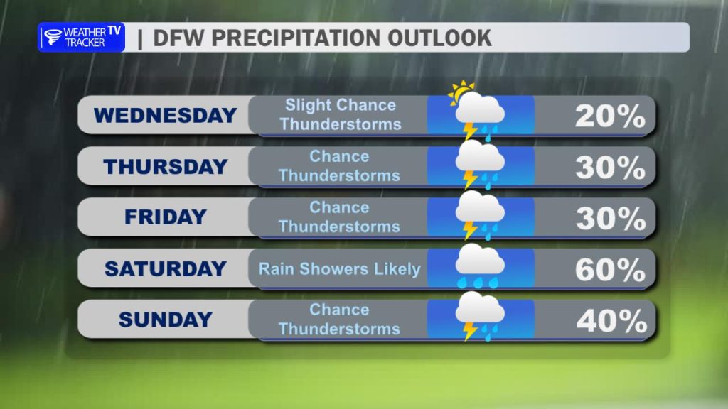
This sets the stage for a much more active, widespread rain event just in time for the weekend. Rain and storm chances will steadily escalate through Friday, with Saturday currently tracking as the highest-impact window for widespread, heavy rainfall. If you are finalizing your weekend outdoor plans, you will definitely want to have a backup indoor option ready. These weekend storms will be incredibly efficient rainfall producers, meaning localized flooding could become a concern for areas that see multiple rounds of training storms.
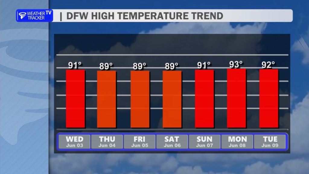
We will keep afternoon highs capped in the low-to-mid 80s through Sunday thanks to the widespread rain and cloud cover. Enjoy the brief break from the intense sun while it lasts, because the long-range data shows the classic summer heat dome trying to assert its dominance by the middle of next week. If that ridge successfully builds in, it will squash our rain chances entirely and pump our high temperatures right back deep into the 90s.
You must be logged in to post a comment.