Good Tuesday morning, North Texas!
Following the recent active weather, we are officially settling into a much quieter and warmer pattern that will dominate the remainder of the work week. A strong ridge of high pressure building in from the Rockies will keep our skies clear and our temperatures on a steady upward climb.
Today & Wednesday: The Warm-Up Begins
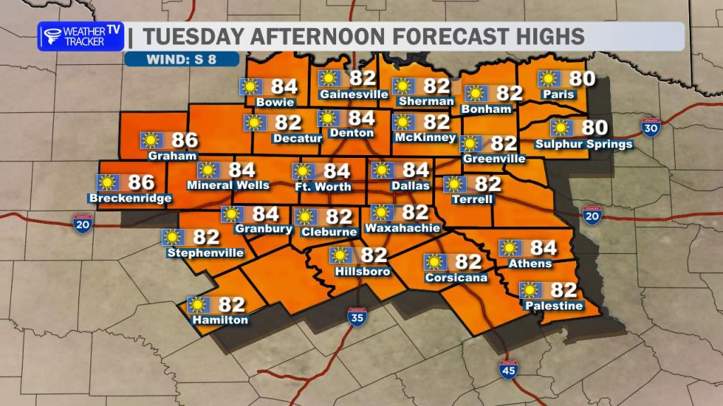
Expect “wall-to-wall” sunshine today. It’s going to be a beautiful afternoon with highs reaching the mid-80s across the Metroplex. Winds will remain light and variable, making for a very pleasant Tuesday.
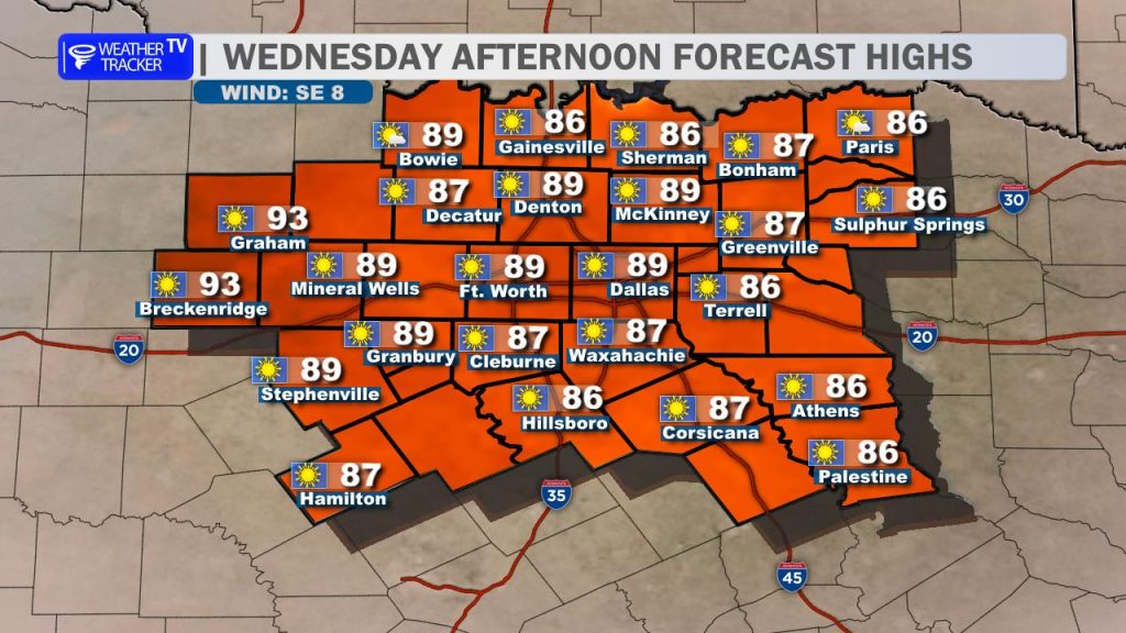
By Wednesday, the warming trend intensifies as the ridge moves closer. We’ll see highs push into the upper 80s, and you’ll notice a light south breeze returning. While a stray shower could pop up well to our northwest near the Red River, North Texas will stay dry and fully sunny.
Late Week: Touching the 90s
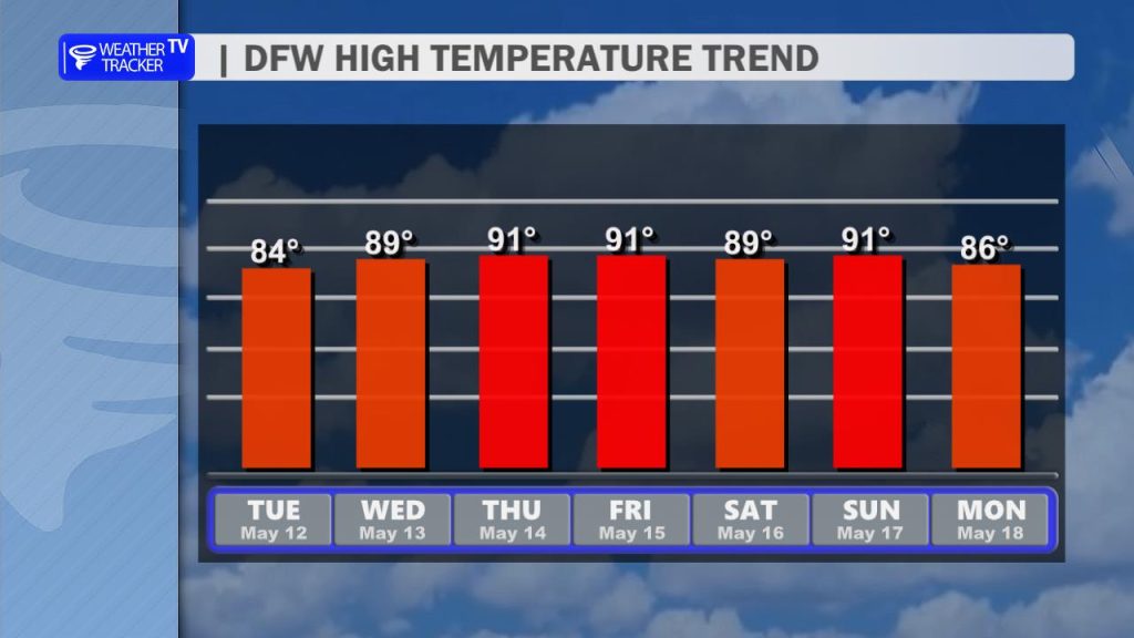
The heat really arrives for Thursday and Friday. We are forecasting highs to break into the lower 90s for most of the area. This dry, warm air will persist through the start of the weekend, providing great conditions for any outdoor Friday night plans.
The Weekend & Next Week: Pattern Change Looming
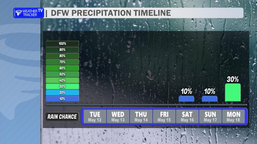
While the forecast remains dry through Friday, we’re keeping a close eye on the weekend.
Saturday/Sunday: Humidity will begin to creep back up, bringing spotty, low-end storm chances near a dryline (around 20%), primarily for areas west of I-35.
Next Monday: A more significant pattern change is on the horizon. A larger storm system is expected to sweep through the Plains, which could bring a return of widespread storm chances and the potential for severe weather to North Texas by early next week.
Stay with Weather Tracker TV DFW as we track that potential pattern change for next week. -William