Good Monday morning, North Texas! After a gorgeous weekend across the region, our weather pattern is shifting as we move into a more active setup. While today remains quiet for most, we are tracking the return of storm chances – and the potential for severe weather – starting as early as this evening.
Today: Warm, Breezy, and Mainly Dry
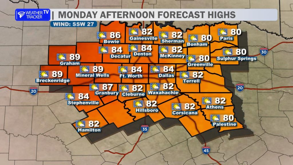
Expect a very warm and windy start to the work week. High pressure is sliding east, allowing robust southerly winds to kick up, with gusts likely exceeding 30 mph at times this afternoon.
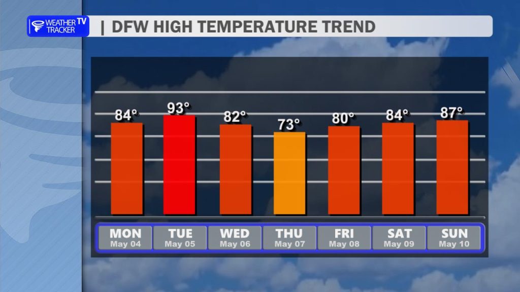
- High Temps: We’ll see 80s across the Metroplex, with our western counties likely hitting the low 90s.
- Cloud Cover: You’ll notice a steady increase in cloud cover through the afternoon as moisture returns from the Gulf.
Tonight: Monitoring the Red River
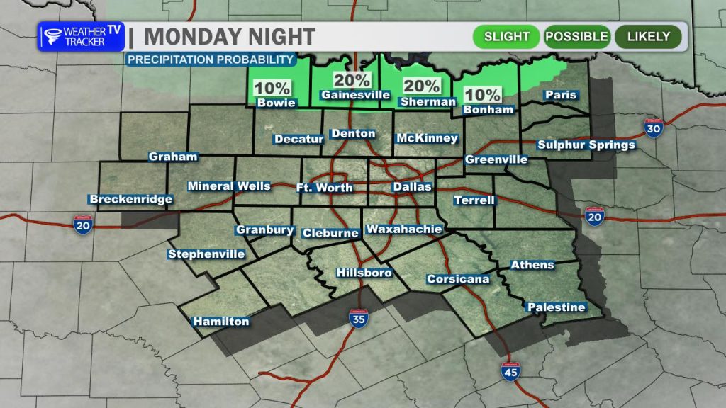
While most of North Texas will stay dry today, we are keeping a close eye on Oklahoma. A few isolated thunderstorms may develop across the Red River late this afternoon.
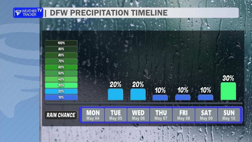
- The Risk: There is a 20% chance that any activity developing to our north could drift into our northernmost counties around sunset.
- Impacts: Should a storm manage to hold together, it could be severe, with large hail and damaging winds being the primary concerns.
Tuesday: Severe Storm Potential
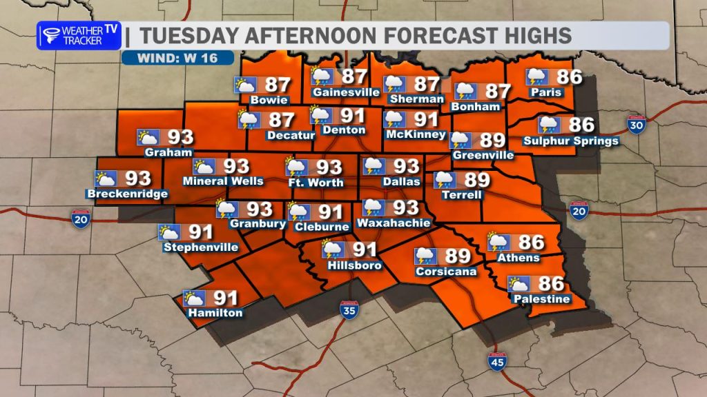
Tuesday is the day we need to be “weather aware.” A cold front will begin sagging into the region, meeting a very unstable air mass characterized by high humidity and temperatures surging into the low 90s.
- Storm Timing: Scattered storms are expected to initiate along the front by mid-to-late afternoon.
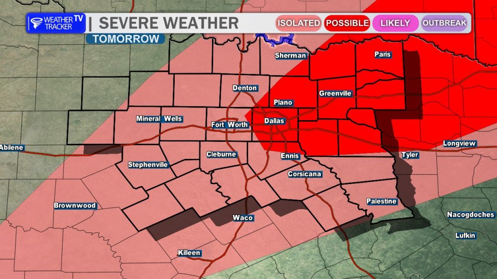
- Location: The highest coverage (40% probability) currently looks to be along and east of the I-35 corridor.
- Threats: The environment will be primed for severe weather. Any storm that develops will be capable of producing damaging wind gusts up to 65 mph and large, damaging hail. This activity will likely linger across our eastern counties through Tuesday night.
The Extended Look: A Mid-Week Cool Down
Once the front clears the area, we’ll see a notable shift in the “feel” of the air.
- Wednesday & Thursday: Temperatures will trend downward, with Thursday looking particularly pleasant as highs struggle to get out of the 70s.
- Next Weekend: While low-end storm chances linger through the week, we are looking toward Sunday for our next significant weather maker. Another boundary is expected to move through, which could bring a more widespread round of storms and a renewed threat of severe weather.
Stay tuned for updates as the timing of Tuesday’s front becomes clearer!