Good Monday morning, North Texas!

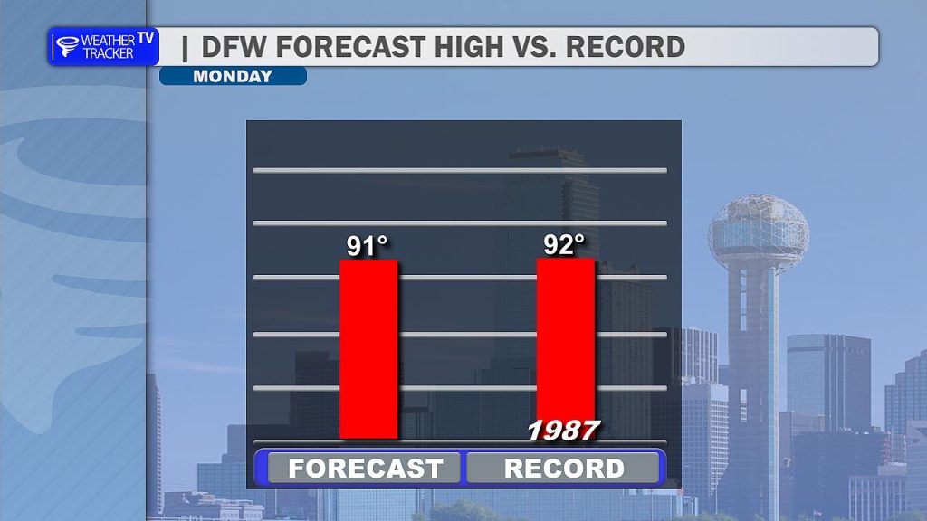
Get ready for a hot, breezy, and humid start to the week. We are monitoring the potential for near-record heat this afternoon as temperatures push into the 90s. The record high for this date at DFW is 93°F, set back in 1987, and we are tracking very close to those numbers today. While morning clouds will linger, they are expected to scatter out by midday, giving way to significant afternoon sunshine.
Today’s Outlook: Hot & Isolated Storm Potential
Most of the region will remain dry today, but we are keeping a close eye on the late afternoon hours east of I-35. While the overall coverage is expected to be low (20% or less), a stray storm or two could develop. The environment, while strongly unstable, lacks the deep-layer support to organize widespread severe weather, but any storm that manages to ignite could become strong, bringing a risk of large hail. Any activity today will fade quickly after sunset.

Tuesday: Increasing Severe Risk
Our focus shifts to a more active weather setup on Tuesday. As a cold front approaches from the north, we expect scattered thunderstorms to develop during the afternoon, spreading southeast along the front across the eastern half of North and Central Texas.
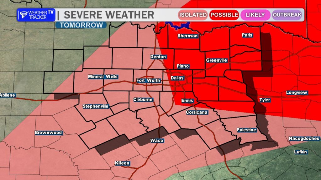
This setup carries a more serious severe weather threat:
- Hazards: We are monitoring for the potential of large hail, damaging wind gusts and tornado warnings.
- Timing: The activity is expected to initiate in the afternoon and persist into the evening hours.
- Action: Please ensure you have multiple ways to receive warnings and keep your family weather-aware as we head into Tuesday afternoon.
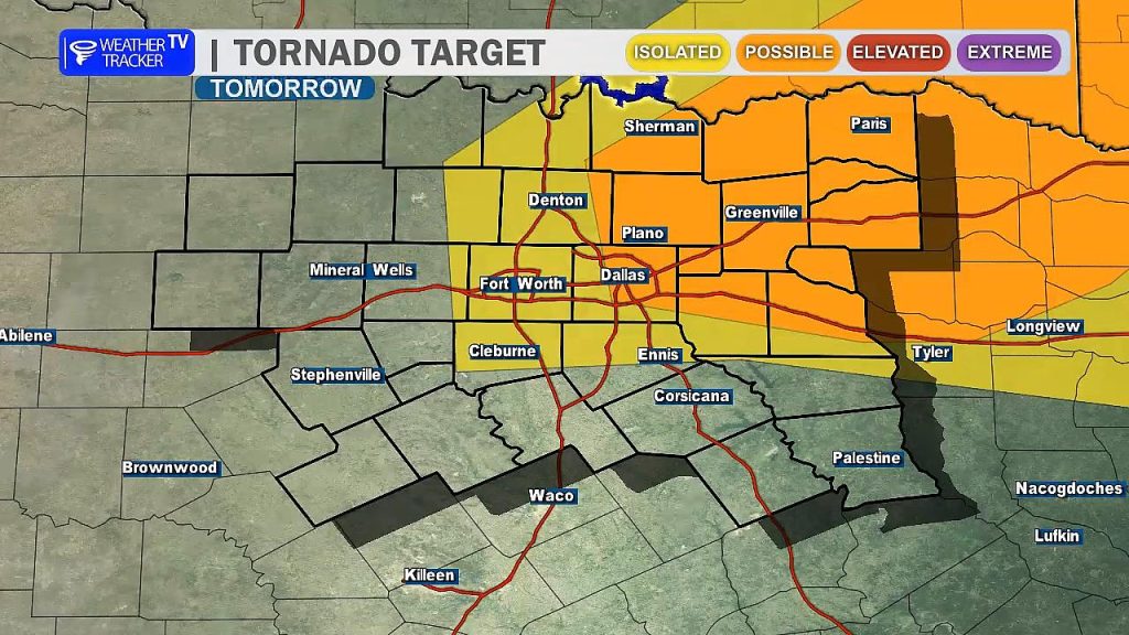
Note: There is also potential for a few storms to fire late Monday night into Tuesday morning across our northwestern counties (near the Red River to the Denton area) due to a strengthening low-level jet. These overnight storms would also be capable of producing large hail.
Looking Ahead: Heavy Rain Potential
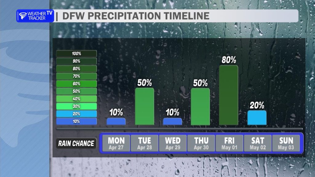
As we move into the second half of the week, the concern shifts from severe storms to a more widespread, heavy rainfall event. The pattern becomes increasingly unsettled by Thursday, as a strong shortwave moves out of Mexico and interacts with a moisture-rich airmass and a lingering frontal boundary.
Expect showers and thunderstorms to increase in coverage late Thursday into Friday. The most significant forcing is currently projected to arrive early Friday, which may lead to concerns for localized flooding or ponding on roadways.