Saturday, April 25, 2026 Good Saturday morning, North Texas!
Today is a North Texas Weather Ready Day. We are monitoring a classic “low coverage, high impact” severe weather setup today. While it is important to note that most areas will remain rain-free and will not see a storm, the environment is highly primed for those that do develop. If a storm forms in your area this afternoon or evening, it has the potential to become significantly severe very quickly.
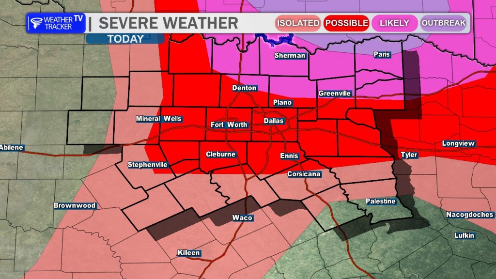
The Setup & Hazards: We are tracking two primary focal points for thunderstorm initiation:
- The Dryline: Setting up just west of the I-35 corridor.
- Boundary Interaction: A development zone near the Red River and into Southern Oklahoma.
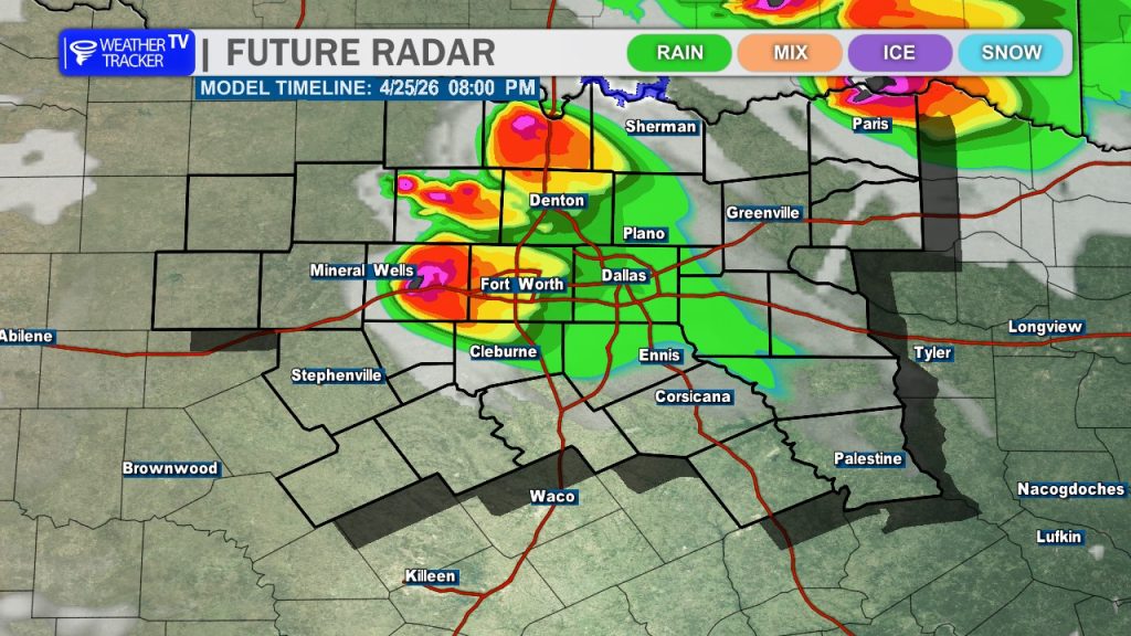
Current data highlights the potential for isolated supercells to develop along the dryline late this afternoon, drifting eastward toward the I-35 corridor. Simultaneously, we expect more robust, intense supercell development across Southern Oklahoma, which will track southeastward into our northeastern Red River counties.
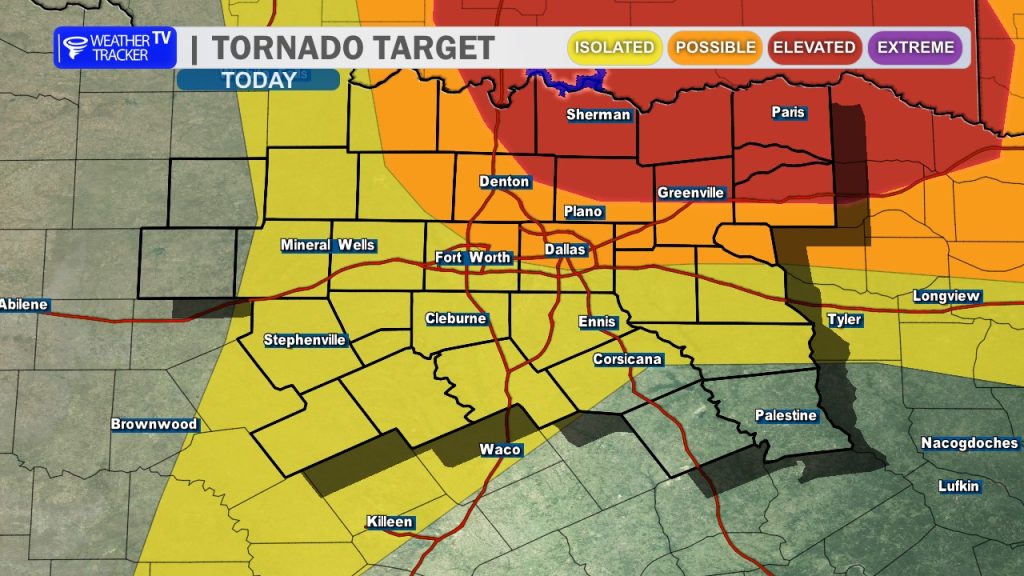
What to Expect: Any storm that manages to initiate will be operating in an environment with high instability and strong deep-layer shear. These ingredients are extremely favorable for significant hazards, including:
- Very Large Hail: Potential for tennis ball-sized hail or larger.
- Damaging Winds: Wind gusts reaching 70 mph or greater.
- Tornadoes: The low-level shear profiles will be favorable for tornado development. Environmental parameters this evening may also come together to support stronger, long-track tornadoes.
Your Action Plan: Because conditions can change rapidly, it is vital to stay “plugged in” to the weather updates from now through the evening hours.
- Review Your Plan: Now is the time to review your tornado safety plan with your family.
- Know Where to Go: Ensure everyone knows exactly where to go (the lowest floor, away from windows, in an interior room) if a warning is issued for your area.
- Multiple Alerts: As the National Weather Service emphasizes, no single method of receiving alerts is perfect. Ensure you have multiple ways to receive warnings – via weather apps, NOAA Weather Radio, or local broadcast coverage – so you can take immediate action if a warning is issued.
We will be here tracking these storms every step of the way. Stay weather-aware, North Texas. -William