Good Thursday morning, North Texas!
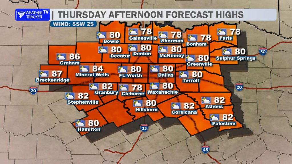
Expect a warm, humid, and breezy afternoon as we transition into a more active weather pattern. High temperatures today will push toward the 80-degree mark area-wide. A noticeable south wind will also be in play throughout the day, with gusts likely reaching around 30 mph. While we have some morning clouds to contend with, those should give way to a decent amount of afternoon sunshine.
Regarding thunderstorm chances:
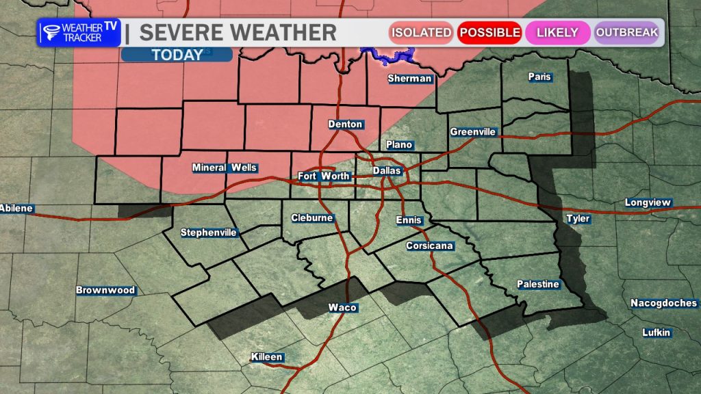
- Today: We will be monitoring the dryline later this afternoon, particularly northwest of the Metroplex. While the dryline will serve as a focus for potential development, a strong capping inversion (warm air aloft) remains in place, which will likely suppress most activity. Any storm that manages to break the cap would be capable of producing large hail and damaging winds, though the overall coverage remains very low.
- Tonight: Our focus shifts north toward a complex of storms expected to move into eastern Oklahoma. While this complex will likely dissipate before reaching North Texas, it should leave an outflow boundary lingering in southern Oklahoma.
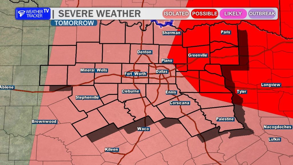
- Friday & The Weekend: That remnant boundary from tonight, combined with the dryline and an incoming shortwave, will likely ignite isolated to scattered thunderstorms on Friday afternoon and evening. This activity may approach our northeastern counties late in the day.
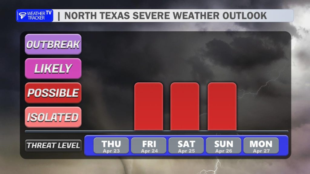
Bottom Line: While the overall rain and storm chances remain relatively low through the weekend, the situation is highly conditional. We are entering a period where the environment will support strong to severe thunderstorms, characterized by high instability and sufficient deep-layer shear. Storm development will hinge entirely on the placement of mesoscale boundaries – such as the dryline and any leftover outflow boundaries – each day. Any activity that does form this weekend will carry a threat of large hail and damaging winds.
Stay with Weather Tracker TV DFW through the weekend for continuing updates on our severe weather chances.