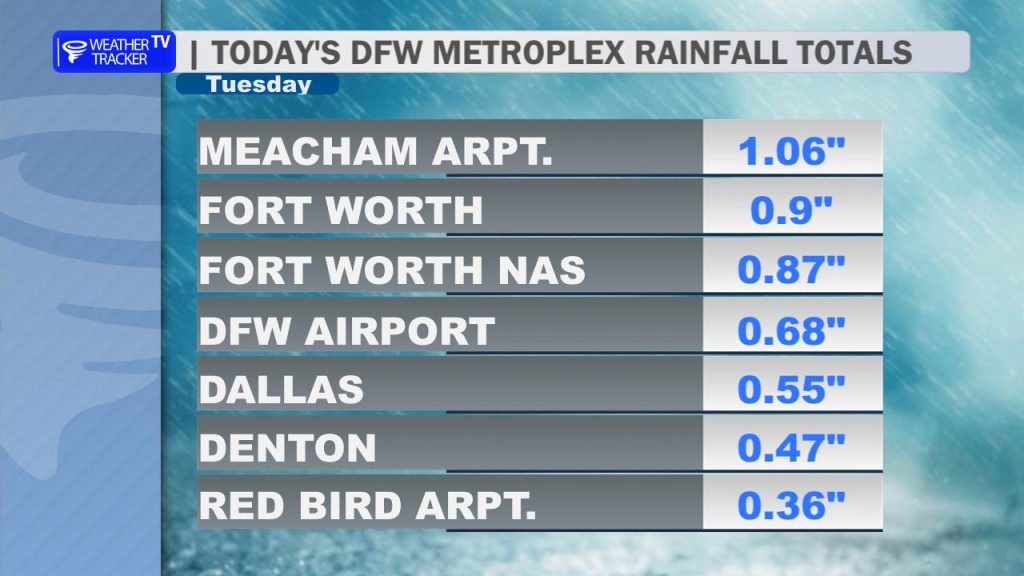
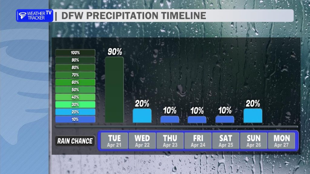
Morning Overview & Commute Impact Happy Tuesday, North Texas! We are waking up to a wet, soggy start across the Metroplex as a steady spring rain continues to move through the region. While we are seeing that beneficial, soaking rain – with some areas like Mineral Wells already reporting over 1.5 inches – the activity is beginning to transition into more scattered coverage as we head through the afternoon.
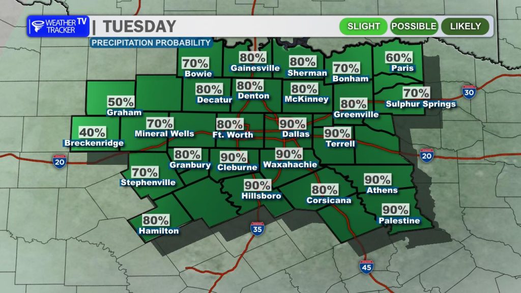
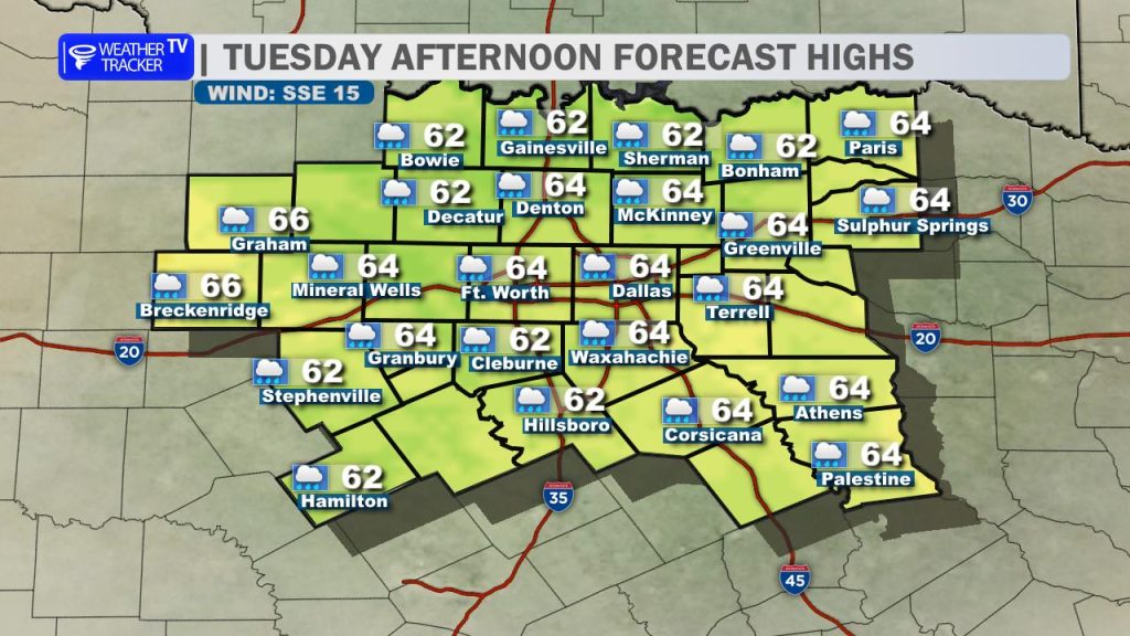
If you are heading out, please allow for extra travel time; while the rain intensity is moderate, the damp conditions will likely lead to a slower, and more touch and go evening commute. Temperatures today are staying cool, with highs essentially flat-lining in the 60s throughout the day.
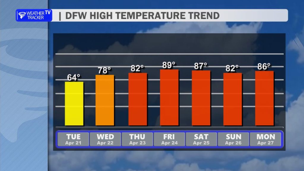
Mid-Week Outlook: Humidity on the Rise As we turn the page to Wednesday, the overall rain coverage will taper off, though we aren’t quite done yet. Expect widely scattered showers to linger, and don’t be surprised if you hear a few rumbles of thunder. Temperatures will respond accordingly, climbing back into the 70s and 80s under a more humid air mass.
Weekend Watch: Monitoring the Dryline Looking ahead to the end of the work week, we are entering a warming trend that brings temperatures back into the mid-to-upper 80s, potentially touching near 90° by Friday.
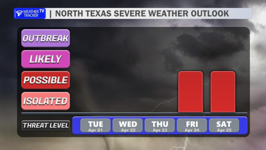
Our main focus is shifting toward the upcoming weekend. We are closely monitoring the development of a dryline setting up from Friday through Sunday. While current model guidance suggests lower overall rain chances, any convective activity that manages to develop along that boundary will need to be watched closely. As we refine the setup over the next 48 hours, we will keep you updated on the potential for severe weather.
Stay tuned to Weather Tracker TV DFW for the latest updates as this system evolves.
You must be logged in to post a comment.