Good Monday morning, North Texas! We are kicking off the work week with a noticeable change in our weather pattern as Gulf moisture returns to the region, bringing an increase in clouds and the return of rain chances.
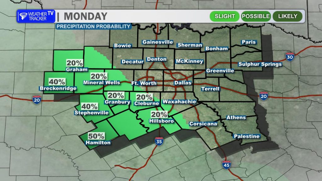
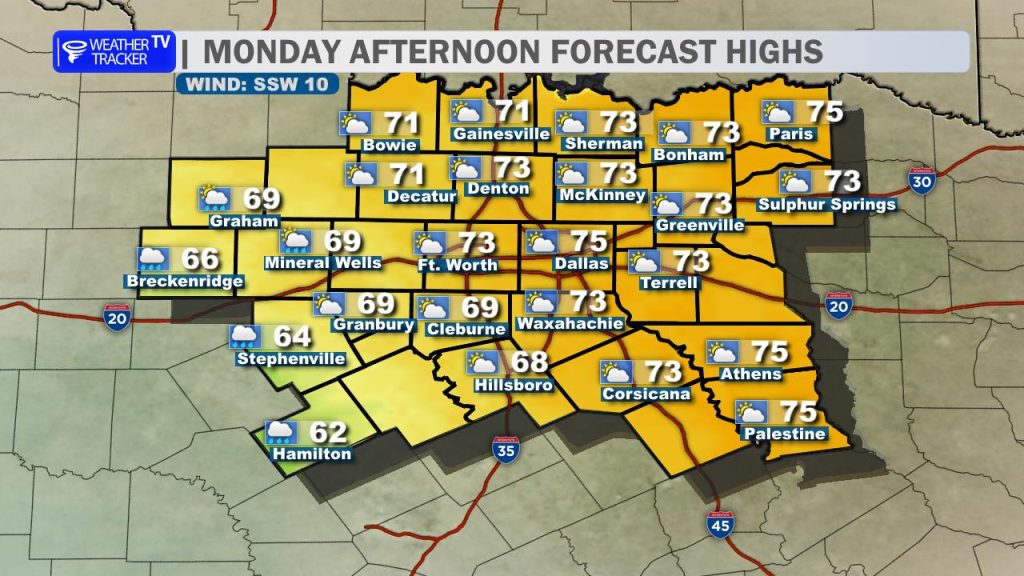
Today: Clouds Increase, Light Rain West Expect a mostly cloudy afternoon as southerly winds pull Gulf moisture northward. A weak disturbance is already initiating some light shower activity to our west and southwest; these showers will spread northeastward through the day. Consequently, we’ll see a significant temperature gradient today:
- Southwest Counties (e.g., Erath, Hamilton, Bosque): More cloud cover and occasional light showers will keep highs cooler, mainly in the low to mid-60s.
- Elsewhere: With more sunshine filtering through at times, highs will reach into the low to mid-70s.
- Winds: A steady southeast breeze of 5–15 mph will persist.
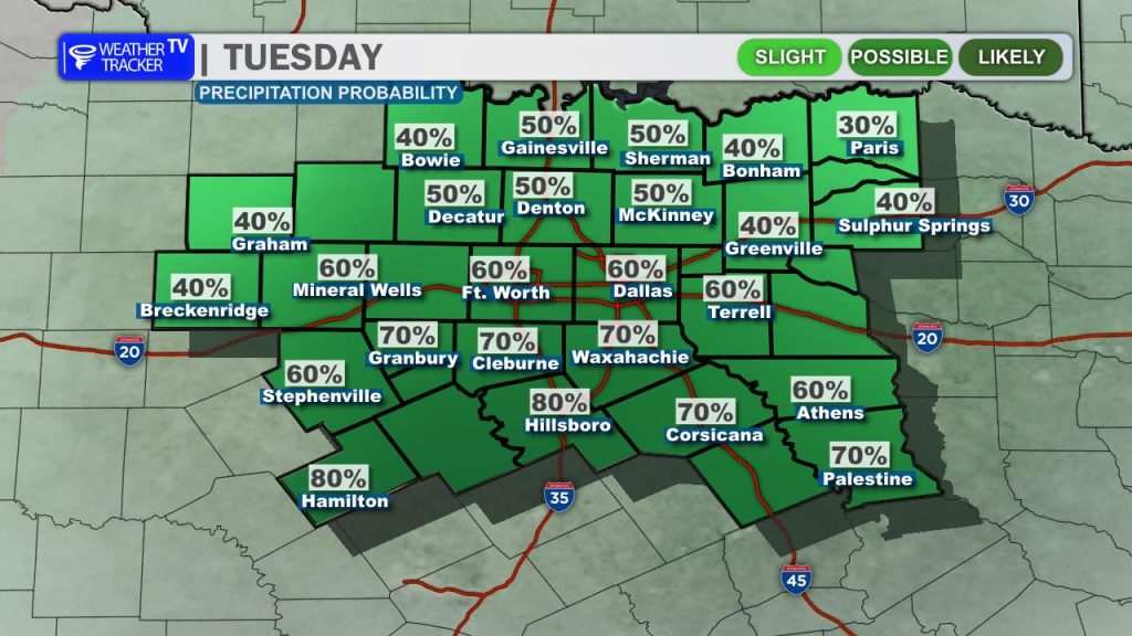
Tonight & Tuesday: Damp & Gray The first disturbance today is just the beginning. A second, more organized system currently over the Desert Southwest will advance east, bringing more widespread shower activity overnight into Tuesday.
- Tuesday Commute: Expect a damp and potentially gloomy Tuesday morning across the Metroplex. While rain chances will be focused from the Metroplex southward into Central Texas, light showers are possible areawide.
- Tuesday Daytime: It will be a gray, damp day. With persistent cloud cover and showers, temperatures will struggle to climb, holding steady in the 60s.
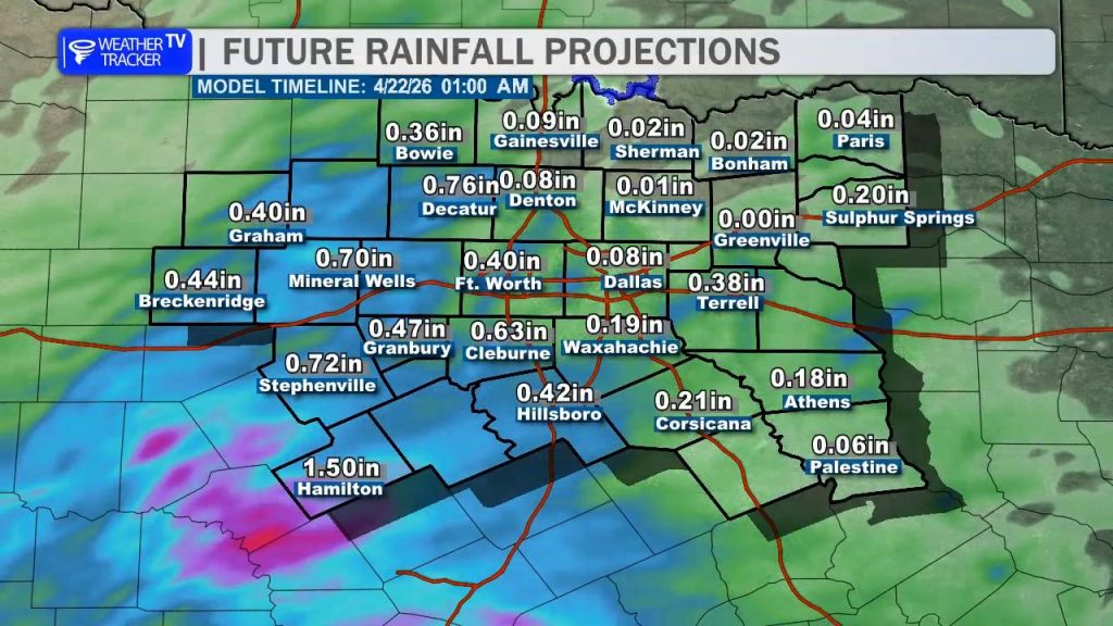
Rainfall Outlook Through Tuesday evening, most locations can expect light rainfall totals between 0.25″ and 0.50″. We’ll be watching our southwestern counties closely, as localized areas could pick up closer to an inch.
Looking Ahead: Warming Trend & Late-Week Severe Risk The pattern shifts toward more typical spring weather by mid-week.
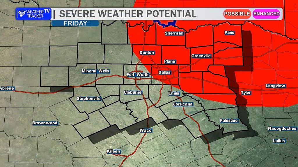
Friday Severe Potential: Our focus turns to Friday, where a dryline is expected to move toward the US-281 corridor. This setup brings the potential for scattered showers and thunderstorms. Some of these storms could become severe late Friday afternoon, particularly from the Metroplex to our northeast. We are actively monitoring this evolving risk and will keep you posted as we get closer to the end of the week.
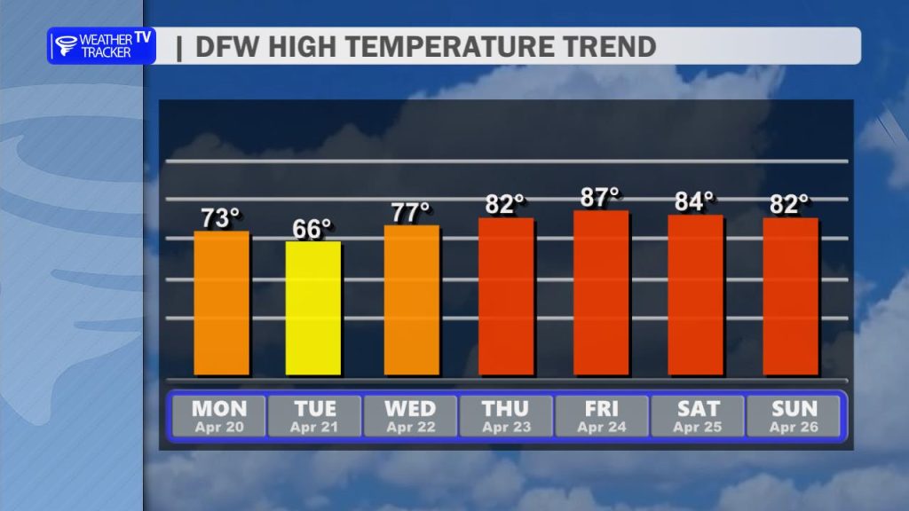
Mid-Week Warmup: We will see a quick rebound in temperatures as we dry out. By Thursday, highs will climb back into the 80s.