Good Sunday morning, North Texas!
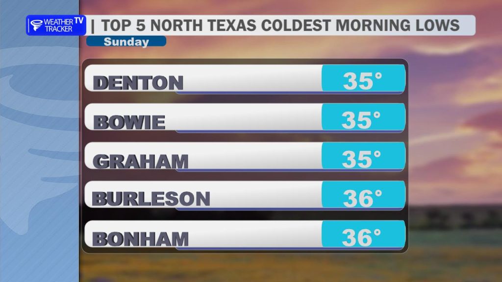
We’ve woken up to a crisp, chilly start this morning following the passage of yesterday’s cold front. Temperatures have dropped into the mid-30s across several spots, with Denton reporting some of the cooler air this morning.
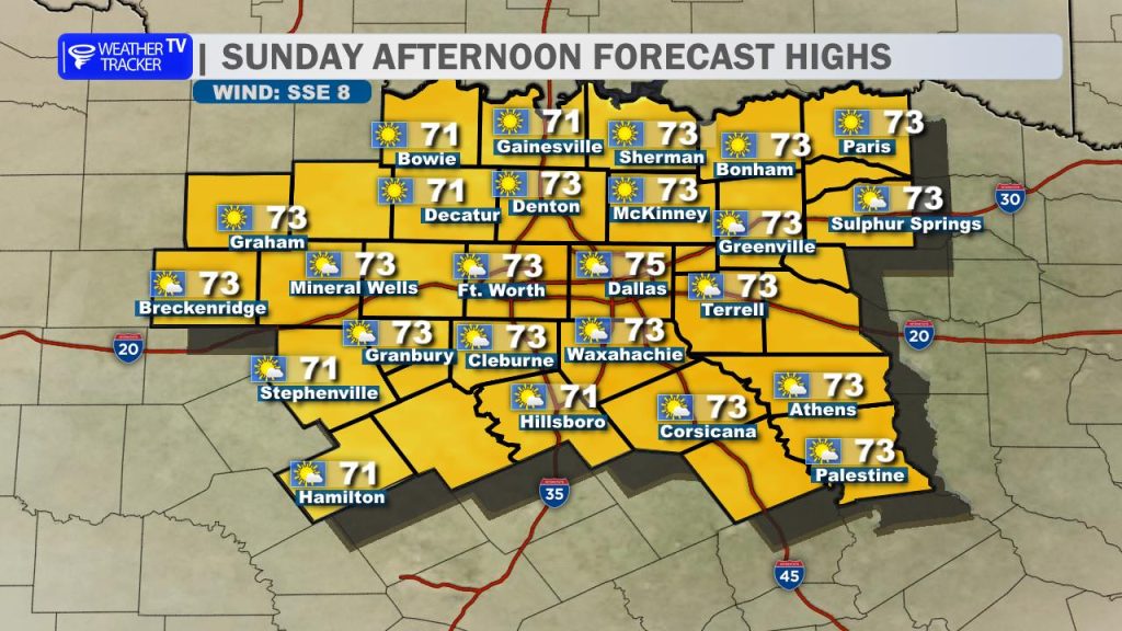
Today’s Outlook After a cool, damp Saturday, we are looking at a beautiful turnaround for the remainder of the weekend. You can expect a fantastic afternoon with plenty of sunshine and light, variable winds. Highs will climb comfortably into the low-to-mid 70s. It’s the perfect day to head outdoors, tackle those yard projects, or take the dog on that long, overdue walk.
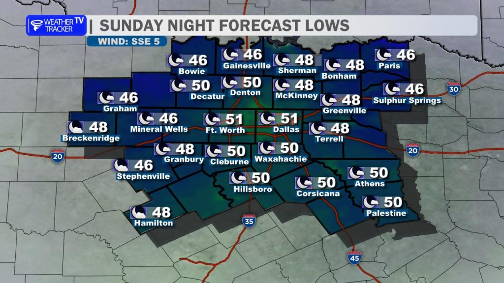
Tonight & Early Week While it won’t be quite as chilly as this morning, tonight will still be cool. Expect overnight lows to dip back into the 40s under fair skies with calm winds.
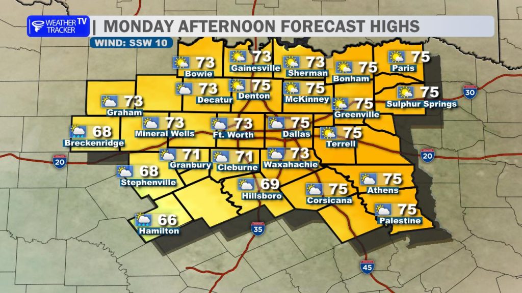
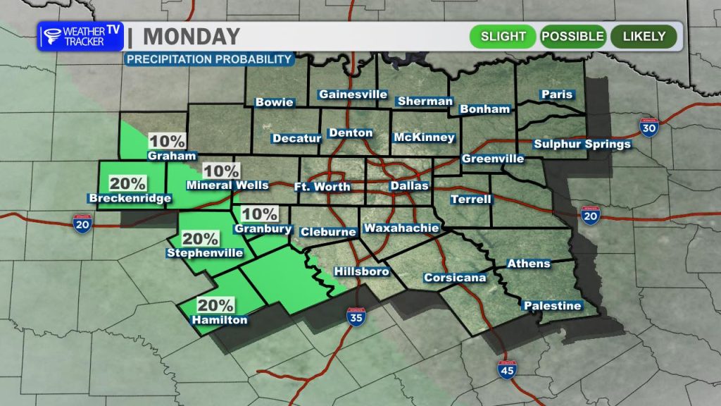
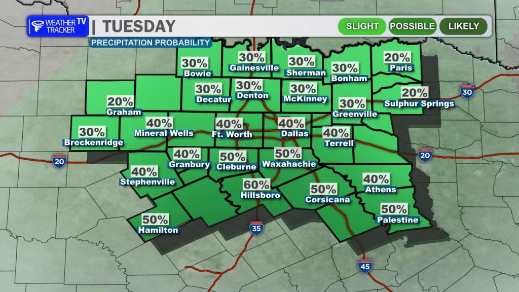
As we head into Monday, the pattern begins to shift. You’ll notice an increase in cloud cover throughout the day. By the time we reach late Monday, light, scattered showers will be possible, primarily targeting our southwestern and southern counties. Rainfall amounts will remain light. Scattered shower chances increase Monday night into Tuesday.
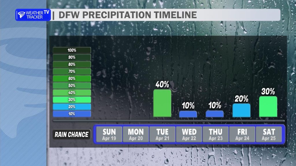
Looking Ahead: Mid-to-Late Week Those lingering scattered shower chances will persist through Tuesday. With the added cloud cover, expect a cooler day on Tuesday with highs holding in the 60s.
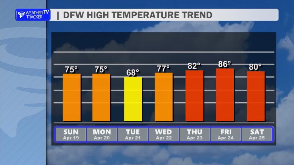
However, don’t get too used to the cooler air. By late week, we enter a transition as the pattern shifts back into a classic, active spring-like setup. We are tracking a return of scattered thunderstorm chances heading into the upcoming weekend, and temperatures will respond by quickly rebounding into the 80s as we close out the work week.
William’s Note: Stay tuned to Weather Tracker TV for the latest updates as we track the return of our active spring pattern later this week.