Good Thursday morning, North Texas!
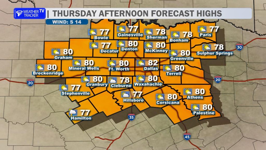
Expect a mix of sun and clouds this afternoon with high temperatures pushing into the upper 70s to right around 80°. A southeast wind will become breezy later today, adding a bit of a gusty feel to the afternoon. While most spots remain totally dry, a couple of isolated showers are possible southwest of the I-20 corridor during the peak heating of the day.
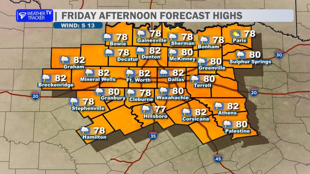
Friday’s forecast looks very similar, though temperatures will be a few degrees warmer with highs mostly in the lower 80s. We’ll see a familiar mix of sun and clouds accompanied by that southeast breeze. A couple of stray showers remain possible, again primarily south of I-20.
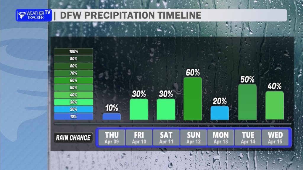
Rain and storm chances begin to increase as we head into the weekend. On both Friday and Saturday evenings, we will be watching to the west for any thunderstorms that form along the dryline. Right now, all indications suggest we stay mostly dry through Saturday night.
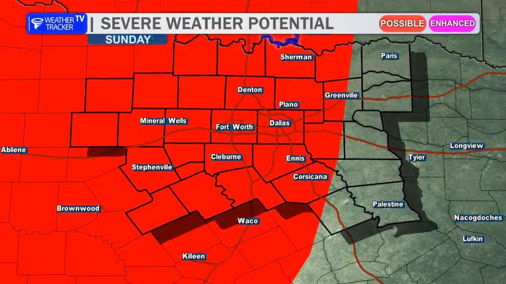
The pattern shifts on Sunday as a complex of storms moves in from the west and crosses the area. By Sunday afternoon, additional thunderstorms may redevelop, and we could see more scattered activity on Monday afternoon. Any activity that forms Sunday or Monday afternoon has the potential to be severe.

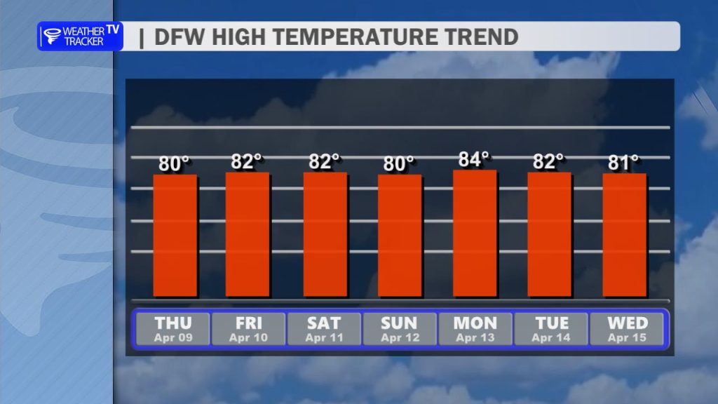
The primary upper-level storm system responsible for this active stretch will push through Tuesday into Wednesday, bringing another round of rain, storms, and a continued risk of severe weather. High temperatures through early next week will level off in the mid-80s.