Good Wednesday morning, North Texas!
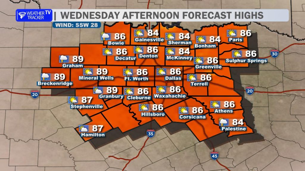
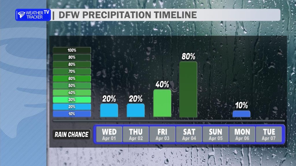
Today is a North Texas Weather Ready Day. While we’re starting with another very warm, breezy, and humid day—with highs climbing into the low-to-mid 80s—we are keeping a close eye on a severe weather risk arriving later this evening and overnight. Daytime storm chances remain low at 20% or less, but that changes as the sun goes down.
Tonight’s Storm Timeline & Risks
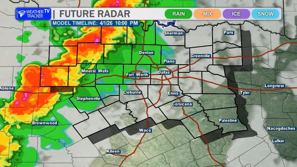
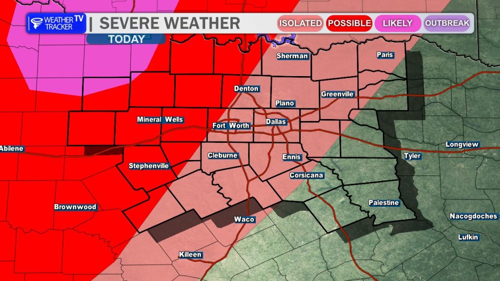
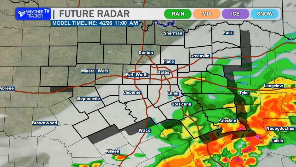
Severe potential ramps up this evening as a line of storms pushes into our western counties from the Big Country.
- Primary Hazards: The main concerns are damaging wind gusts up to 70 mph and golf ball-sized hail, particularly for areas west of the I-35 corridor.
- Tornado Risk: While the tornado probability remains low, it is not zero, so stay weather-aware.
- Timing: The most intense activity is expected in our western counties between 9 PM and midnight.
- Metroplex Impact: After midnight, the line will move into the DFW Metroplex. Current data suggests a weakening trend as it pushes east, so while the severe threat is lower for DFW, you should still expect heavy rain, frequent lightning, and gusty winds through the overnight hours.
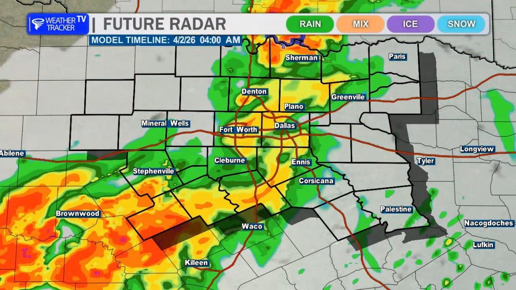
The rain will linger into the Thursday morning commute, so plan for wet roads and extra travel time. The activity will gradually shift southeast, clearing our southern counties around noon.
We won’t have long to dry out, though. Another, potentially more potent round of storms is set for Friday afternoon into Saturday morning. A strong cold front will collide with record-level moisture, bringing another risk of severe weather and a concern for localized flooding, with some areas potentially seeing 1–3 inches of rain.
Easter Sunday Outlook
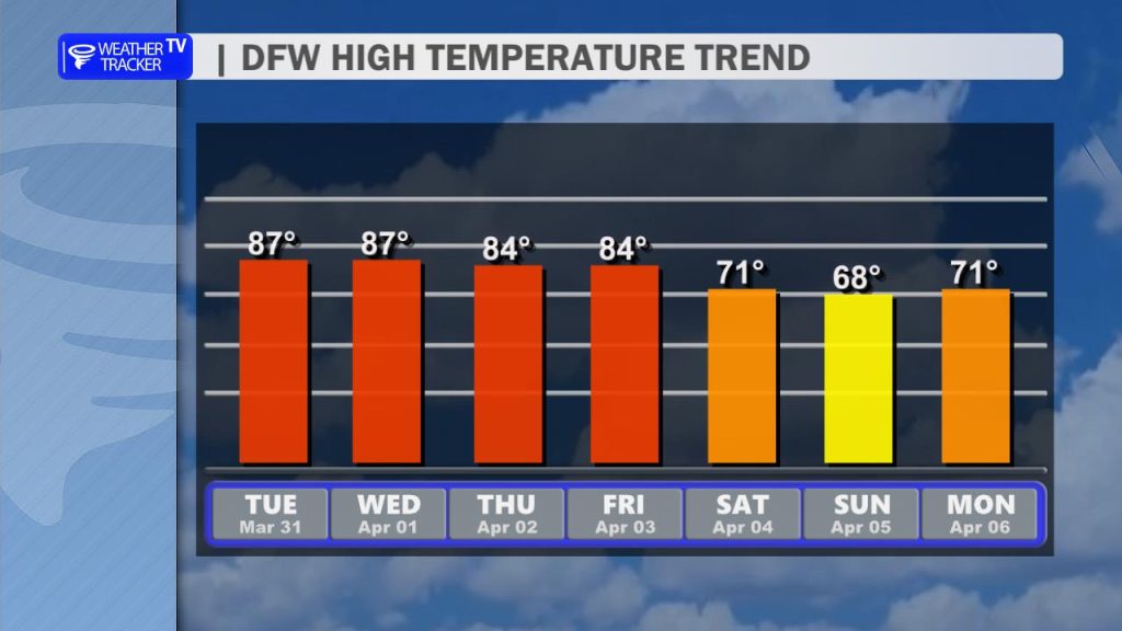
The good news? The front clears out just in time for Easter. We’ll turn cooler but remain dry for Easter Sunday.
- Morning: Chilly! If you’re heading to a sunrise service, grab a jacket as temperatures will start in the 40s.
- Afternoon: Beautiful and crisp, with highs in the mid-60s, partly cloudy skies, and a fresh northeast breeze.