Good Wednesday morning, North Texas.

Today is a Weather Ready Day across the region as the threat for severe storms returns to the area.
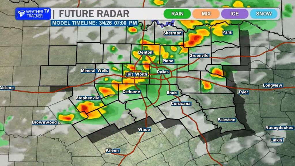
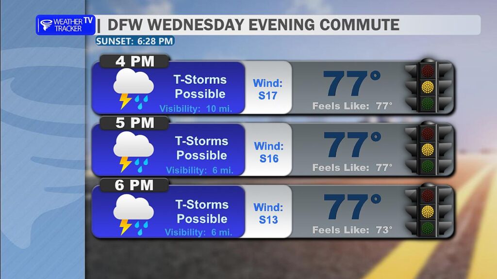
Through the late morning and early afternoon, we could see scattered showers and a few rumbles of thunder, but the greater concern arrives later in the day. Storm chances will begin to increase after about 4 PM across the Metroplex, unfortunately lining up with the evening commute.
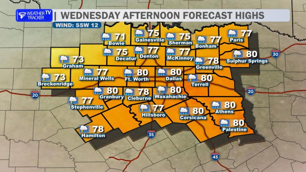
Temperatures this afternoon will climb into a mix of the 70s and lower 80s, depending on cloud cover and how quickly storms begin to develop. A cold front moving in from the northwest will act as the main trigger for thunderstorm development later today, and some storms could develop right over the Metroplex as the front moves through.
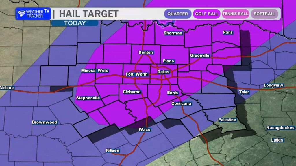
Not every storm will be severe, but any storm that becomes strong could quickly reach severe limits. The main threats today will be large hail and strong wind gusts. Hail sizes could range from quarter to half dollar size, and a few isolated reports of golf ball sized hail cannot be ruled out.
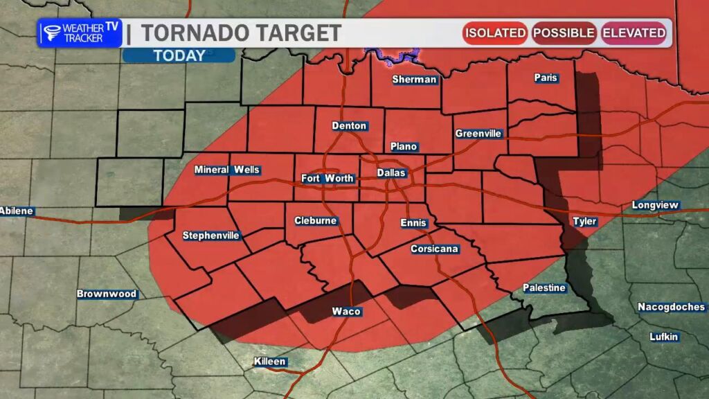
The overall tornado threat remains low, but it is not zero. With the amount of wind shear in the atmosphere today, it’s possible that one or two storms could briefly rotate, so a tornado warning or two cannot be completely ruled out.
As always during severe weather season in North Texas, it’s a good idea to review your severe weather safety plan today. Make sure you have a way to receive warnings, especially this evening when many people will be traveling or heading home from work.
And of course, we’ll be monitoring storms closely this afternoon and evening and will bring you updates as needed. -William