Good Tuesday morning, North Texas!
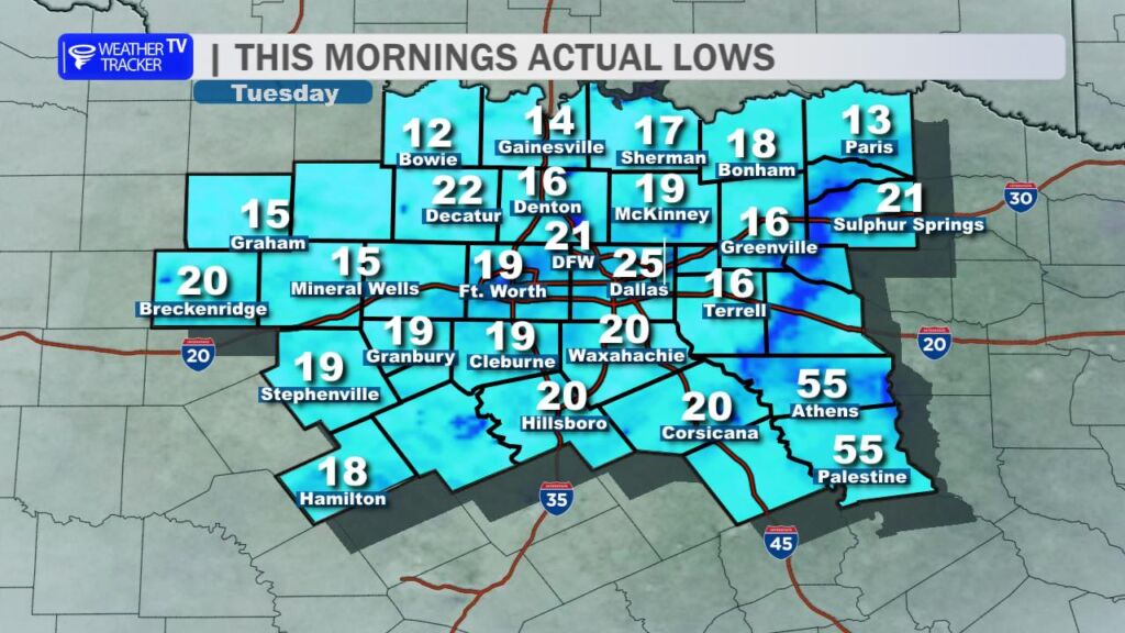
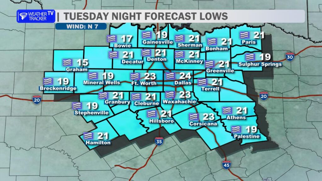
It’s another bitterly cold start across the region. Most communities woke up to temperatures in the teens and 20s, and officially at DFW Airport we dropped to 21 degrees right around sunrise.
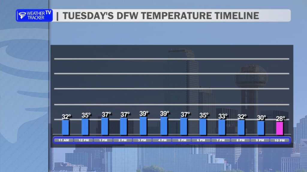
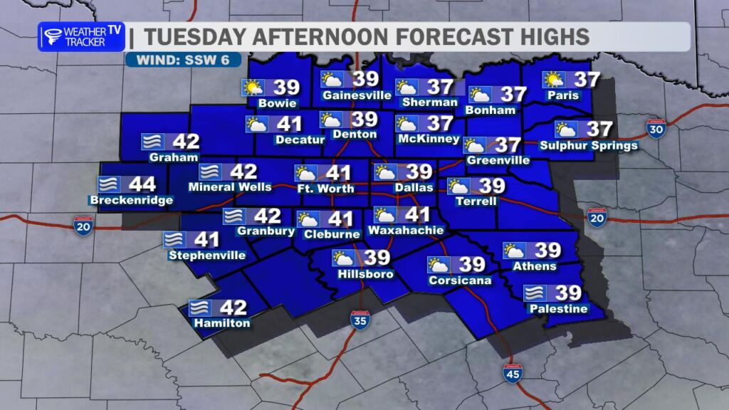
The good news is we will climb back above freezing this afternoon. High temperatures should reach around 40 degrees in the Metroplex under mostly sunny to partly sunny skies. That sunshine, combined with slightly milder air, will help improve road conditions through the afternoon as ice continues to melt on untreated surfaces.
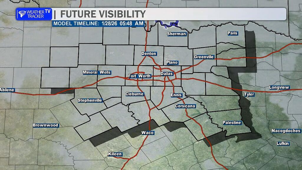
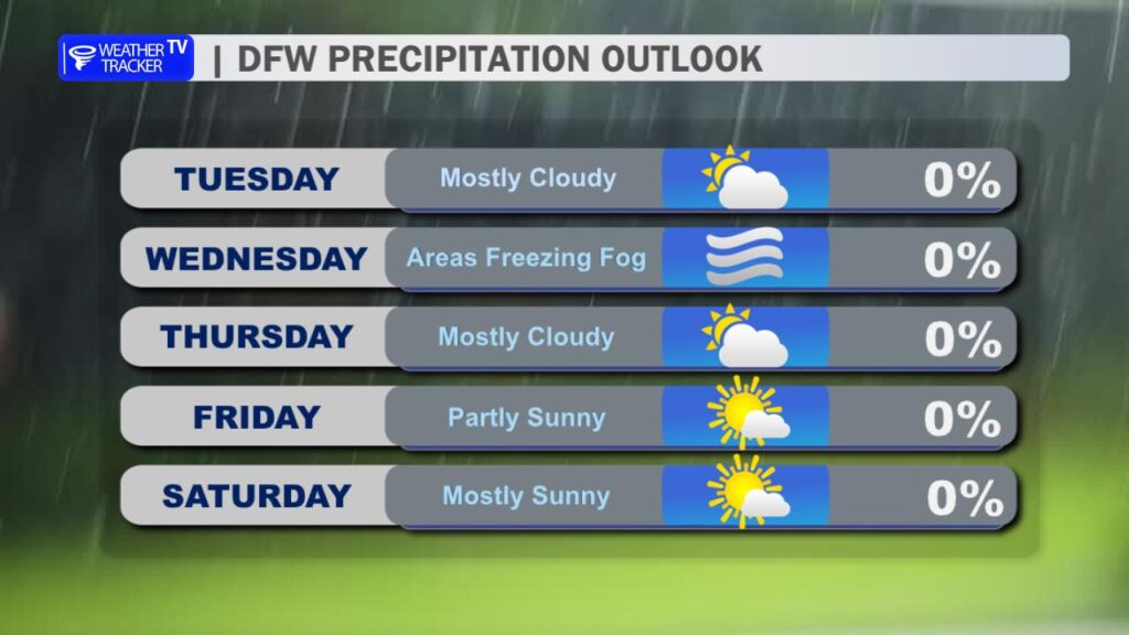
However, conditions will deteriorate again this evening. Temperatures are expected to fall back below freezing by around 8 PM, setting the stage for refreezing on area roadways overnight. To make matters worse, widespread freezing fog is likely to develop late tonight and persist into the Wednesday morning commute. That combination of refreezing moisture and freezing fog could create slick spots – especially on bridges, overpasses, and other elevated surfaces – along with reduced visibility. Some light glazing will be possible, and travel early Wednesday could be treacherous. If you can delay the morning commute again tomorrow, it would be a wise move.
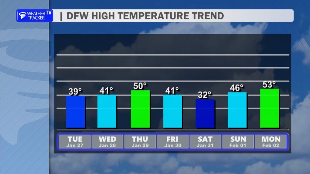
Looking ahead, temperatures will continue to gradually moderate through the middle of the week. But don’t get too comfortable – another Arctic front is expected to arrive late in the week, sending temperatures sharply downward once again heading into the weekend. Highs on Saturday may struggle to reach the lower 30s. At this time, the forecast remains dry, but the cold will certainly be back in full force.
Stay safe and stay warm. -William