Good Saturday morning, North Texas! 🌤️
What a way to wrap up 2025 – we’re looking at another unseasonably warm day across the Dallas-Fort Worth area, with a legitimate shot at tying or breaking the daily record high – again.
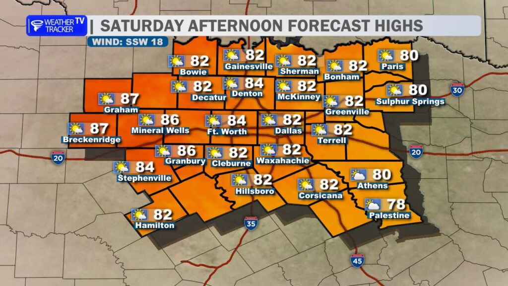
Skies will be variably cloudy today, with generally more cloud cover building in areas southeast of DFW. Winds will be breezy out of the southwest at 15-20 mph, adding a touch of that classic Texas warmth to the air.
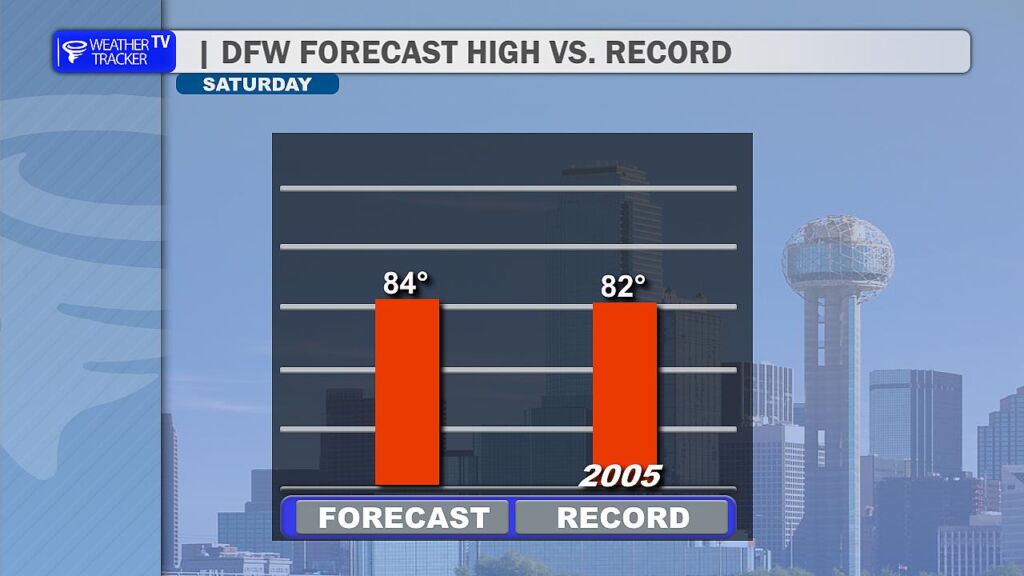
The big headline? Temperatures. My forecast high is around 84°, which would push us past the current record high of 82° set back on this date in 2005. We’re talking well above the typical December normal highs which usually hover in the upper 50s.
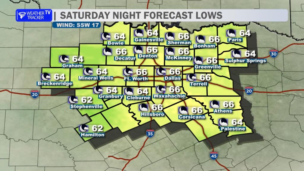
If you’re heading out for Saturday evening or night plans, it’ll stay pleasantly mild with fair to partly cloudy skies continuing. Overnight lows will only dip into the mid to upper 60s – no jacket required for most folks.
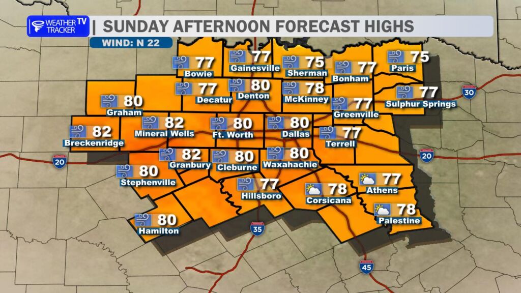
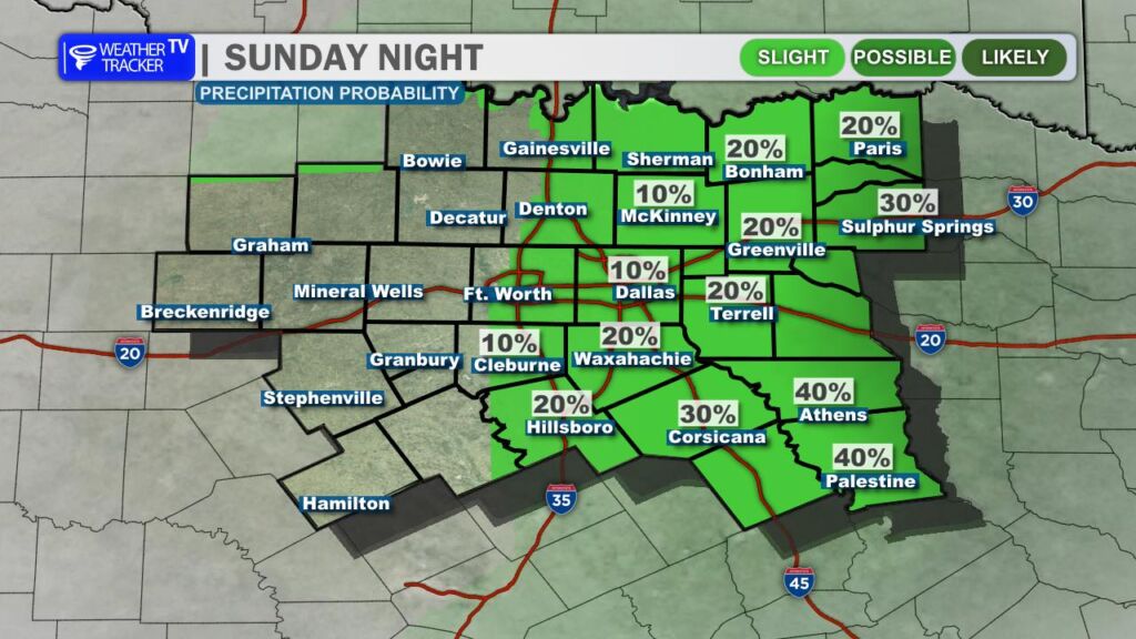
Sunday brings the turning point: a strong cold front will barrel through late in the day, ushering in a classic Blue Norther-style change. Highs will still manage to reach the upper 70s to low 80s early on, but expect blustery north winds gusting over 30 mph (possibly higher) as the front passes.
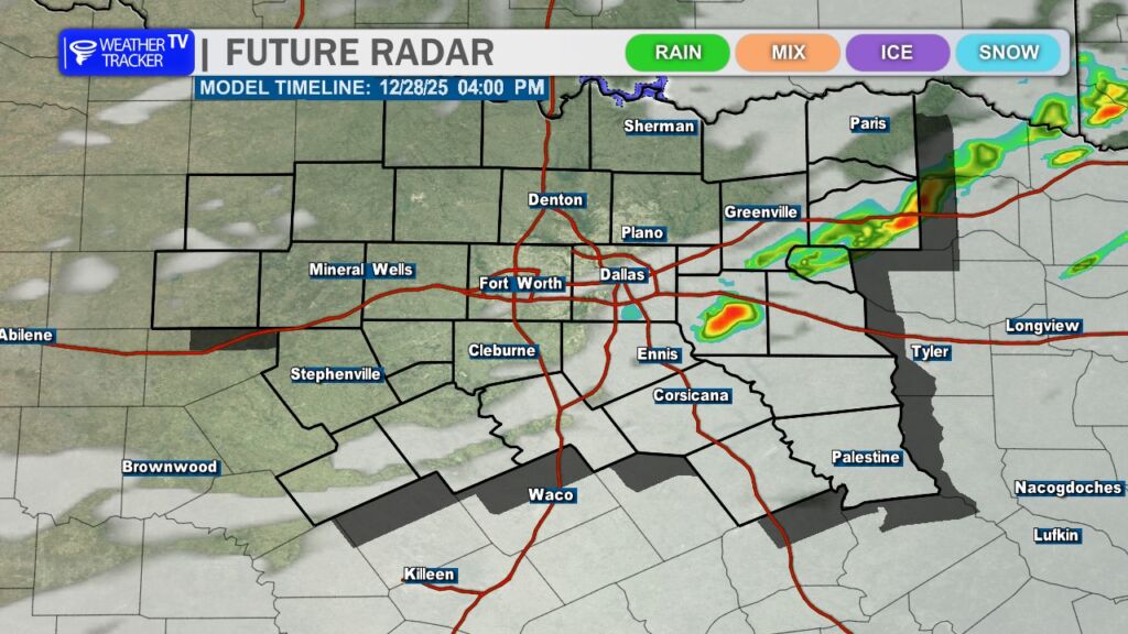
A thin line of showers and isolated thunderstorms could pop up near and ahead of the front, mainly in the late afternoon/evening. Rainfall totals should remain very light – we’re not expecting any widespread soaking, and severe weather isn’t on the table today.
Behind the front, temperatures will plummet quickly. Monday and Tuesday look chilly with highs likely in the 40s and lows dipping into the 30s (widespread freeze possible Monday night into Tuesday morning). Bundle up if you’re out early next week!
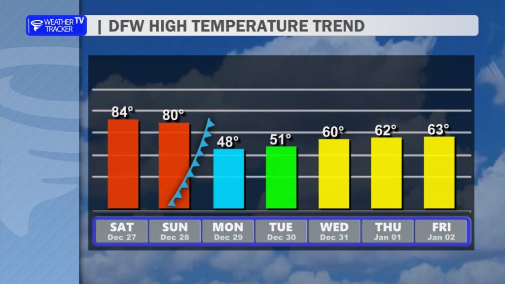
Then we get a nice rebound as we close out the year – temperatures climb back into the 60s by the end of next week, finishing 2025 on a milder note.