Happy Monday, North Texas!
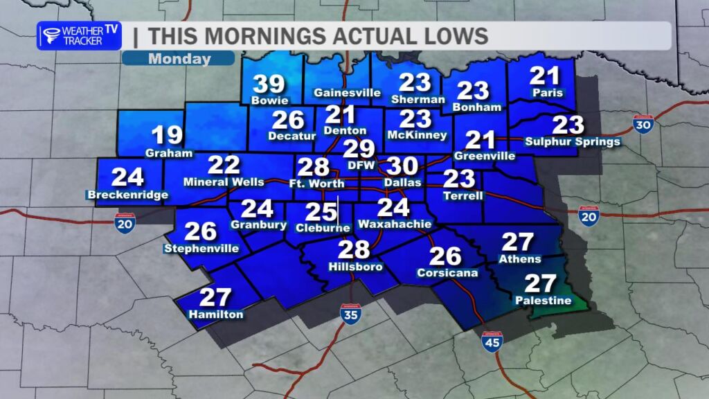
Brrr – what a chilly kickoff to the week. We woke up to a bitterly cold morning across the region, with DFW International Airport officially bottoming out at 29°. That’s our coldest low since back in February, so if you felt that sharp bite in the air while warming up the car or bundling up for the school drop-off, you’re not alone.
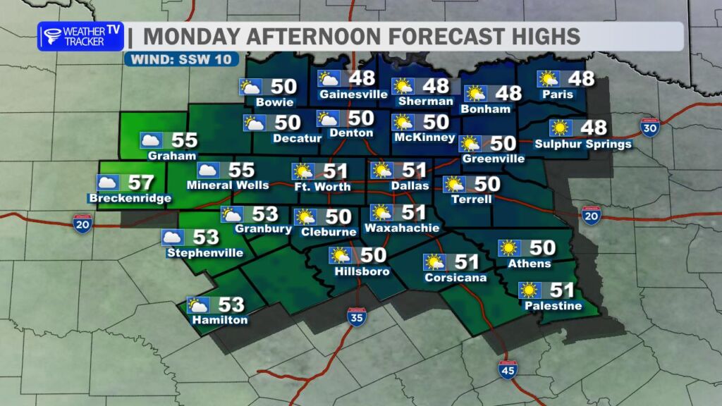
This afternoon, we’ll stay on the cooler side, lingering mostly in the 40s throughout the day. The DFW metroplex might briefly nudge up to around 50° later on, under a mix of partly to mostly cloudy skies. Bundle up if you’re heading out – layering is your friend today.
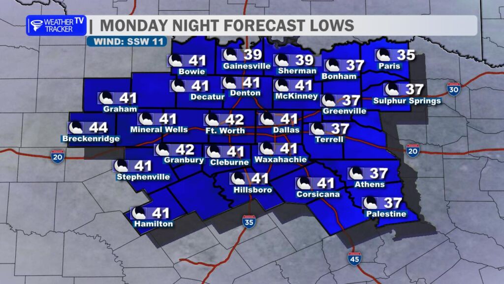
Tonight won’t be quite as cold, with lows settling into the upper 30s to lower 40s and lighter winds helping to keep things a bit more bearable.
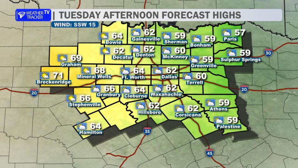
A nice warming trend kicks in starting tomorrow. We’ll see temperatures steadily climbing, reaching the upper 60s by midweek – perfect for shedding some of those extra layers and enjoying some outdoor time.
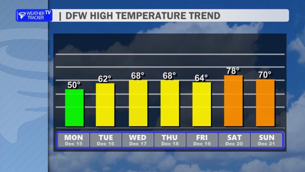
Looking further ahead, a weak cold front slides through on Friday, knocking highs back just a few degrees into the low to mid-60s. But don’t worry – it rebounds quickly, with plenty of sunshine and temperatures soaring into the 70s over the weekend.
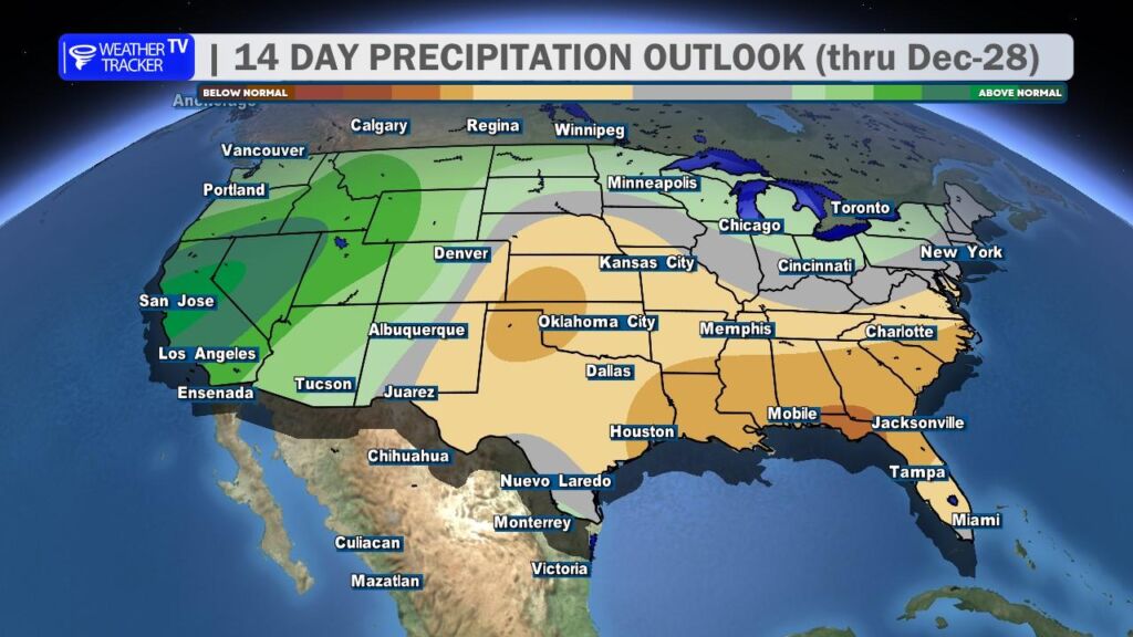
As we head toward the holidays, the current outlook remains dry all the way through Christmas. No major rain or storms in sight, which means clearer skies for any Christmas lights viewing or travel plans.
Stay warm out there today. -William