TGIF, North Texas!
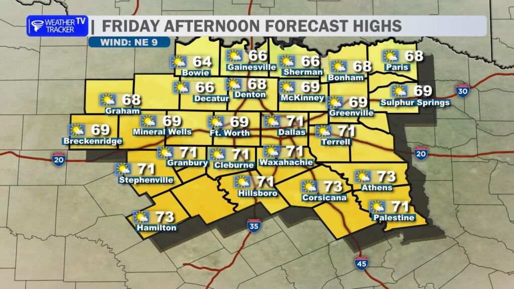
Happy Friday! We’re wrapping up the work week with another gorgeous, spring-like December afternoon. Expect highs ranging from the mid-to-upper 60s across most of the Metroplex to low 70s down in our southern counties (Hillsboro, Corsicana, Athens). Skies will stay partly cloudy – perfect weather for lunch on a patio, or just soaking up the sunshine before the weekend chill arrives.
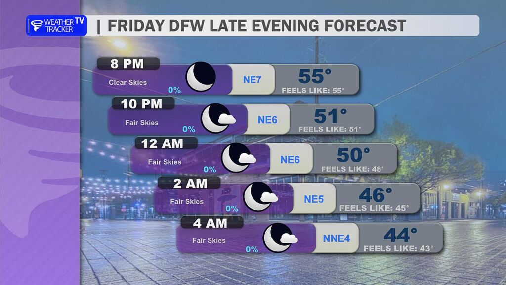
Tonight If you’ve got Friday night plans – holiday lights at the Arboretum, dinner downtown, or the big rivalry games – it’ll feel chilly but very manageable. Temperatures will slide from the low 60s at kickoff/dinner time down through the 50s by midnight. Grab a light jacket or hoodie and you’ll be golden.
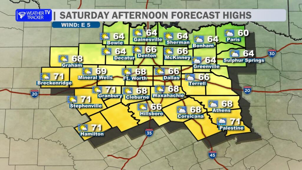
Saturday One more mild day! Highs climb back into the mid-to-upper 60s under a mix of sun and clouds. But keep an eye on the clock: a strong cold front barrels through late Saturday afternoon and evening (roughly 4–8 p.m. from north to south). Winds will flip to the north and crank up to 20–30 mph with gusts over 35 mph possible. Temperatures will nosedive behind the front – from the 60s into the 40s in a matter of hours Saturday night.

Sunday Brrr! Welcome to real December weather. A raw, brisk day with highs only in the low-to-mid 40s (some spots north of I-20 may not even crack 45°). Wind chills will hover in the 30s all day, so bundle up for any outdoor plans (Cowboys watch parties included). Skies stay mostly cloudy, but it’ll be dry.

Next Week Fast warm-up on the way. We rebound nicely:
- Monday: Low to mid 50s
- Tuesday: Near 60°
- Wednesday: Back near 70° with lots of sunshine

A storm system approaching from the west could bring a low-end chance of showers as early as Tuesday night into Wednesday, with slightly better rain chances possible late next week or next weekend. Still too far out for specifics, but we’ll keep you posted.
Stay warm and have a fantastic weekend, North Texas. -William