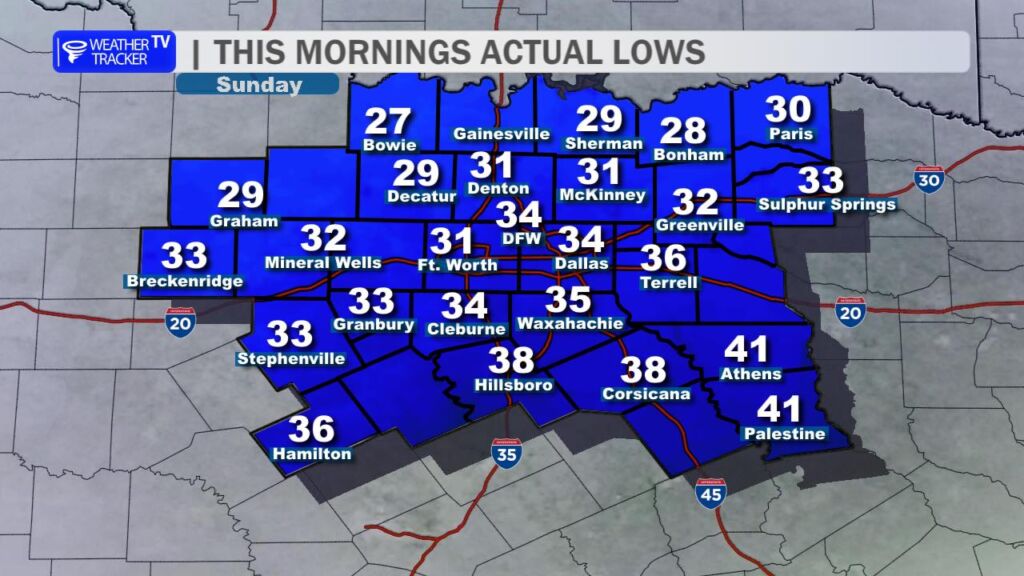
A much sharper chill greeted North Texas this morning, courtesy of yesterday’s strong cold front. Temperatures plummeted overnight, with most of the region either reaching or slipping below the freezing mark before sunrise. Officially at DFW Airport, we squeaked by with a morning low of 34 (so far), but many neighborhoods a little north and west of the Metroplex woke up to the mid-20s and low 30s — definitely a coat-and-scarf kind of start!
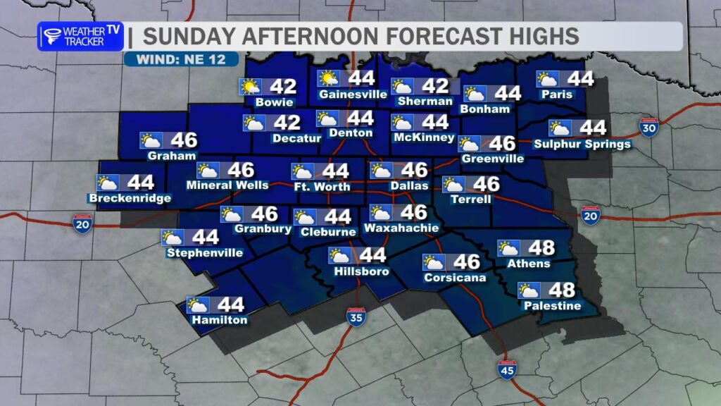
Today will stay downright chilly. High temperatures this afternoon will struggle to climb out of the 40s – think low-to-mid 40s at best. A brisk north wind will make it feel even colder, with wind chills hovering in the 30s for much of the day.
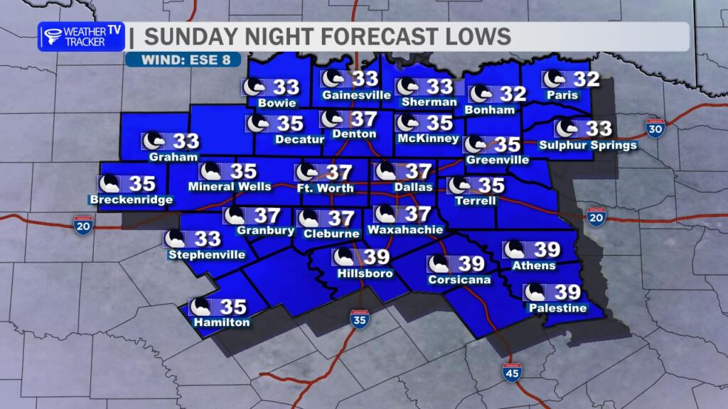
Tonight stays cold – lows will dip back into the 30s across most of the area, but most locations hovering above the freezing mark.
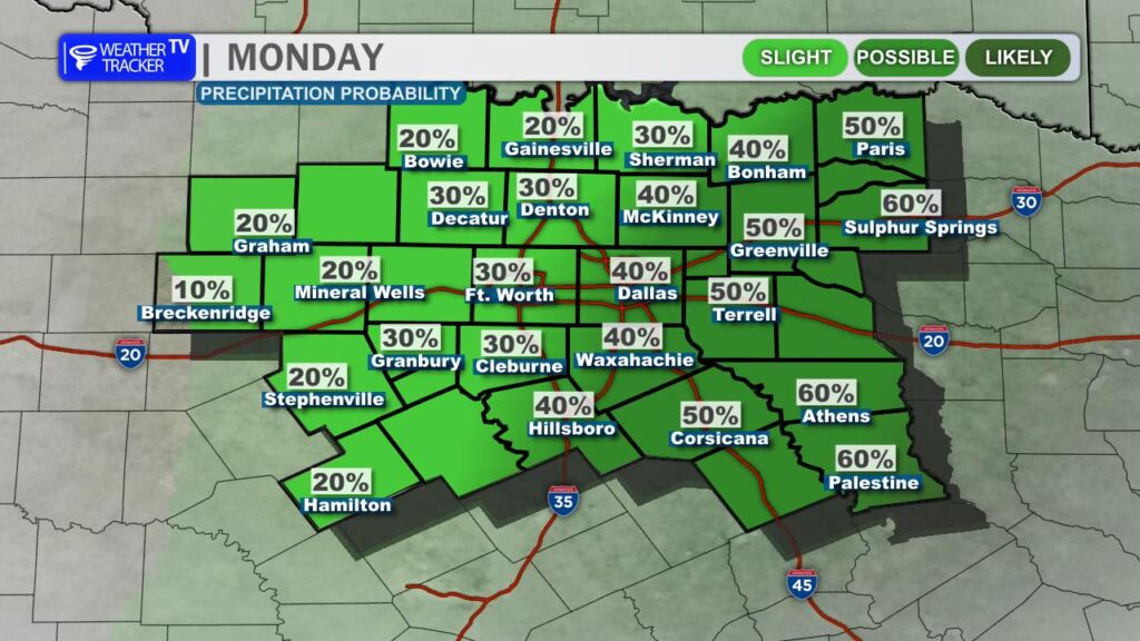
Monday looks similar: another day stuck in the 40s for highs, but we’ll throw in a few light showers as a weak disturbance slides by. Don’t expect much rain – many spots will see just a trace to a tenth of an inch – but it’ll be enough to keep things damp and raw.
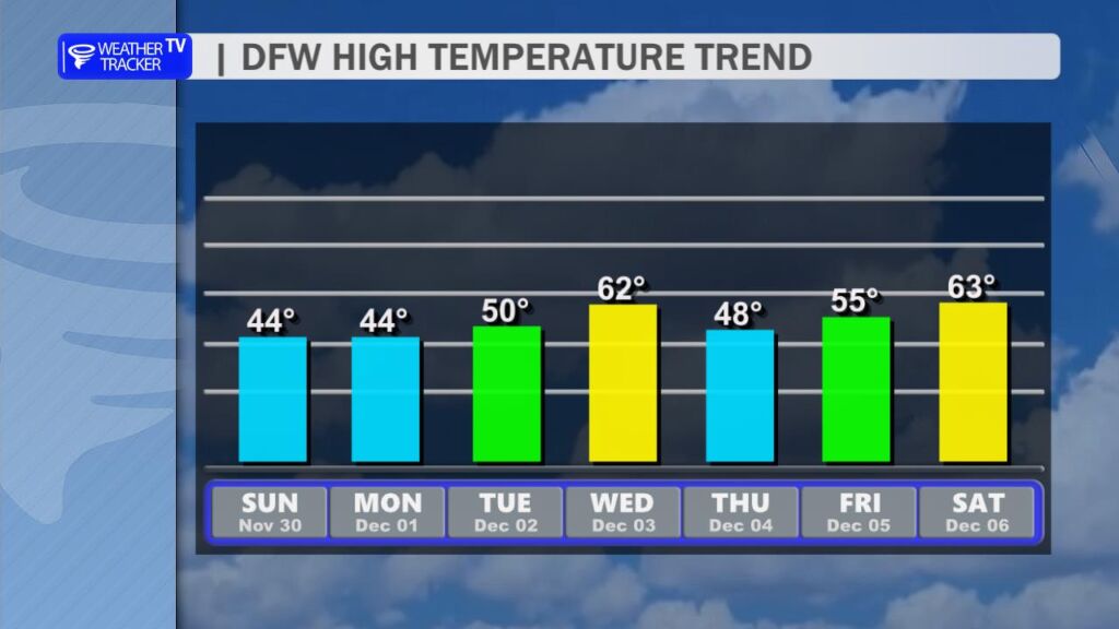
After that, we finally start a slow warm-up through the middle of the work week. By Tuesday and Wednesday, afternoon highs should climb back into the 50s and eventually the low 60s – feeling much more seasonable.
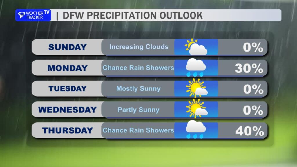
Enjoy it while it lasts. Another cold front arrives Thursday into Friday, bringing another round of rain chances followed by a fresh blast of colder air to end the workweek.
In short: Bundle up the next couple of days, keep the umbrella handy for Monday, and get ready for the Texas weather roller coaster to keep on rolling! 🥶➡️🌧️➡️😎➡️🥶