Get ready, North Texas – the next couple of days are going to feel a lot more like early October than mid-November.

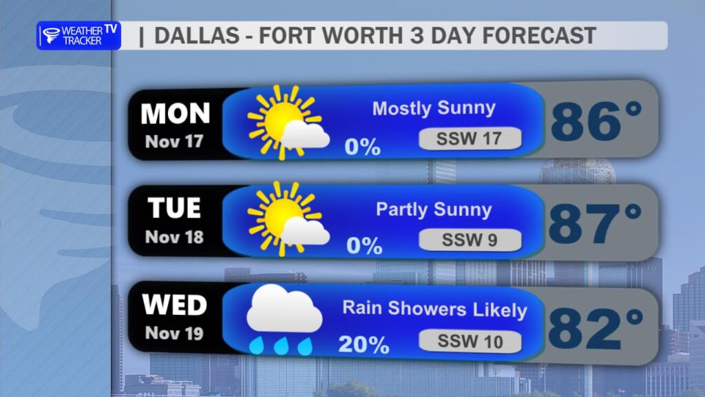
Today (Monday, Nov 17)
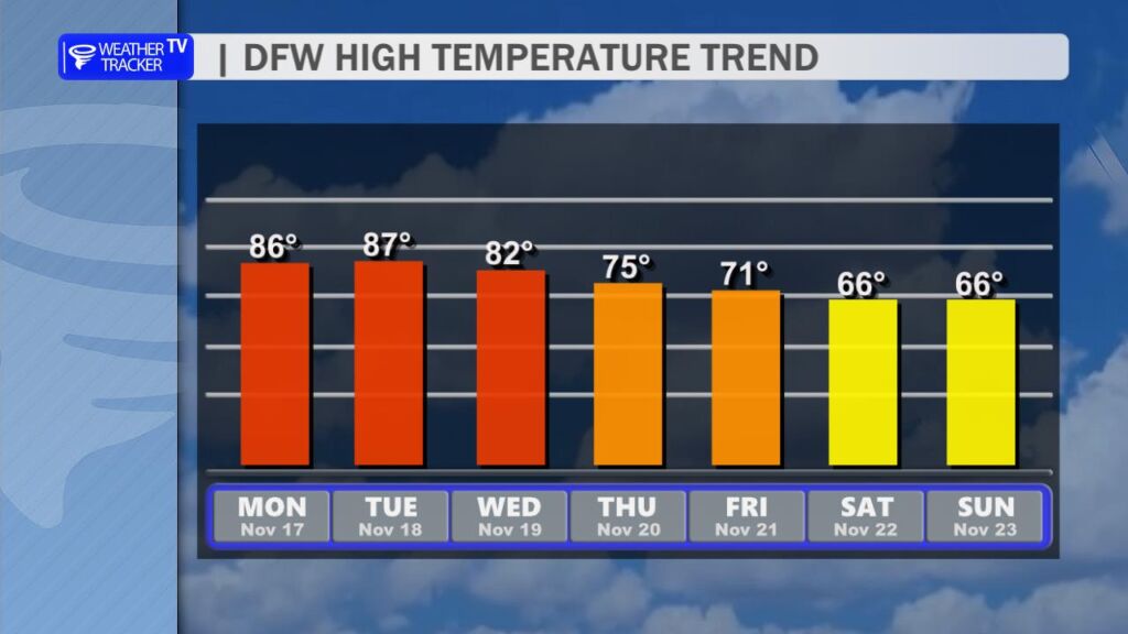
We’re flirting with the all-time November 17 record high at DFW of 87° (set in 1938 & tied in 2013 and 2019). The official forecast high is 86°, which means we’ll either tie or come within 1 degree of the record. Morning lows only dipped into the upper 60s, so it’ll feel muggy and summer-like right from the start.

Tuesday (Nov 18)
We go for broke on the record books. The November 18 record stands at 83° (1973), but the forecast high is an eye-popping 87°. That would smash the daily record by 4 degrees and would be one of the warmest November days ever recorded in North Texas. Widespread mid-to-upper 80s are expected from Dallas-Fort Worth down through Waco and even into parts of Central Texas.
This ridiculous warmth is courtesy of a strong upper-level ridge parked over the southern Plains and a gusty south wind pumping in deep Gulf moisture and very mild air.
Mid-to-Late Week Pattern Flip
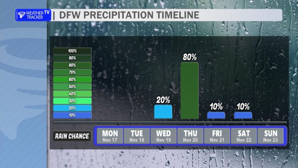
Enjoy the heat while it lasts – big changes arrive Wednesday night into Thursday as a potent upper-level trough and cold front sweep in from the west.
- Rain chances ramp up quickly Wednesday night and continue into Friday
- Some embedded thunderstorms are likely; a few could produce heavy downpours (1–3″+ possible in isolated spots)
- The severe-weather threat still looks low (limited instability), but an isolated strong storm or two can’t be totally ruled out
- Localized flooding will be the main concern, especially in poor-drainage and urban areas
This Weekend – Back to Reality
The same system ushers in a legit shot of chilly November air. Highs this weekend look to only reach the low-to-mid 60s with morning lows dropping into the 40s (maybe even upper 30s north of I-20 by Sunday morning). Feels like fall finally decided to show up!
Bottom line: Soak up the record-challenging warmth the next 48 hours because a much cooler and wetter pattern takes over by midweek. Stay weather-aware later this week for potential heavy rain and minor flooding risks.
You must be logged in to post a comment.