Good Sunday morning and Happy Father’s Day, North Texas!
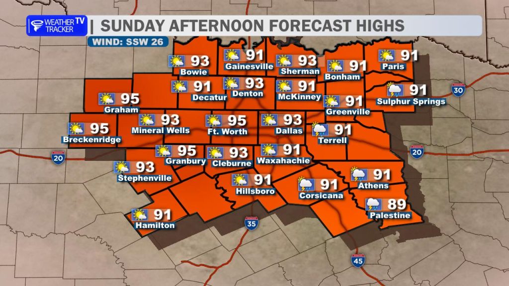
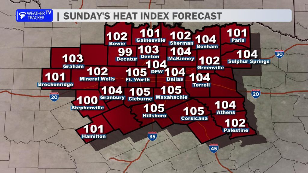
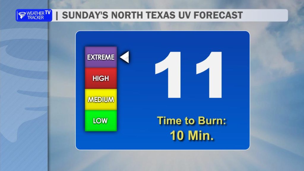
Expect a hotter afternoon today with highs pushing back into the mid-90s and heat indices climbing to around 100 to 105 degrees. A breezy south wind will gust between 15 and 25 mph at times, creating a moderate chop on our area lakes. If you are celebrating Dad outdoors today, keep in mind the UV index is an 11 – meaning a sunburn can occur in as little as 10 minutes. Slap on the sunscreen and stay hydrated!
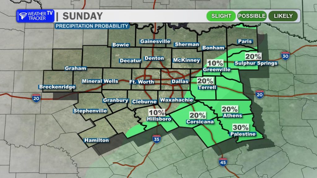
A few scattered showers remain possible in our far southeastern counties today, but the rest of North Texas will remain dry under a building ridge of high pressure.
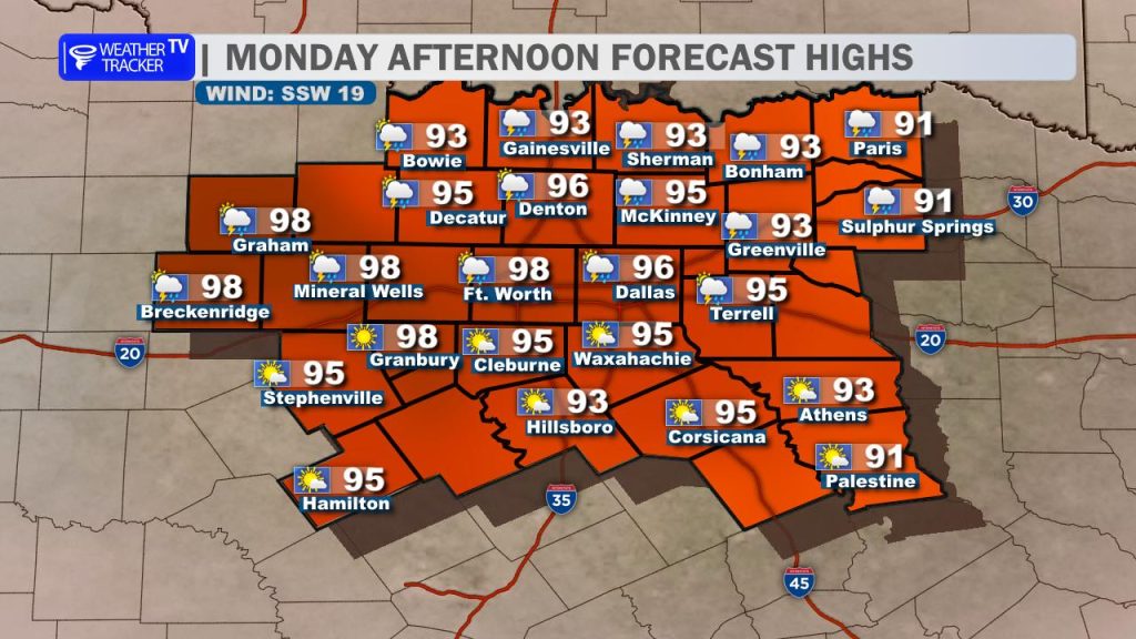
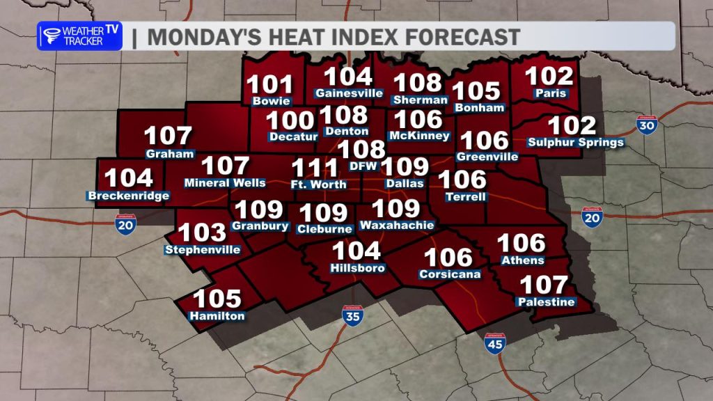
Monday brings even more intense heat, with afternoon highs climbing into the mid to upper 90s. Sticky humidity will hold firm, sending heat index values pushing past the 100-degree mark once again.
The Week Ahead: The Precipitation Breakdown
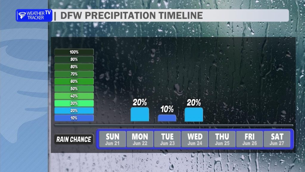
Our rain chances return to the forecast as we head into the workweek, but the setup is highly conditional. North Texas will find itself positioned right on the southern edge of a classic summertime northwest-flow corridor.
Here is how this pattern will play out:
- The Oklahoma Engine: A stationary frontal boundary parked across the Southern Plains will serve as the breeding ground for nocturnal clusters of storms – known as Mesoscale Convective Systems (MCS) – to fire up across Oklahoma nearly every single night this week.
- The Timing: Driven by the upper-level steering winds, these storm complexes will attempt to dive south overnight. By sunrise each morning, we will have to closely monitor the Red River counties for approaching activity.
- The Outflow Wildcard: Even if these midnight storm complexes completely fizzle out before crossing the state line, they will throw out residual outflow boundaries (cool pools of air). These leftover boundaries will slide into North Texas and act as miniature cold fronts during the peak heating of the afternoon, serving as the main trigger to spark new, localized scattered thunderstorms.
- The Hazards: While widespread severe weather isn’t expected, any storm that successfully fires in this juicy, humid airmass will be capable of producing frequent lightning, localized downpours, and gusty winds.
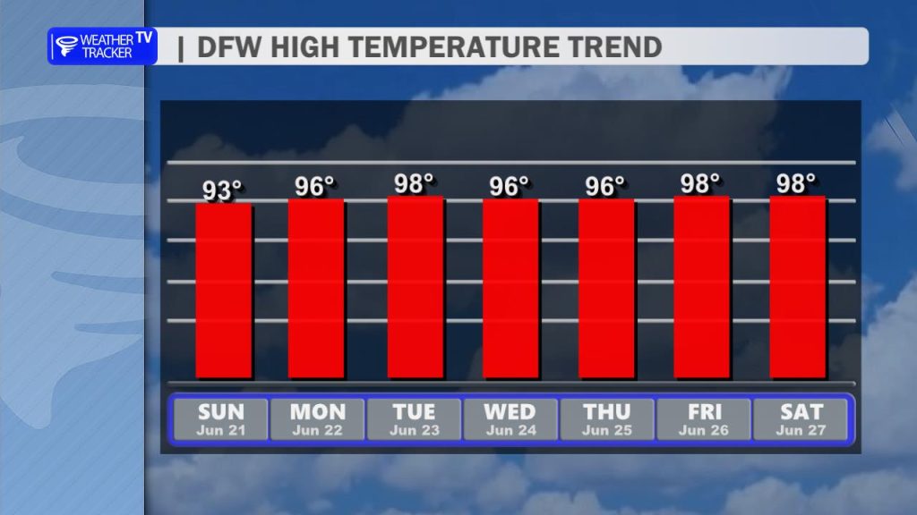
If you miss out on the rain, the heat will be the dominant story. Temperatures will slowly trend upward through the workweek, with widespread upper 90s back in the forecast by next weekend.
You must be logged in to post a comment.