Good Sunday morning, North Texas!
A complex of showers and thunderstorms continues to push out of Oklahoma into our area. Pockets of heavy rain and wind gusts up to 40 mph are possible with this initial wave. While this morning’s activity will gradually weaken as it moves south, it is going to leave behind a lingering outflow boundary across our southern counties.
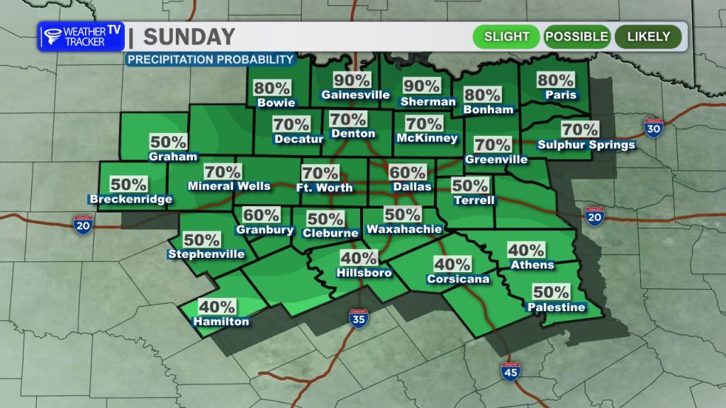
During peak heating this afternoon, that boundary will serve as the focal point for a few additional showers and thunderstorms to redevelop. The best chances will remain south of I-20, particularly near and south of Waco into Central Texas.
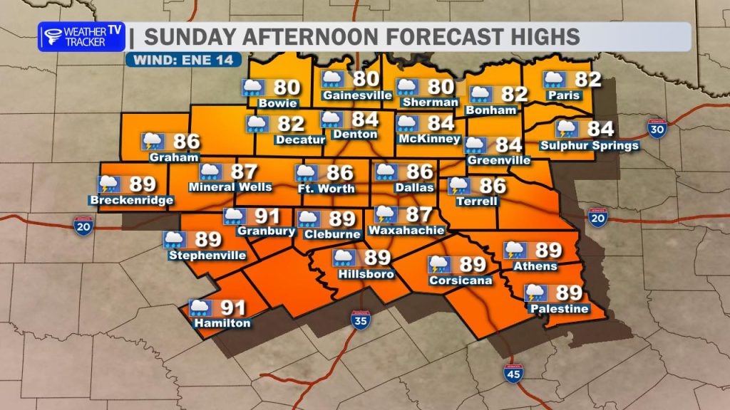
Thanks to the rain-cooled air and the arrival of a weak cold front, we get a fantastic break from the recent summer heat! Afternoon temperatures will be held down area-wide, with highs topping out only in the mid-to-upper 80s alongside a fresh, refreshing northeast breeze.
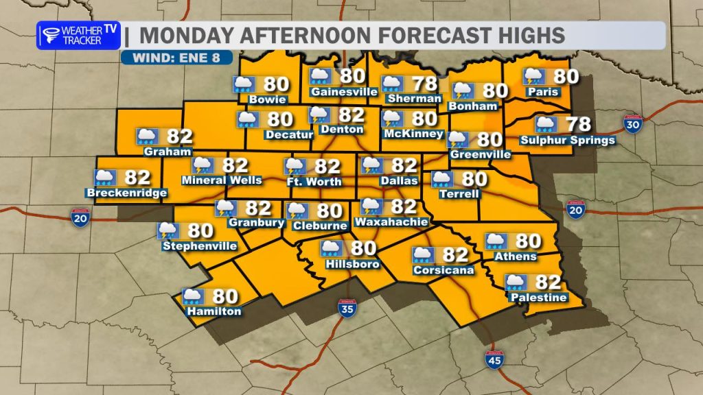
We get to enjoy these “less hot” temperatures on Monday as well, with highs once again stuck in the 80s. However, because that front will stall out across the region and a secondary atmospheric disturbance moves overhead, scattered afternoon thunderstorms will be a solid bet for many of us.
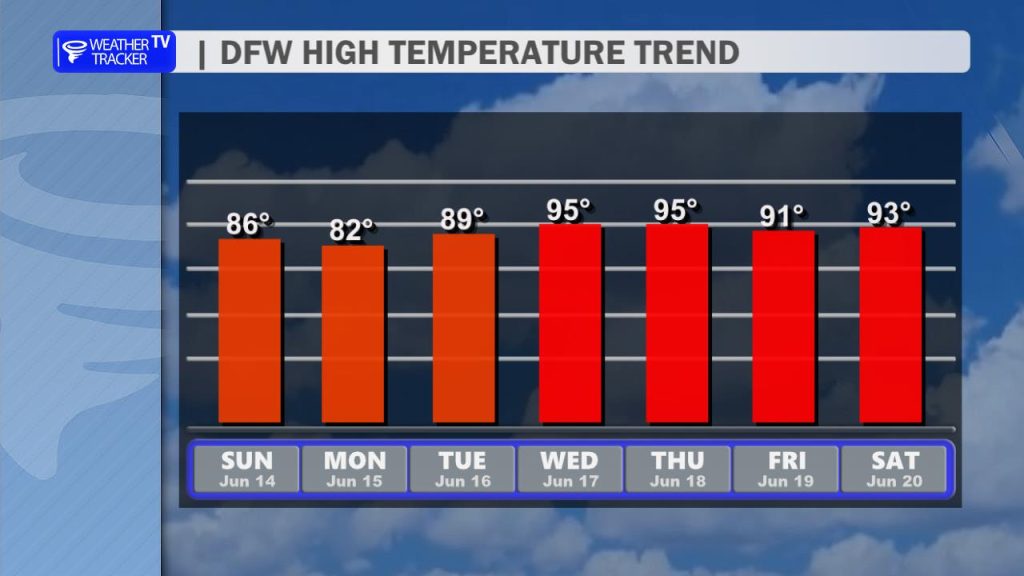
Enjoy the rain chances and cooler air while they last! After Monday, high pressure builds back in, we turn off the rain machine, and temperatures quickly ramp back up. Highs will push right back into the mid-90s by midweek, bringing back that classic Texas summer heat.
You must be logged in to post a comment.