Good Thursday morning, North Texas.
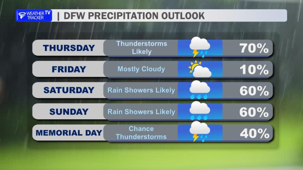
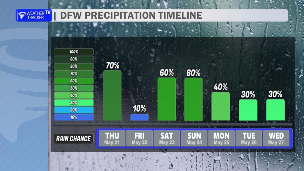
Our soggy stretch of weather isn’t going anywhere just yet, with daily chances for rain and thunderstorms remaining in the forecast right through the Memorial Day holiday weekend. The silver lining here – especially for late May – is that the threat of widespread, organized severe weather remains minimal.
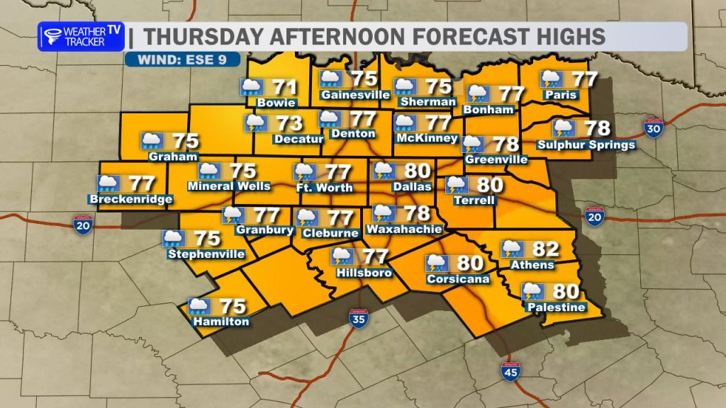
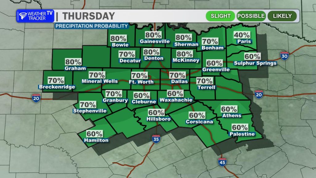
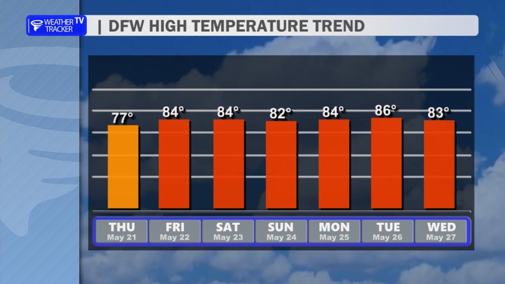
Today is looking quite wet across the region as an upper-level disturbance rolls in. Expect scattered showers and thunderstorms to steadily increase in coverage as the day progresses. While we aren’t anticipating widespread, catastrophic flooding, slow-moving storms could drop quick, locally heavy downpours. A few isolated reports of minor flash flooding certainly aren’t out of the question. Between the thick cloud cover and rain, afternoon highs will stay unseasonably cool, topping out in the upper 70s under very muggy conditions.
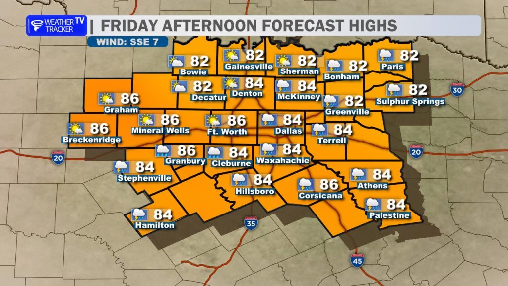
We should catch a brief break and see a bit of a lull in the widespread activity on Friday. While most of the daytime hours look dry, keep in mind that a few isolated storms could still pop up late in the day during peak afternoon heating. Highs on Friday will bounce back into the mid-80s, and with plenty of lingering Gulf moisture, it is going to feel incredibly humid.
Heading into the holiday weekend, the active weather pattern resumes with daily storm chances from Saturday straight through Memorial Day Monday. To be clear: this is not tracking to be an all-out holiday washout, so there is no reason to cancel your outdoor plans or lake trips just yet. However, because atmospheric wind shear is so weak, these will behave more like typical summer pop-ups – incapable of widespread severe weather, but highly efficient rainmakers that can quickly produce frequent lightning, small hail, and sudden downpours.
Keep a close eye on the radar, have a backup indoor alternative ready just in case, and note that the highest overall risk for heavy rain and localized flooding will tend to focus just to our south across Central Texas. Expect afternoon highs throughout the weekend to stick around the low to mid-80s with very warm, sticky, and muggy conditions lingering.
You must be logged in to post a comment.