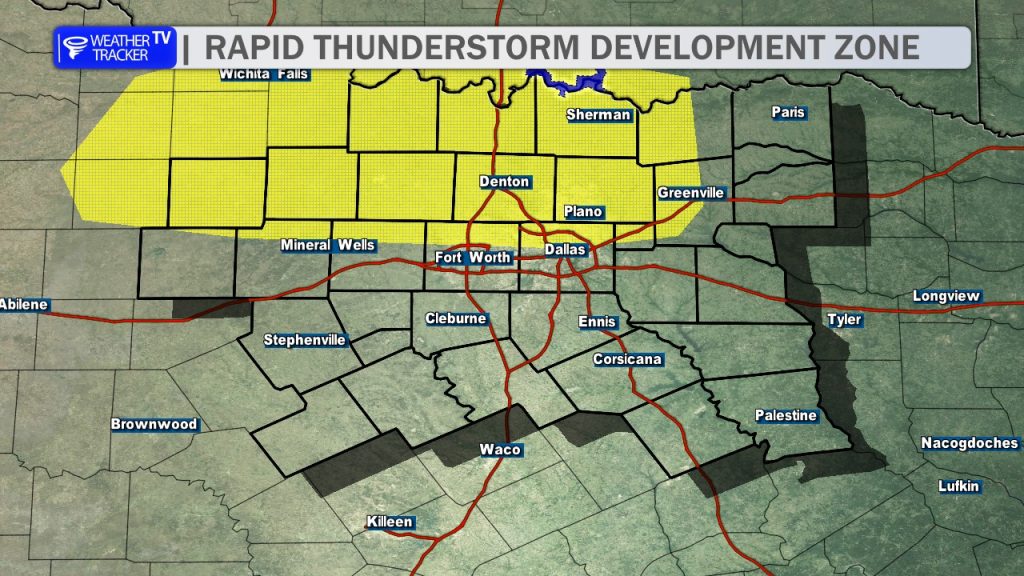
A Tornado Watch is expected to be issued soon as conditions rapidly destabilize across North Texas. The Storm Prediction Center is tracking the potential development of supercell thunderstorms along an outflow boundary near the Metroplex, fueled by extreme instability. These storms will be capable of producing destructive, very large hail (3–4 inches), damaging wind gusts, and a few tornadoes. Please finalize your safety plans and keep your vehicle sheltered; the most intense activity is expected to coincide with the evening commute.
You must be logged in to post a comment.