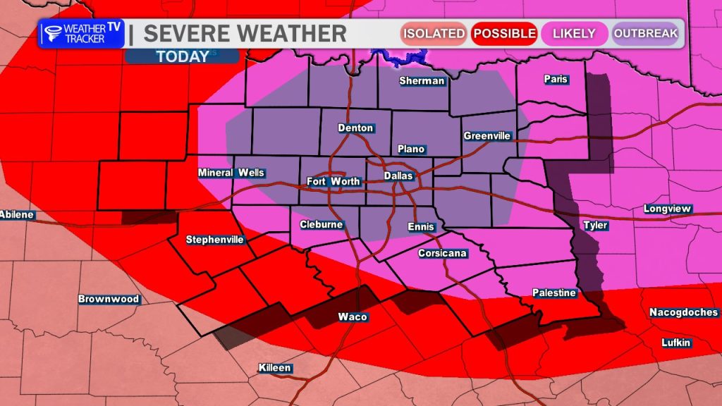
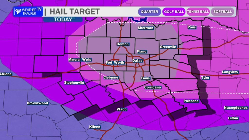
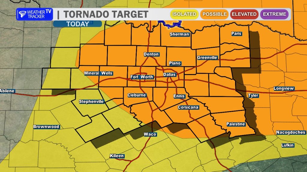
The Storm Prediction Center has upgraded the Dallas – Fort Worth Metroplex to a Moderate Risk (Level 4 of 5) for severe weather today. This upgrade is driven by a heightened threat for destructive, very large hail – potentially exceeding 3 inches in diameter – along with damaging wind gusts and the potential for a couple of tornado warnings.
Key Impacts:
- Very Large Hail: The atmosphere is highly unstable, capable of producing large, destructive hail stones.
- Timing: The window for severe storm development remains tied to the arrival of the cold front this afternoon, directly impacting the evening commute across the Dallas-Fort Worth Metroplex.
- Safety: Please treat this as a high-end severe weather day. If you have the ability to plan your travel around the late afternoon and evening hours, please do so. Ensure your vehicles are garaged or sheltered, and have your severe weather plan ready.
Stay tuned to Weather Tracker TV for continuous live coverage as we track these storms moving into the area.
You must be logged in to post a comment.