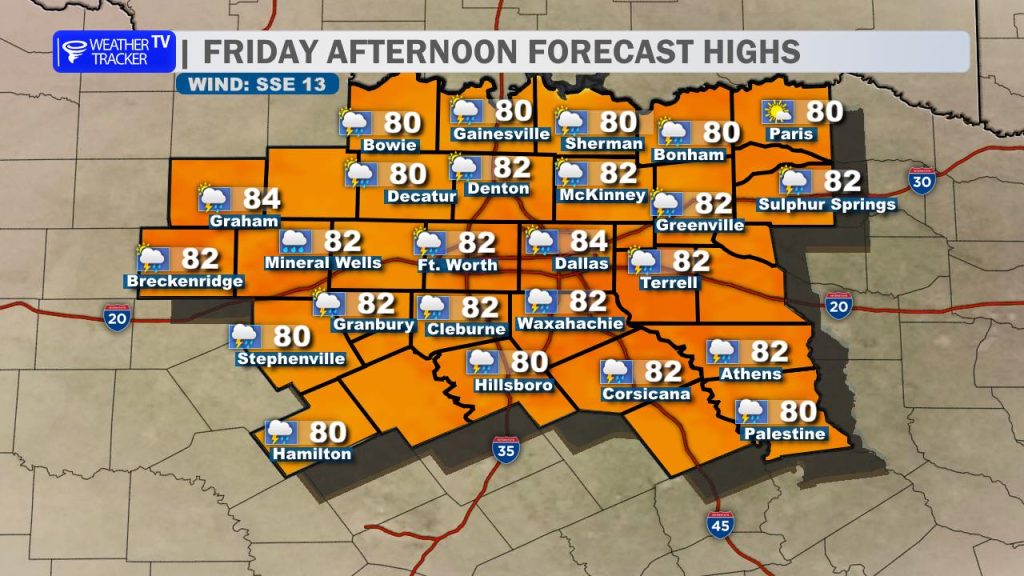
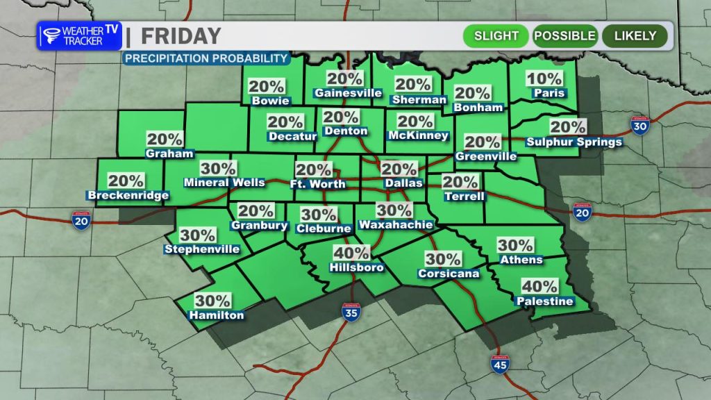
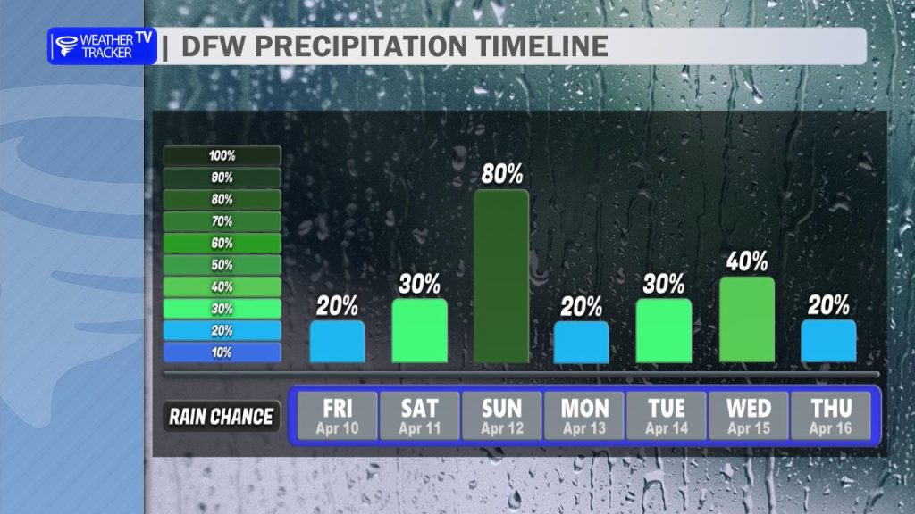
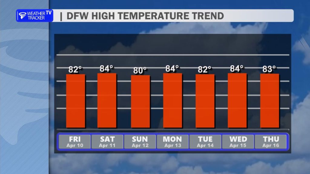
Happy Friday, North Texas! We’re kicking off the weekend with another mild day featuring a mix of sun and clouds. You’ll notice the air feeling a bit more active today—southerly winds are picking up with gusts reaching 20 mph. Highs will comfortably settle in the low 80s for most of the Metroplex. Keep an eye on the sky this afternoon; while most remain dry, we have a 20-30% chance for widely scattered showers or a stray T-Storm, with the highest potential focused south of the I-20 corridor.
Saturday: The Calm Before the Transition
Saturday will feel very similar to today but notably more humid as Gulf moisture surges into the region.
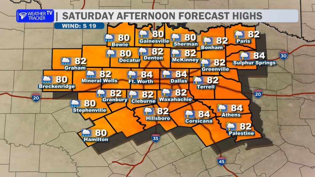
- Highs: Low to mid-80s.
- Conditions: Partly cloudy with a steady southeast breeze.
- Late Day Watch: Our eyes will be glued to the western horizon late Saturday evening. A line of storms is expected to develop in West Texas and approach our western counties (like Stephens and Young) during the overnight hours. While these may weaken as they arrive, they set the stage for a messy Sunday morning.
Sunday: A “Weather Ready” Day
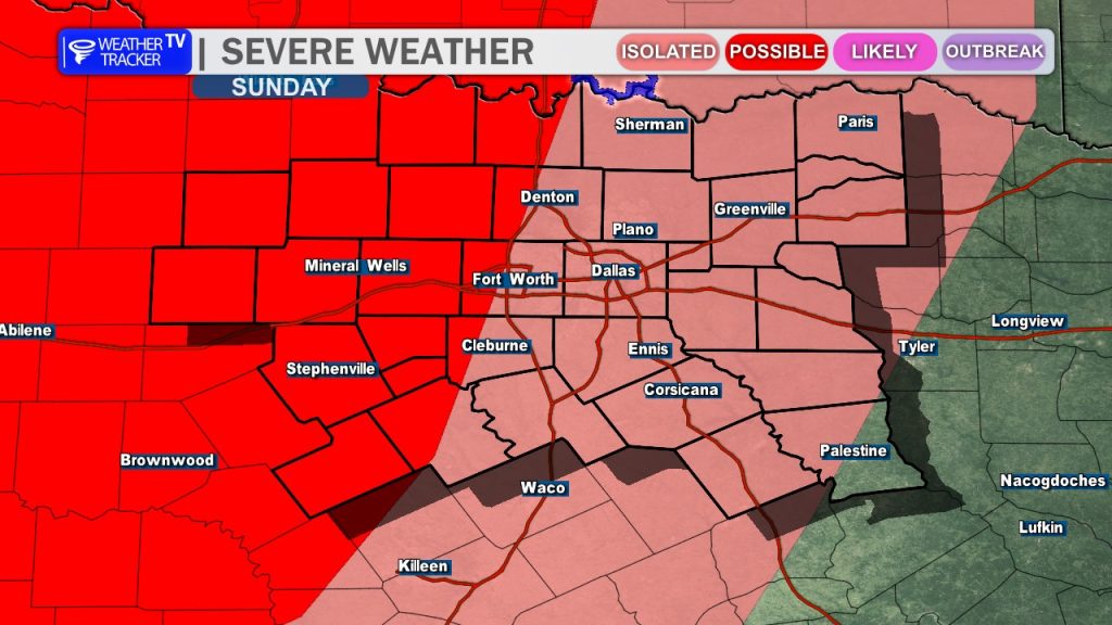
Sunday is the day to stay weather-aware. The forecast hinges entirely on how the Saturday night storms evolve.
- The “Morning Rain” Factor: If widespread rain and clouds linger Sunday morning, it will keep us cooler and limit the “fuel” (instability) for afternoon storms.
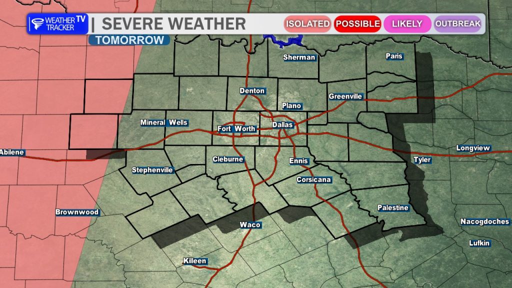
- The “Severe” Factor: If we see early clearing and sunshine, the atmosphere will recover quickly. In this scenario, we expect supercell development Sunday afternoon and evening.
- Threats: The Storm Prediction Center already has us under a Slight Risk (Level 2/5). All hazards are on the table, including large hail, damaging winds, and a low-end tornado threat.
Looking Ahead: An Active Week
The active pattern doesn’t end with the weekend. We are entering a multi-day stretch of storm chances:
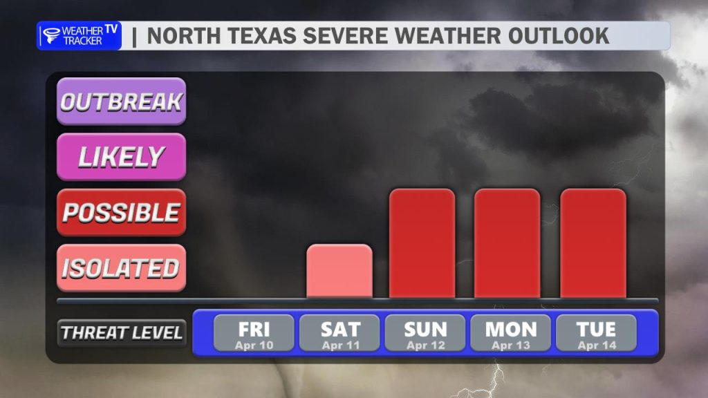
- Monday: A brief relative lull, though isolated storms remain possible.
- Tuesday/Wednesday: Our next significant weather system arrives. Tuesday currently looks like the best bet for widespread rain and another round of potentially severe weather.
- Temperatures: Despite the rain, we stay warm. Expect highs to remain consistent in the 80s through next week.
Bottom Line: Enjoy the sunshine today and Saturday, but make sure your weather alerts are turned on for Sunday. We’ll be monitoring the latest model data and will provide updates as the timing for Sunday’s threat becomes clearer.