Good Monday morning, North Texas!
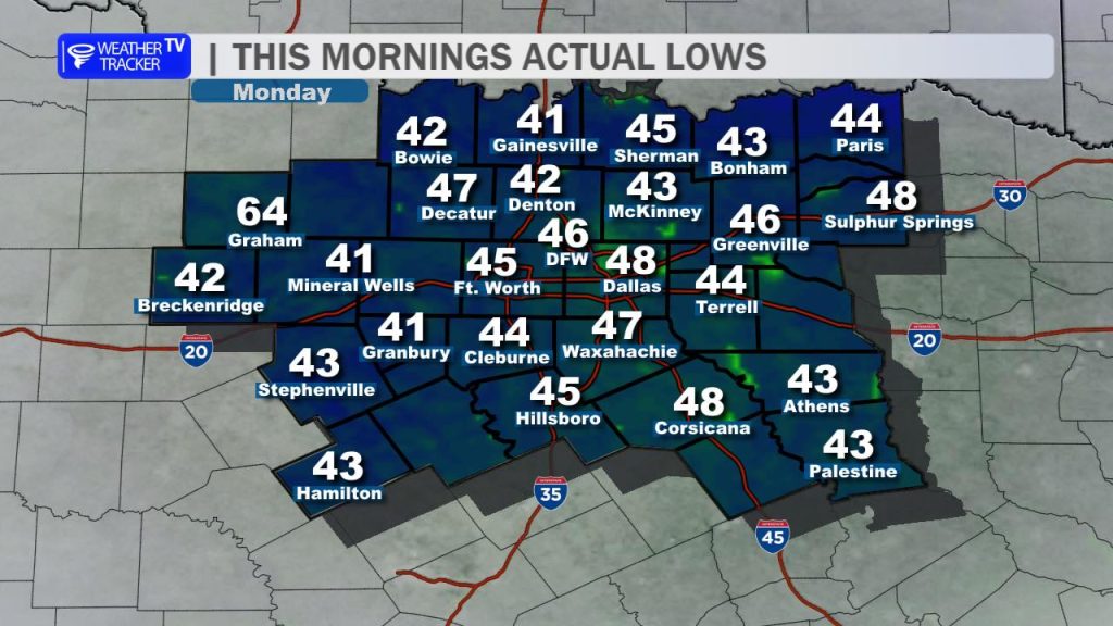
It was a crisp, chilly start as you headed out the door this morning. Actual observed lows dipped into the 40s areawide, providing a brief reminder that spring still has its cool moments. However, we are turning the corner quickly.
Today’s Highlights
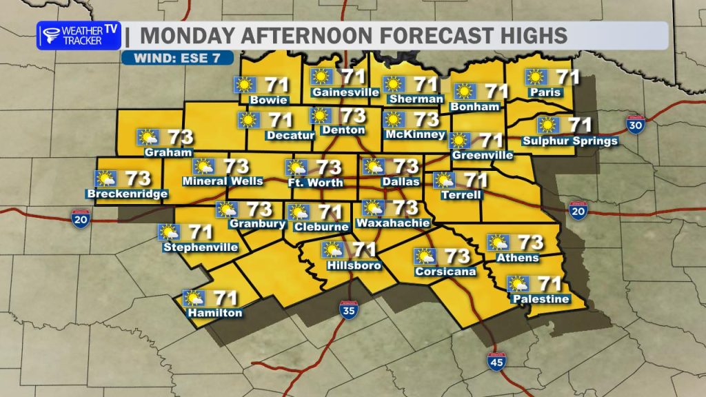
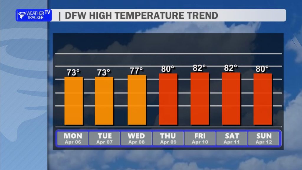
Expect wall-to-wall sunshine for the rest of your Monday. With a very light easterly breeze and dry air in place, conditions are nearly perfect. Highs will climb comfortably into the low to mid 70s. If you have outdoor plans, today is easily the “pick day” of the entire week.
Mid-Week Outlook: Increasing Clouds
The tranquility shifts slightly as we head into Tuesday.
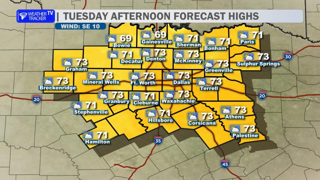
- Tuesday: We’ll see an increase in cloud cover as a weak, moisture-starved storm system approaches from the west. Highs will remain pleasant, generally staying in the 70s.
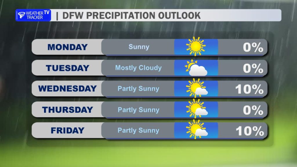
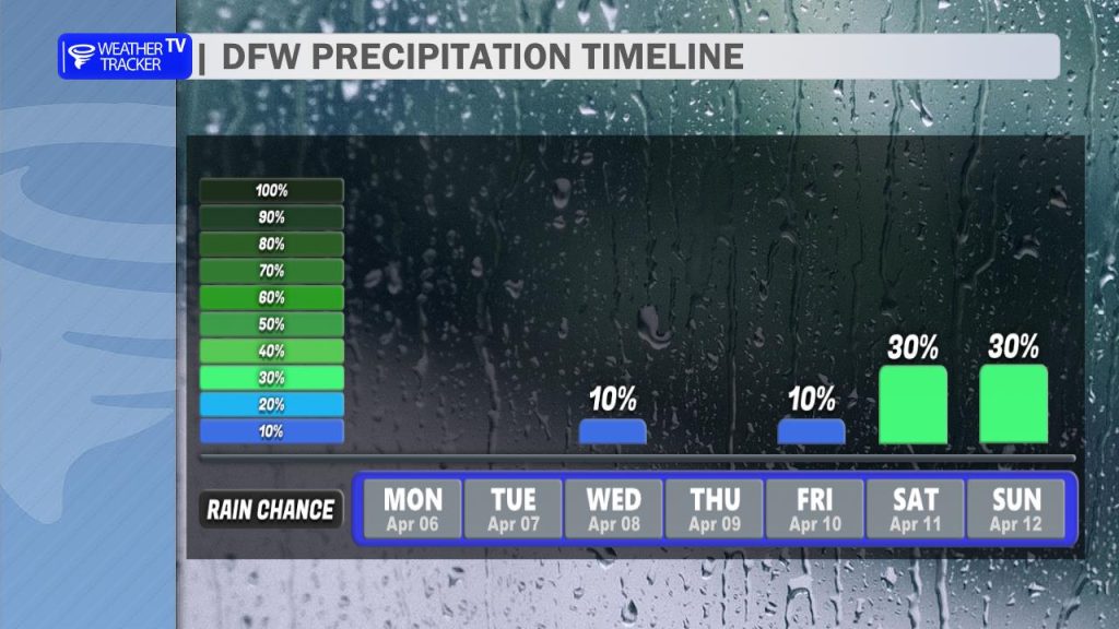
- Tuesday Night/Wednesday: As the system moves overhead, there is a slight chance (20%) for a few scattered showers or trace amounts of rain. Most of us will stay dry, but don’t be surprised by a stray sprinkle.
The Warm-Up and Weekend Storm Risk
Temperatures will begin to build as we close out the work week. By Thursday and Friday, the mercury returns to the 80s, and the humidity will start to creep back up.
The forecast becomes much more unsettled as we head into the weekend:
- Dryline Setup: A dryline will establish itself to our west, acting as a trigger for storm development.
- Thunderstorm Chances: With several pieces of upper-level energy moving through, scattered thunderstorms are possible – especially for our western counties.
- Severe Threat: We are closely monitoring the potential for severe weather with this activity. While the exact timing and coverage are still being refined, the typical spring “dryline play” is back on the table for Saturday and Sunday.
Stay tuned for updates as we get a better look at the weekend setup. -William