Good Tuesday morning, North Texas!
We’re off to another mild and somewhat muggy start across the region with a deck of low clouds in place early. Those clouds will gradually break apart through the day, giving way to a mix of sun and clouds this afternoon.
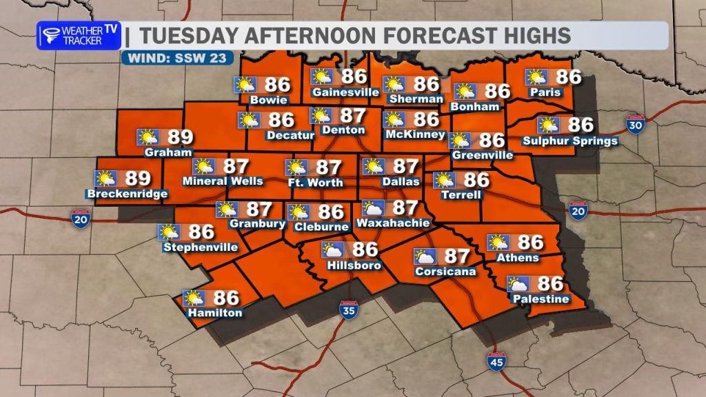
Expect another warm, humid, and breezy day with highs climbing into the 80s area-wide. A steady south wind will continue to pull in Gulf moisture, keeping that sticky feel in the air.
We are starting to transition into a more active weather pattern heading into the next few days.

Late this evening and tonight, a slight chance of storms will develop well to our west along a dryline across the Texas Panhandle and West Texas. A few of those storms may attempt to drift toward our northwestern counties after sunset, but they will likely weaken as they move east. Many areas will stay dry overnight.
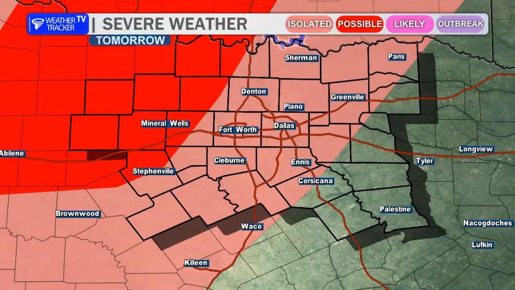
Our next and more significant system arrives Wednesday night into early Thursday morning.
A line of showers and thunderstorms is expected to develop to our northwest and move southeast into North Texas. Some of these storms could become strong to severe, with the primary threats being:
- Damaging wind gusts up to 60 mph
- Hail up to around half-dollar size
The greatest severe risk will be west of the I-35 corridor, but storms will likely impact a large portion of the region.
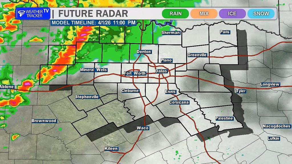
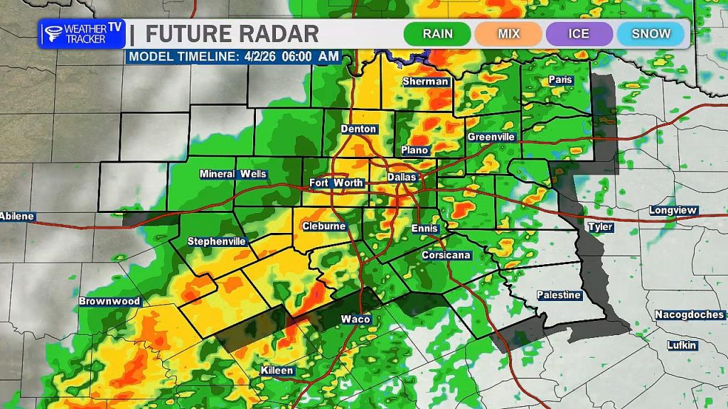
Timing right now brings storms into the Metroplex around midnight, with activity continuing into the Thursday morning commute before gradually pushing east and clearing out later Thursday morning.
We’re not done just yet.
Another round of storms is possible Friday night into Saturday, and once again, a few strong to severe storms cannot be ruled out. We’ll continue to fine-tune those details as we get closer.
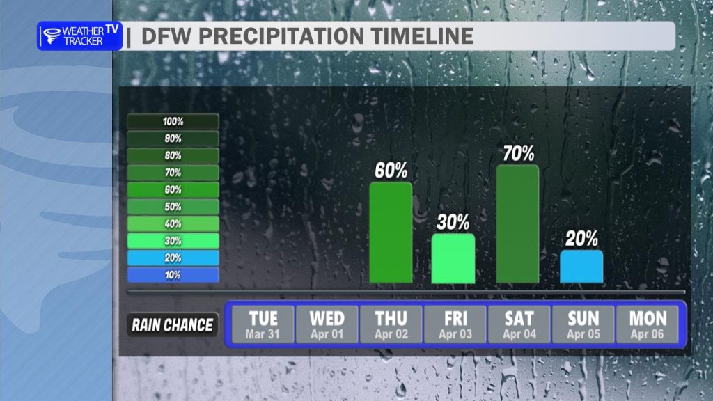
The good news — conditions improve just in time for Easter Sunday with dry weather returning.
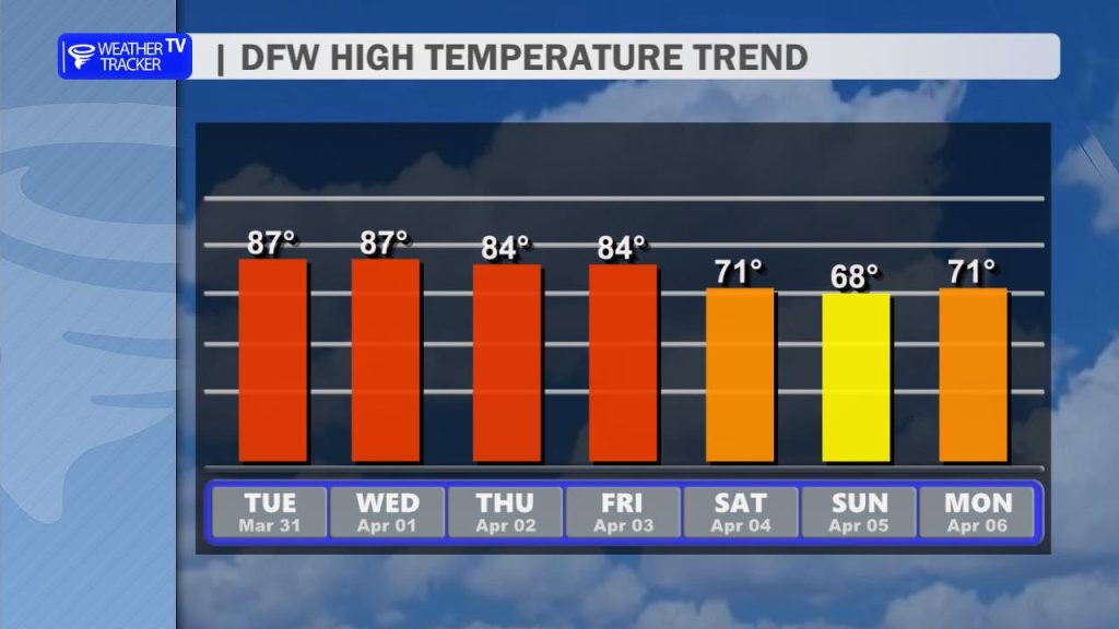
Temperatures will remain unseasonably warm through the week with highs in the 80s, but behind the late-week system, we do cool things down a bit. Highs by Easter Sunday will fall back into the 60s, bringing a much cooler and more comfortable feel.