Good Monday morning, North Texas!
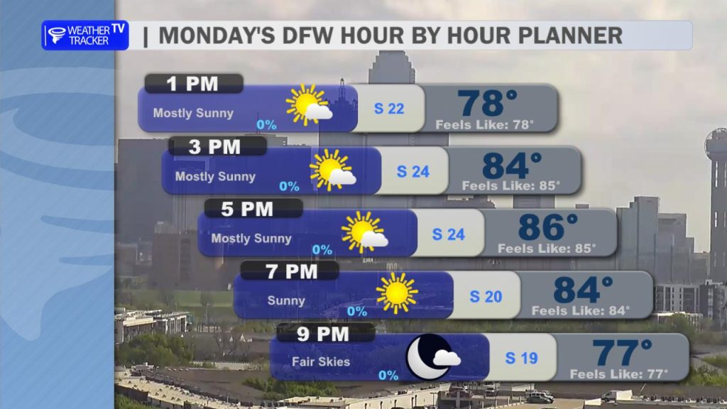
We’re starting the day under a blanket of low gray stratus clouds, giving us a fairly overcast start across the region. As we head into the afternoon, those clouds will gradually break apart, allowing for more sunshine to return.
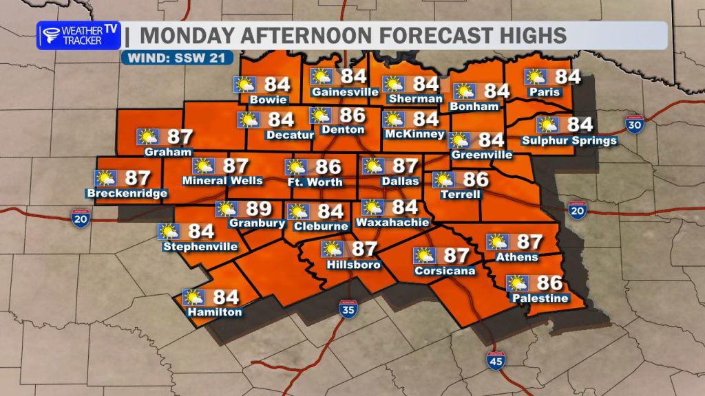
It’s going to be a warm, humid, and breezy day. Afternoon highs will climb into the 80s area-wide, with a steady south wind adding to that early-summer feel. Wind gusts could occasionally top 20 mph, but overall, today stays dry.
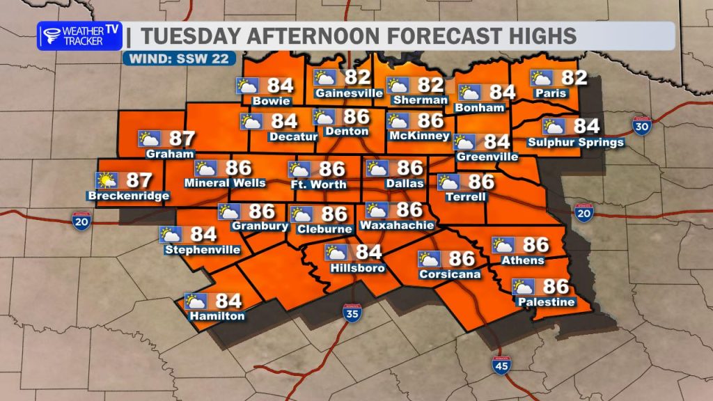
Tuesday follows a similar pattern, but with a bit more cloud cover hanging around. We’ll once again start the day with low clouds, and they’ll be slower to clear. That means a mostly cloudy sky for much of the day. Even so, it remains warm, humid, and breezy with highs back in the 80s and south winds gusting up to around 20 mph.
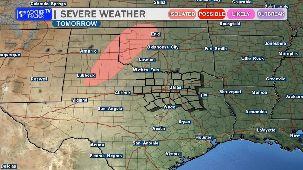
By Tuesday evening, our attention turns to the west. Thunderstorms are expected to develop out in the Texas Panhandle and western Oklahoma. A few of those storms may attempt to move toward our northwestern counties late Tuesday night, but there’s a good chance they weaken before reaching much of North Texas.
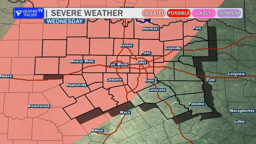
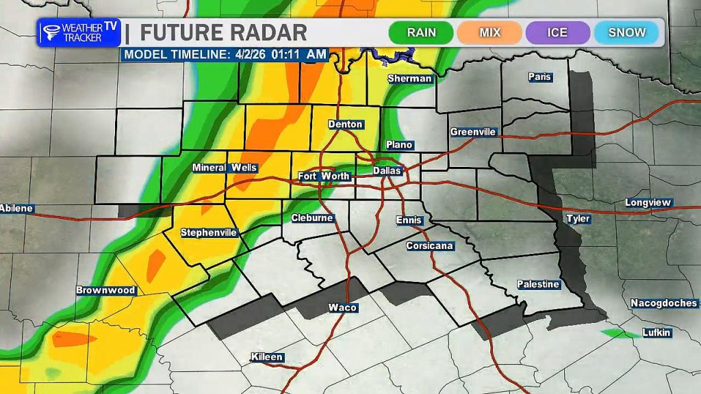
The better opportunity for widespread rain and storms arrives Wednesday evening into Wednesday night. A line of storms is expected to develop and move from northwest to southeast across the region. Some of these storms could be strong to severe, with the main threats being damaging wind gusts up to 60 mph and hail up to quarter size.
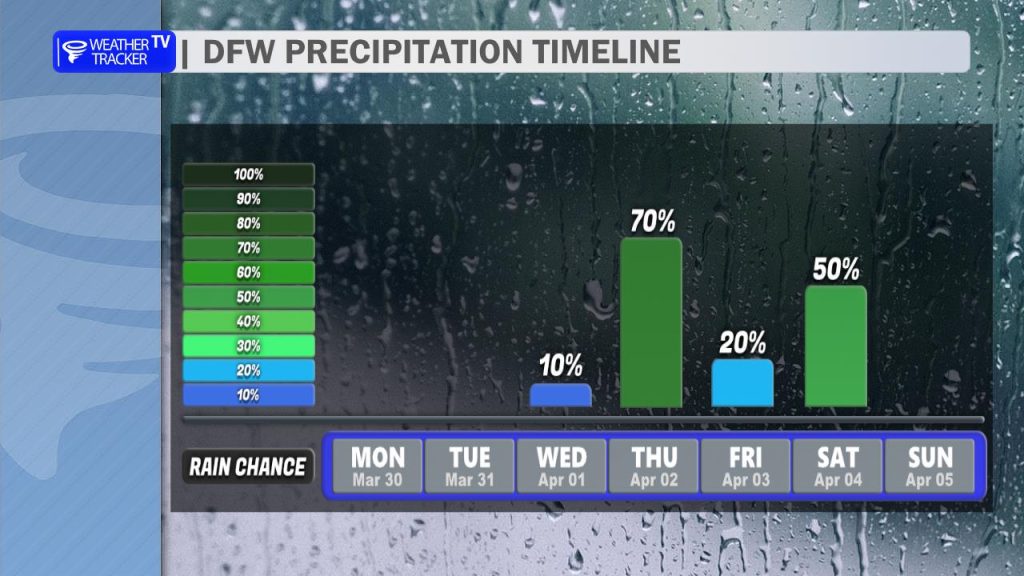
We’re not done there. Another round of rain and storms looks possible Friday night into Saturday, and once again, a few strong or severe storms can’t be ruled out as we continue to track this active pattern.
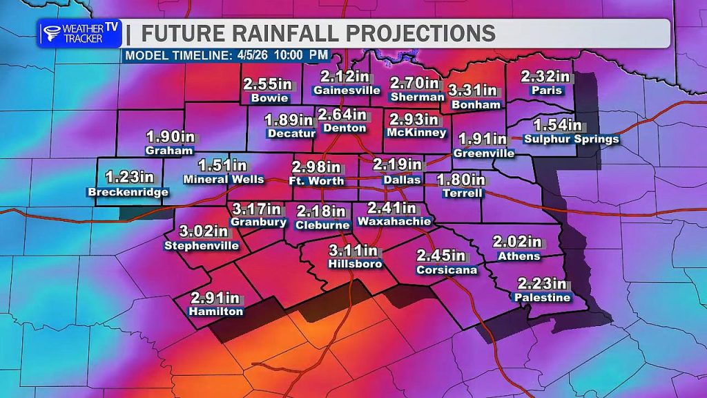
By the time everything wraps up late Saturday, many areas across North Texas could pick up between 1 to 3 inches of rainfall, with locally higher amounts possible where storms repeatedly move over the same locations.
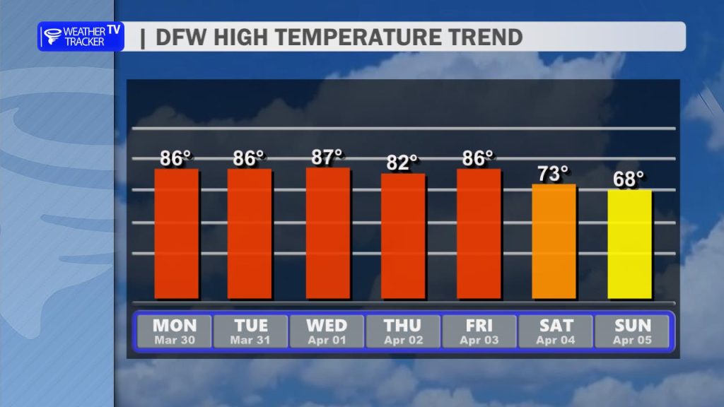
Temperatures will remain warm through the end of the week and into the weekend, with highs generally in the 80s. Behind this active weather pattern, we do expect a cooldown heading into Easter Sunday, with highs dropping back into the 60s under clearing skies.
We’ll continue to fine-tune the timing and severity details over the next couple of days.
You must be logged in to post a comment.