Good Sunday morning, North Texas!
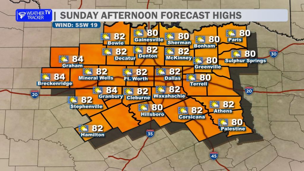
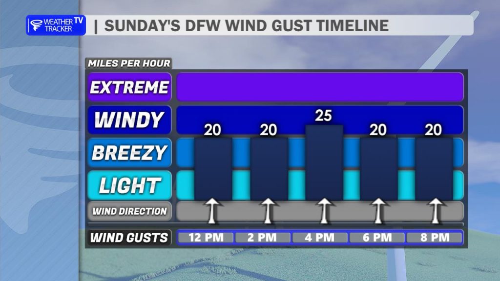
After a cooler and gray Saturday, we’re turning the corner in a big way today. Sunshine returns, and with a breezy south wind in place, temperatures will respond quickly this afternoon. Highs will climb back into the 80s area-wide, making for a warm and pleasant end to the weekend. That south wind will stay noticeable, with gusts at times reaching up to 25 mph.

The warming trend doesn’t stop there. As we head into the start of the workweek on Monday, even warmer air moves in. Afternoon highs will push into the mid to upper 80s across much of North Texas, with a few of our western counties flirting with the 90-degree mark. Skies will be partly cloudy, and that gusty south wind will continue to add to the early taste of summer.
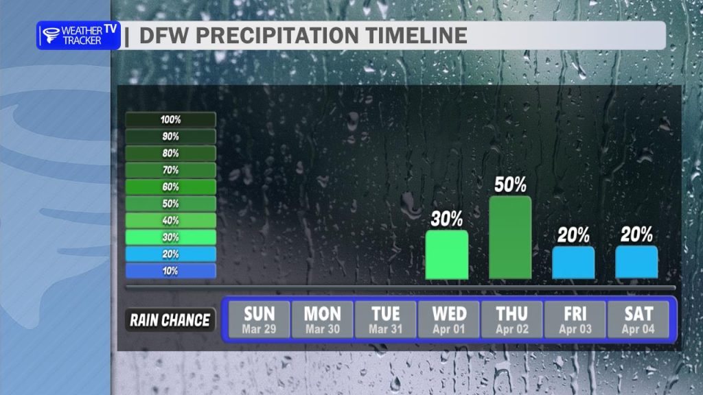
Looking ahead, our pattern becomes more active. Rain and thunderstorm chances return beginning late Tuesday, with additional rounds possible Wednesday into Thursday, and again late Friday. As it stands right now, a few of these storms could become strong, possibly even severe, depending on how the setup evolves.
In addition to the severe threat, we’ll also be watching the potential for locally heavy rainfall, which could lead to pockets of minor flooding if storms track over the same areas.
We’ll be fine-tuning those details over the next couple of days, so be sure to stay weather-aware as we head deeper into the week.