Good Saturday morning, North Texas!
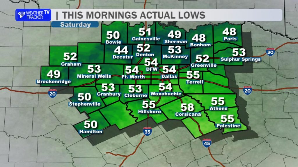
We’re off to a noticeably cooler start today, with morning temperatures settling into the 50s across much of the region. That cooler air is going to stick around through the day, as a brisk northeast wind early keeps temperatures from recovering very much this afternoon.
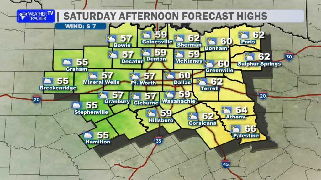
Expect highs to remain in the 50s to near 60 degrees for most areas, making it a much different feel compared to the warmth we’ve had recently. Low gray cloud cover will also be stubborn, likely hanging on through much of the day and limiting sunshine.
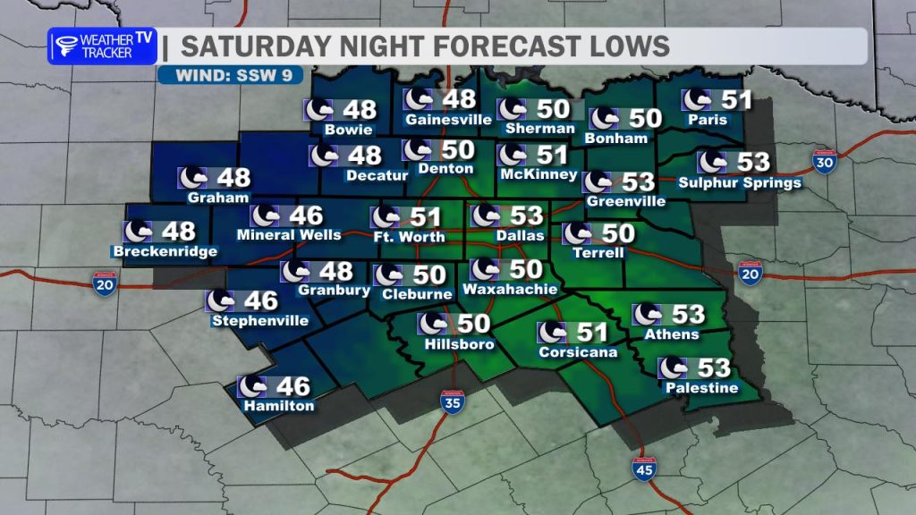
As we head into tonight, skies will gradually clear and winds will begin to relax, setting the stage for a quick turnaround heading into Sunday.
And it will be a completely different story tomorrow.
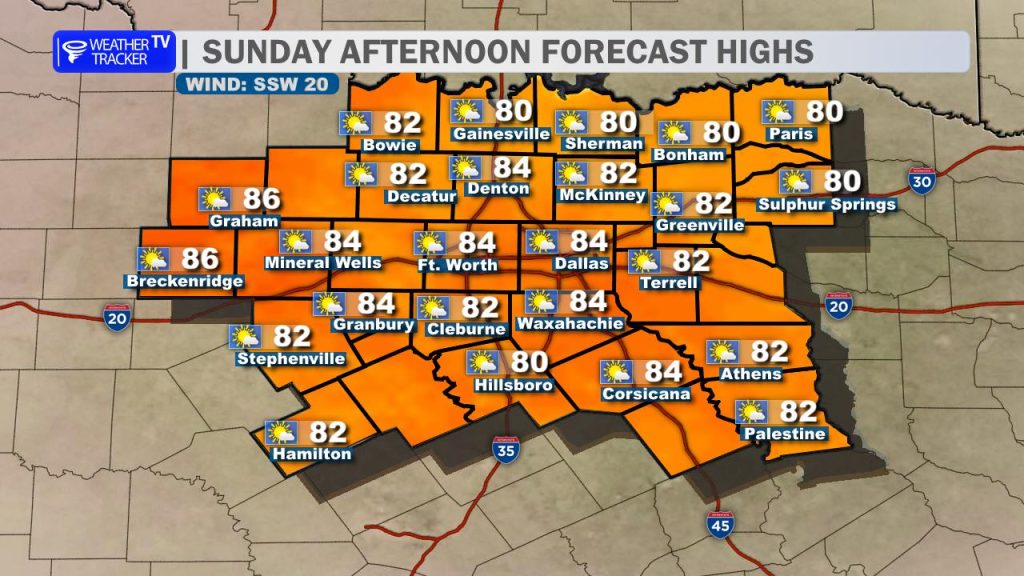
Southerly winds return and become breezy once again, helping temperatures rebound quickly under mostly sunny skies. Highs will surge back into the 80s area-wide, bringing back that warm, spring-like feel.
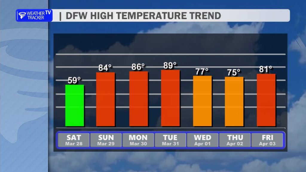
That marks the beginning of a warmer pattern heading into next week. Temperatures will remain well above average, with highs generally in the 80s to near 90 through the early part of the week. A slight cooldown is possible by midweek, bringing highs back into the 70s.
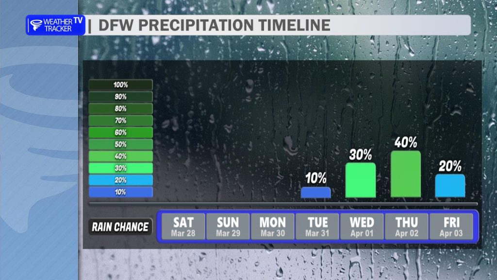
The bigger story, though, will be the return of rain chances. We’re watching multiple opportunities for showers and storms as we move through the week.
One key aspect of the forecast we’ll be monitoring closely is the potential for severe weather. While it’s still several days out, a few ingredients are beginning to come together that could support at least some severe storm risk.
We’ll continue to refine the details and keep you updated as we get closer.