Happy Friday, North Texas!
We’re heading into the weekend with a classic “tale of two forecasts” as a cold front moves through today, bringing a quick cooldown before temperatures rebound just as fast by Sunday.
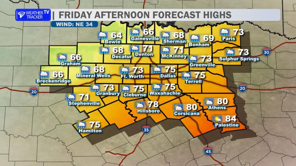
That cold front is already making its way south across the region this morning. Our northern counties will begin to feel the cooler air first, while areas farther south will still warm close to 80 degrees ahead of the front.
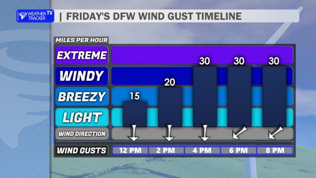
For the Metroplex, expect the front to move through right around midday. Once it passes, temperatures will begin to fall through the afternoon with a noticeable shift to a breezy north wind. Low gray cloud cover will also fill in behind the front, and a few spotty light showers can’t be ruled out.
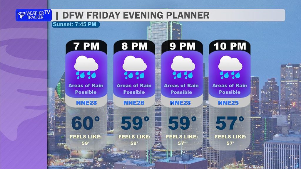
If you have plans this Friday evening, expect a much different feel compared to recent nights. It will be breezy, cloudy, and noticeably cooler with temperatures dropping into the 50s.
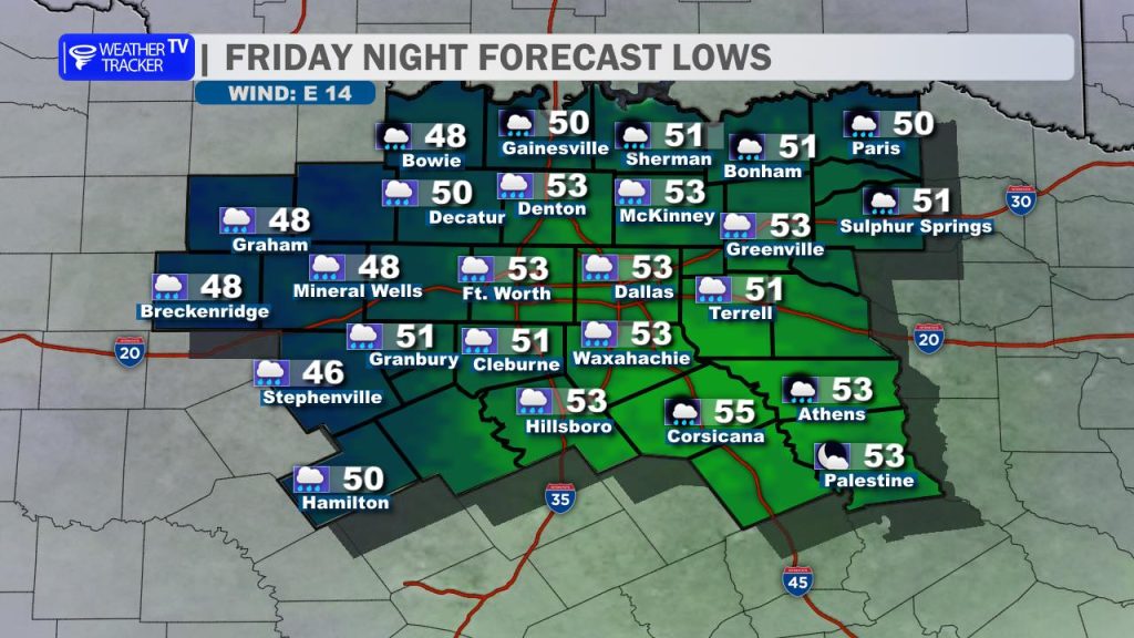
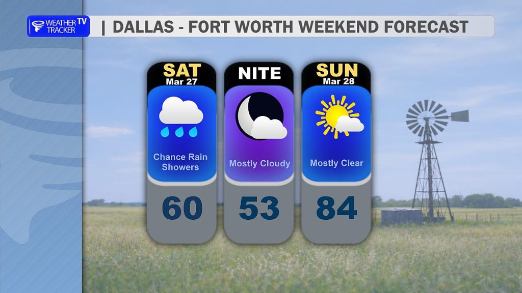
Overnight, we’ll hold onto the clouds with a continued chance for a few light, scattered showers. Lows by early Saturday morning will dip into the 40s and 50s across North Texas.
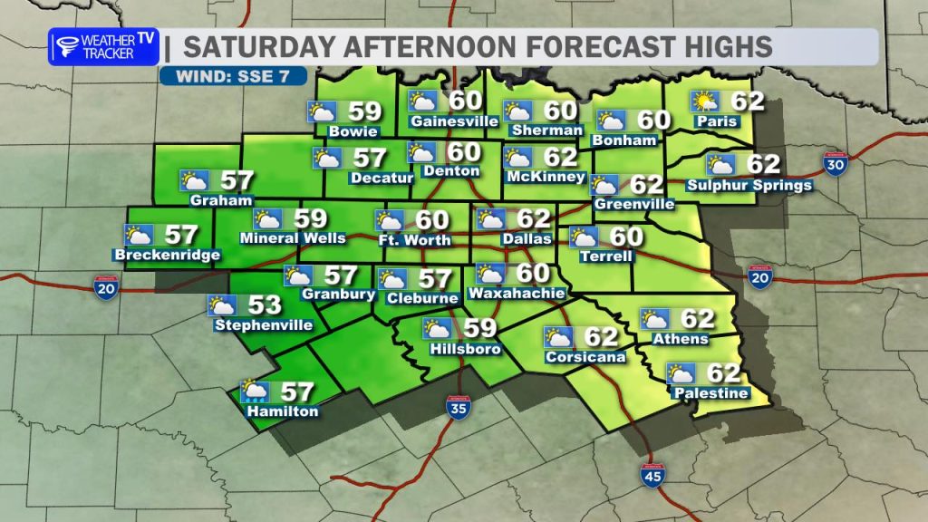
Saturday will be the coolest day of the stretch. Expect mostly cloudy skies with a brisk north wind throughout the day. A few light showers may linger, mainly south of the Metroplex during the morning hours. Afternoon highs will struggle to get out of the 50s and 60s.
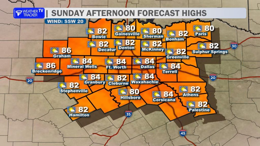
The cooldown doesn’t last long. By Sunday, winds shift back to the south and a ridge of high pressure begins to build back in. That will send temperatures soaring right back into the 80s across all of North Texas under a warmer and more spring-like setup.
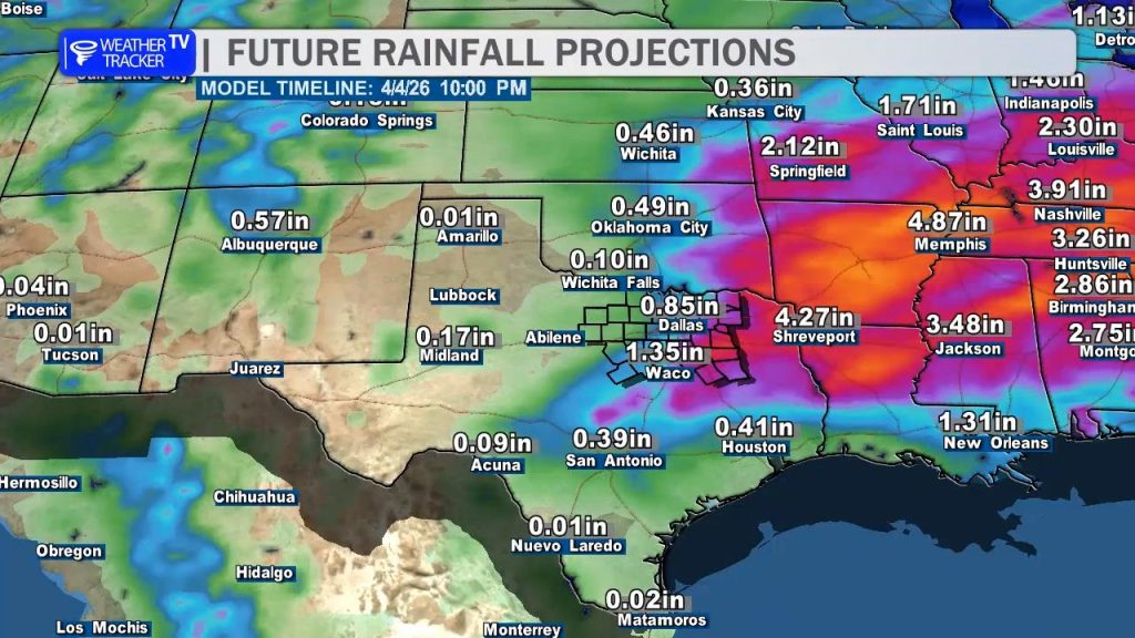
Looking ahead to next week, we continue to monitor signs of a pattern shift. Rain and storm chances are expected to return to the forecast, and there could even be the potential for some stronger storms depending on how the system evolves.