Good Tuesday morning, North Texas!
We’re starting the day with a blanket of low clouds across the region, but don’t let that fool you – those clouds will gradually break apart through the late morning, giving way to intervals of afternoon sunshine.
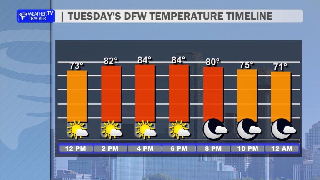
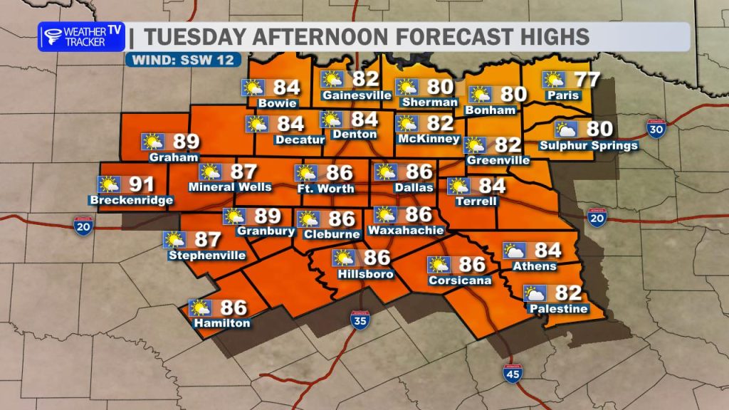
Temperatures will respond nicely to that added sun, climbing into the 80s area-wide this afternoon. Winds will remain light and somewhat variable early on, but expect a shift to a southerly breeze later today, generally around 5 to 15 mph.
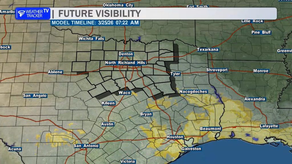
Heading into tonight, low gray stratus clouds will begin pushing north from the Gulf Coast. That cloud deck may make it into parts of our far southeastern counties – including Navarro, Anderson, Henderson, and Freestone counties – by late tonight. With the added moisture in place, a few areas of patchy fog could also develop toward early Wednesday morning.
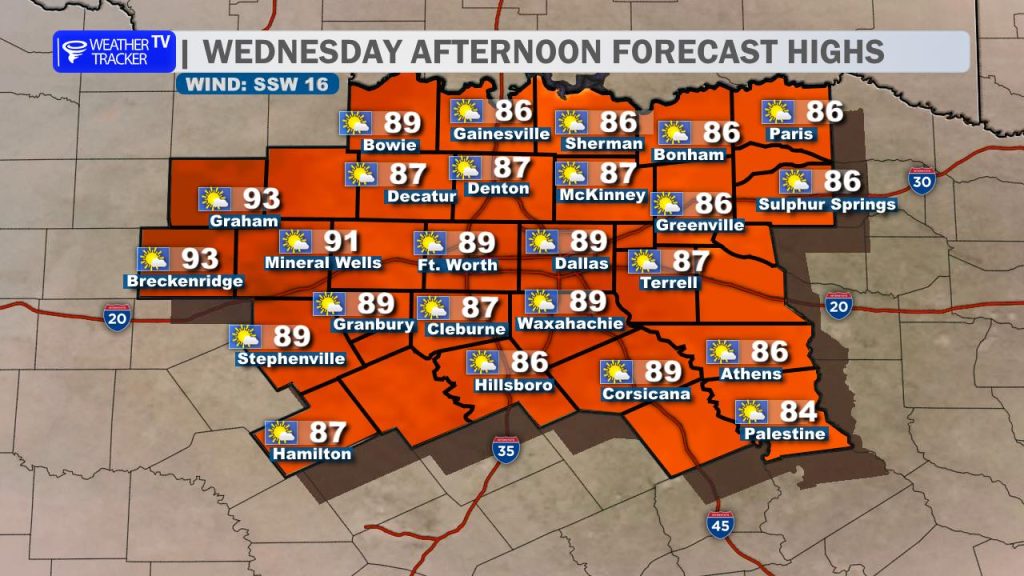
The warming trend continues on Wednesday as south winds pick up, helping temperatures climb even higher. Highs will range from the 80s to near 90 degrees across North Texas. With the warmer temperatures, dry vegetation, and increasing south winds, grassfire danger will be elevated – especially across our western counties.
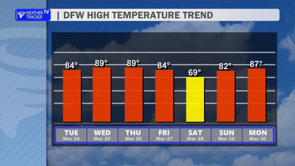
Looking ahead, a cold front is set to move through the region on Friday. This front won’t bring much in the way of rain, but it will knock temperatures back for a brief period. Highs on Saturday will be noticeably cooler, holding in the 60s before a quick rebound into the 80s returns by Sunday.
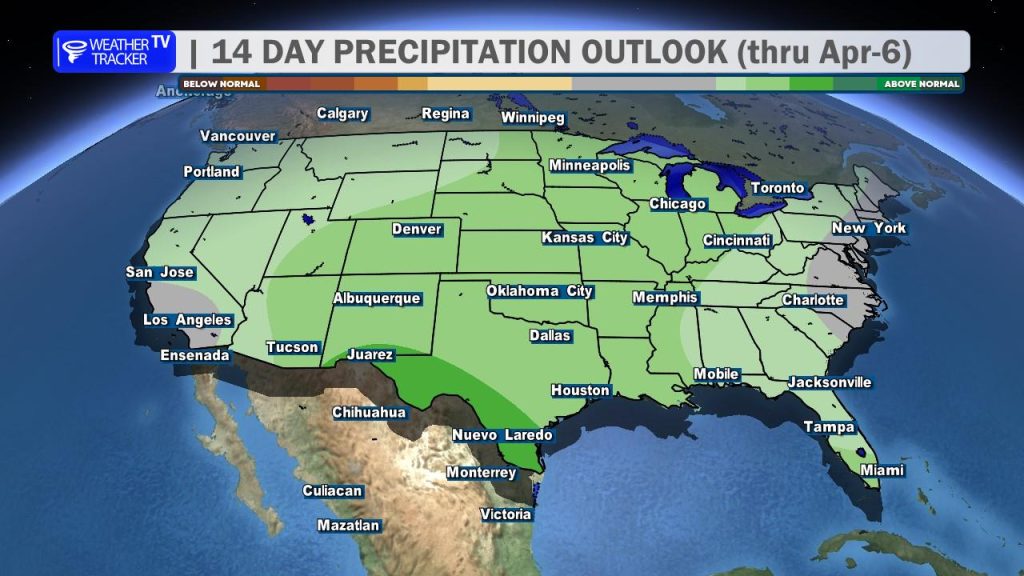
The overall pattern remains dry in the short term, but there are early signals that a more active weather pattern could develop as we head into the start of April. That may bring back chances for rain and possibly storms to North Texas.