Good Sunday morning, North Texas!
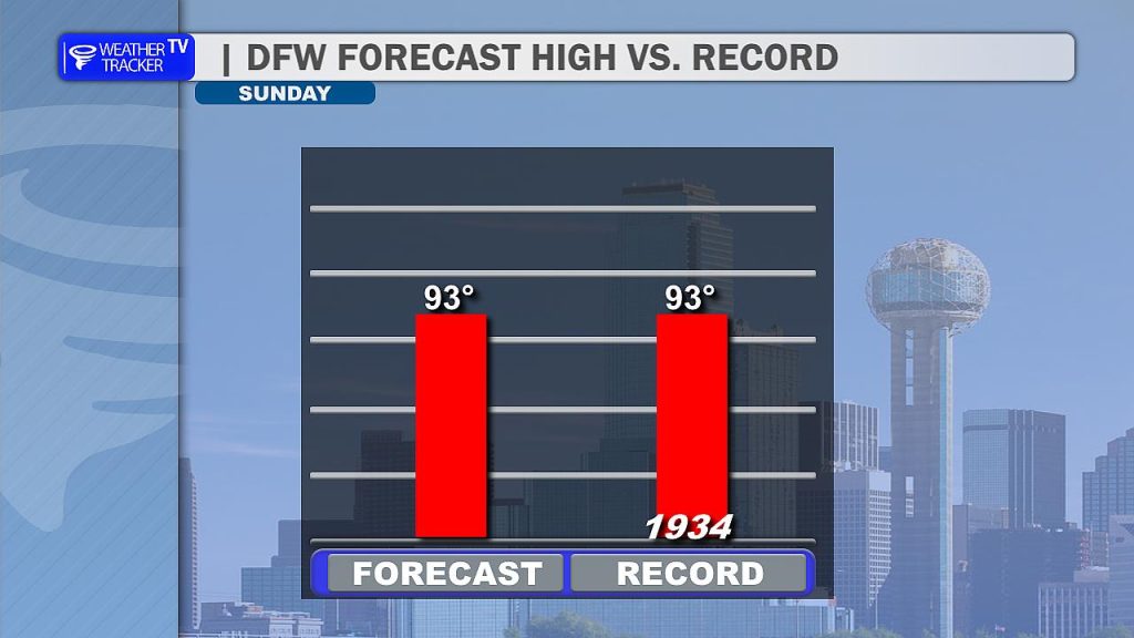
We’re in for another hot day across the region as this early-season heat wave peaks this afternoon. High temperatures in the Metroplex will climb into the low to mid 90s, and we could be flirting with a bit of weather history. The current record high at DFW for today is 93 degrees, set back in 1934 – and that’s right in line with our forecast. So, a tie or even a new record is certainly possible.
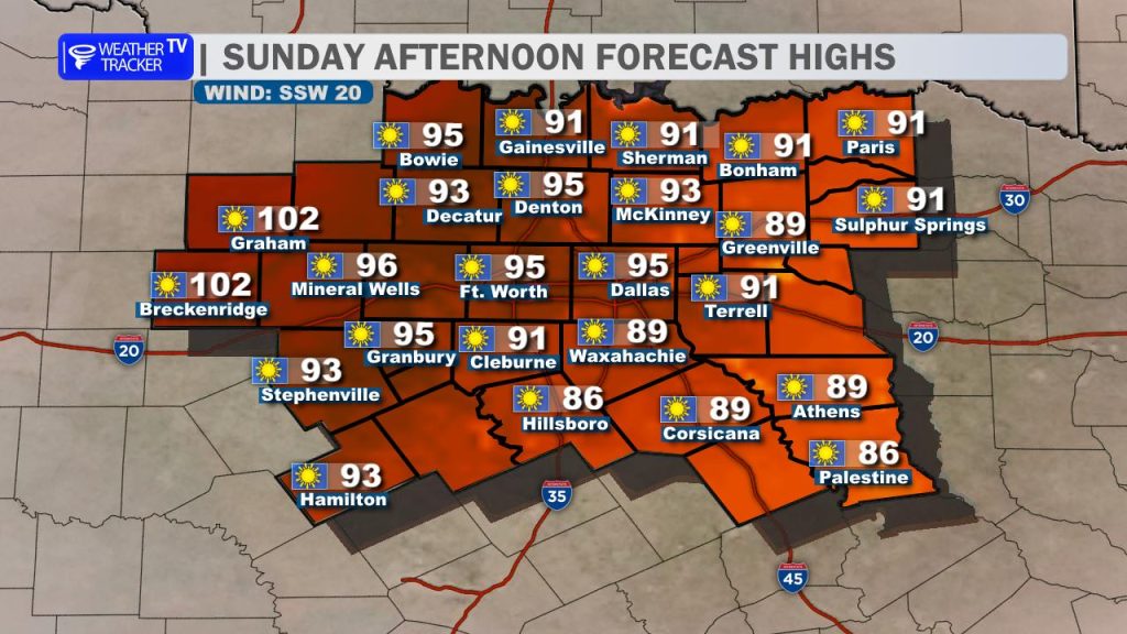
Out west, the heat will be even more intense. Across the Big Country and our western counties, temperatures could easily surge toward the 100-degree mark under mostly sunny skies and a steady south wind.
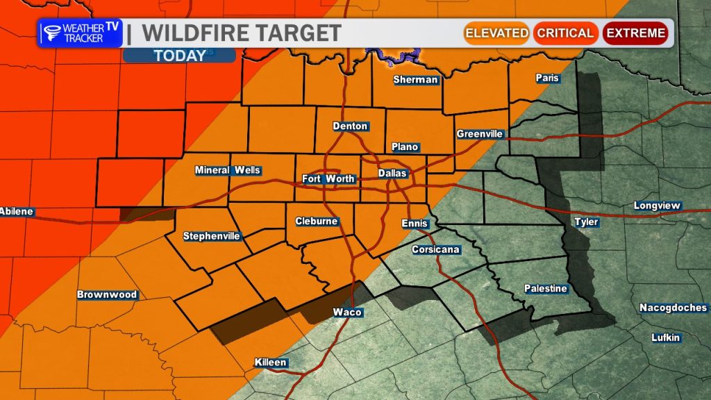
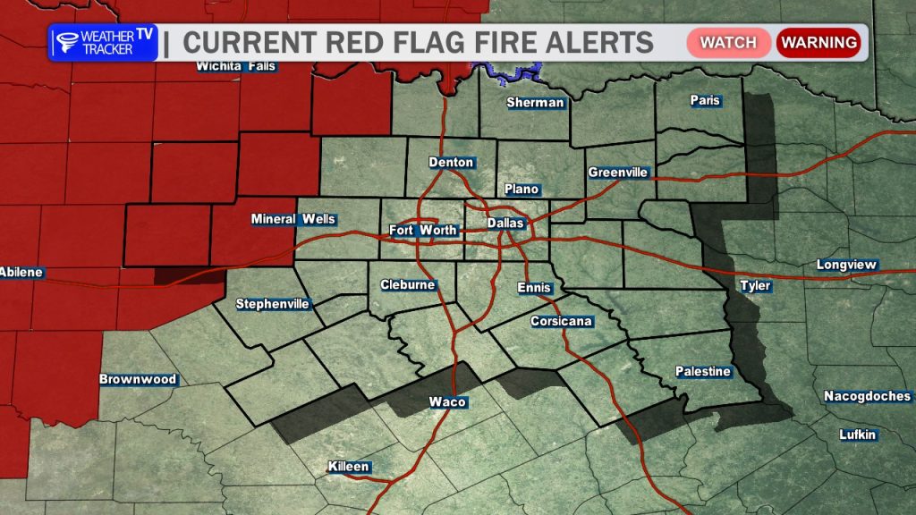
Along with the heat, fire danger remains a major concern. Elevated to critical fire weather conditions are in place once again today. In fact, a Red Flag Warning is in effect for our northwestern counties through 8 PM this evening. With dry vegetation, low humidity, and gusty winds, any fires that develop could spread rapidly. Be sure to avoid outdoor burning and anything that could create sparks.
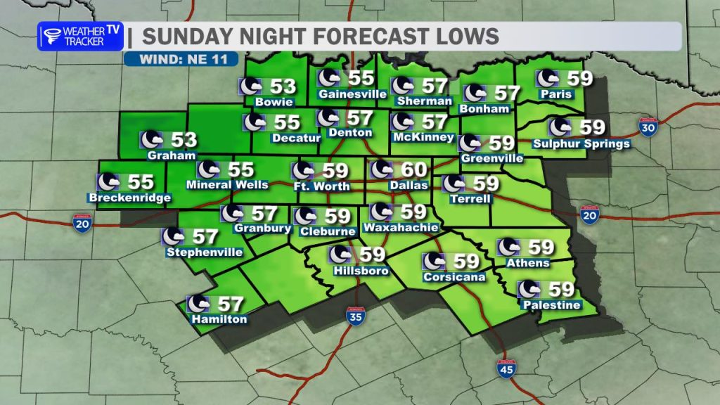
Relief is on the way, though. A cold front will begin moving into North Texas late this afternoon and evening, reaching the Metroplex between about 7 PM and 10 PM. Behind the front, winds will shift to the north and temperatures will begin to fall, leading to a much cooler overnight. Lows by Monday morning will drop into the 50s and 60s.
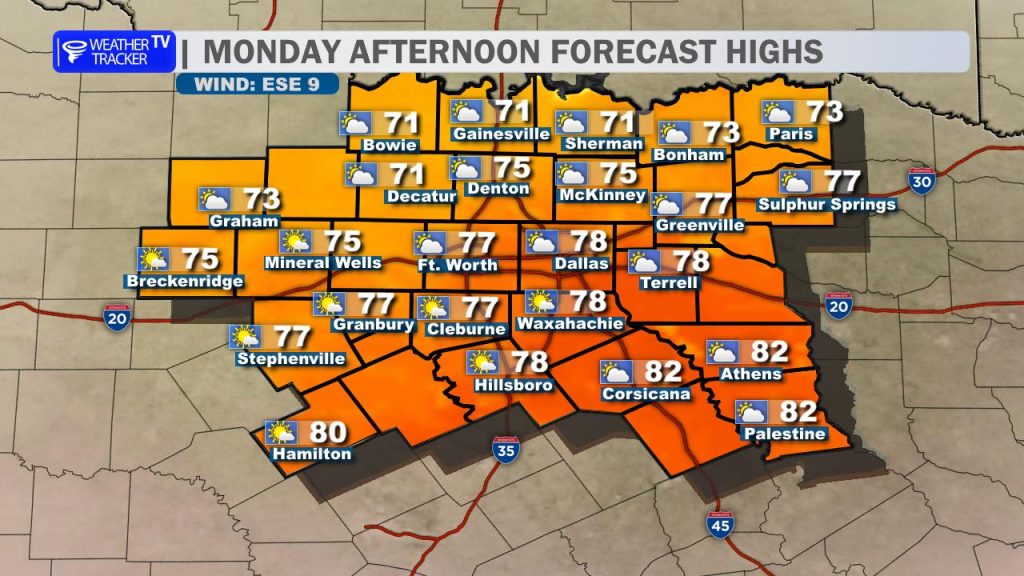
That front will make a noticeable difference as we start the new week. Monday will bring cooler conditions with highs in the 70s and 80s, along with mostly cloudy to partly sunny skies. A refreshing north breeze will make it feel even more comfortable compared to the weekend heat.
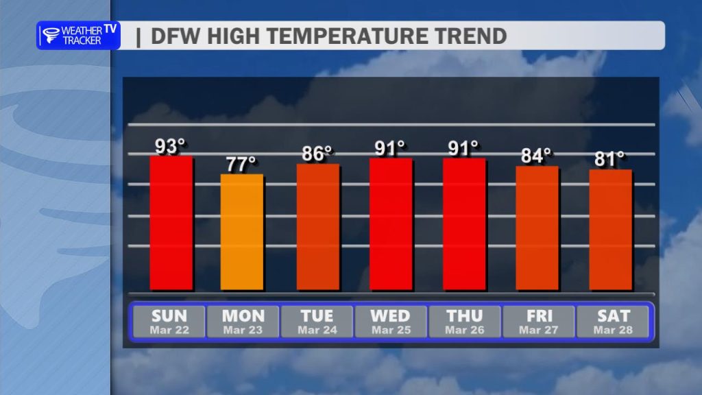
The cooldown doesn’t last too long, though. Temperatures will begin climbing again by midweek, returning to the 90s. With continued dry conditions, fire danger will remain something we’ll need to monitor closely in the days ahead.