Happy Friday, North Texas!
Get ready for a summer-like stretch as we head into the weekend. A building ridge of high pressure will take control of our weather, sending temperatures soaring and keeping skies mostly sunny.
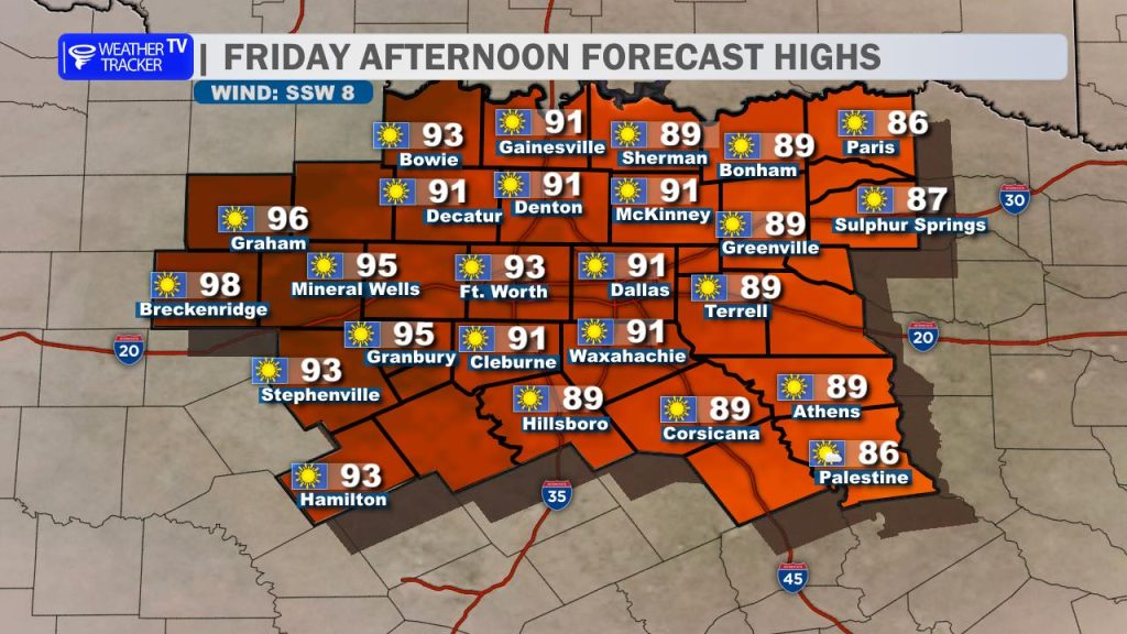
That warming trend begins today. Expect plenty of sunshine this afternoon with a light south to southwest breeze. Highs will climb into the 90s across much of North Texas, while our eastern counties stay a bit cooler, generally in the upper 80s.
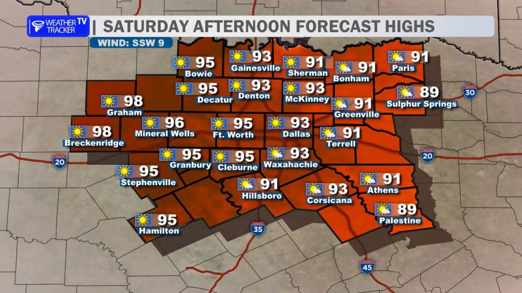
The heat intensifies heading into the weekend. On Saturday, most areas will once again reach the 90s, with a few spots in our western counties pushing into the upper 90s under full sunshine and a steady southwest breeze.
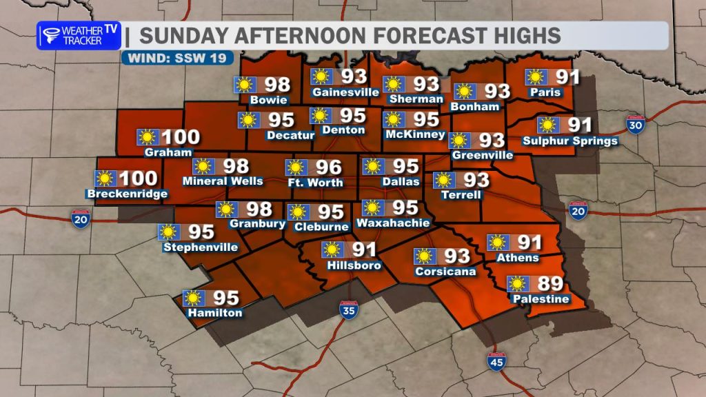
Sunday looks to be the hottest day of this stretch. Highs will climb into the mid to upper 90s across much of the region, with some western locations nearing the 100-degree mark. It will remain sunny, and a slightly stronger southwest wind could gust up to around 20 mph at times.

Relief is on the way, though. A cold front is expected to move through late Sunday, bringing temperatures back down into the 80s by Monday along with a bit of a refresh to start the new week. However, that cooldown will be brief, as warmer temperatures begin to return by midweek.
Heat Safety Tips:
- Stay hydrated by drinking plenty of water throughout the day
- Take frequent breaks if you’re working or spending time outdoors
- Never leave children or pets in a parked vehicle
- Check on neighbors, especially the elderly
- Wear light-colored, loose-fitting clothing
Stay cool and have a great start to your weekend! -William