Good Thursday morning, North Texas!
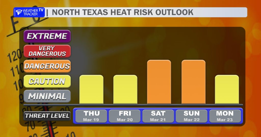
We’re heading into a hot stretch of weather across the region as a strong ridge of high pressure builds overhead. This will set the stage for a mini heat wave through the upcoming weekend, with temperatures climbing higher each day.
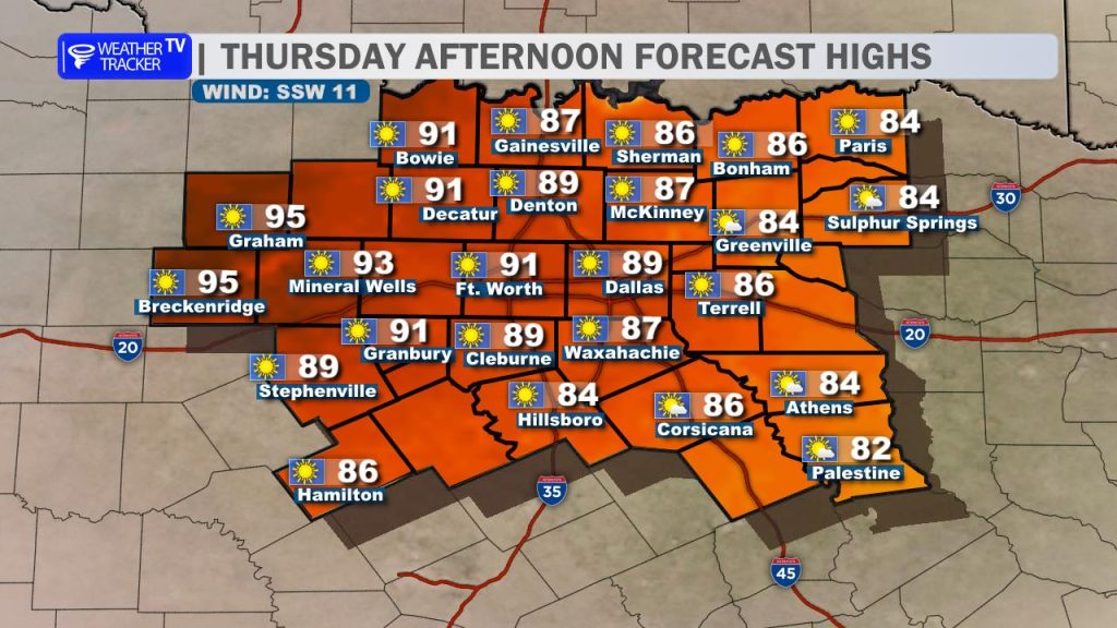
That warming trend begins today. Afternoon highs will push close to 90 degrees across the Metroplex, with a few mid-90s possible in our western counties. Plenty of sunshine and a developing southerly breeze will help fuel the heat.
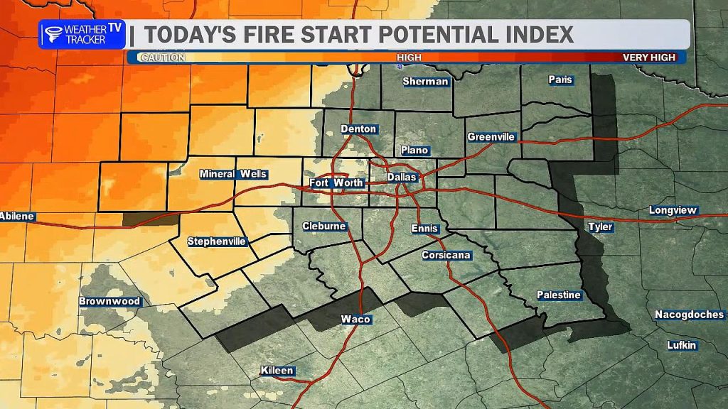
The forecast remains dry through the weekend, but that brings an increased concern for fire danger. Hot temperatures, dry vegetation, and gusty south winds will create elevated to potentially critical fire weather conditions—especially west of Interstate 35. It’s important to avoid any outdoor burning or activities that could create sparks. Fires that develop in these conditions can spread quickly.
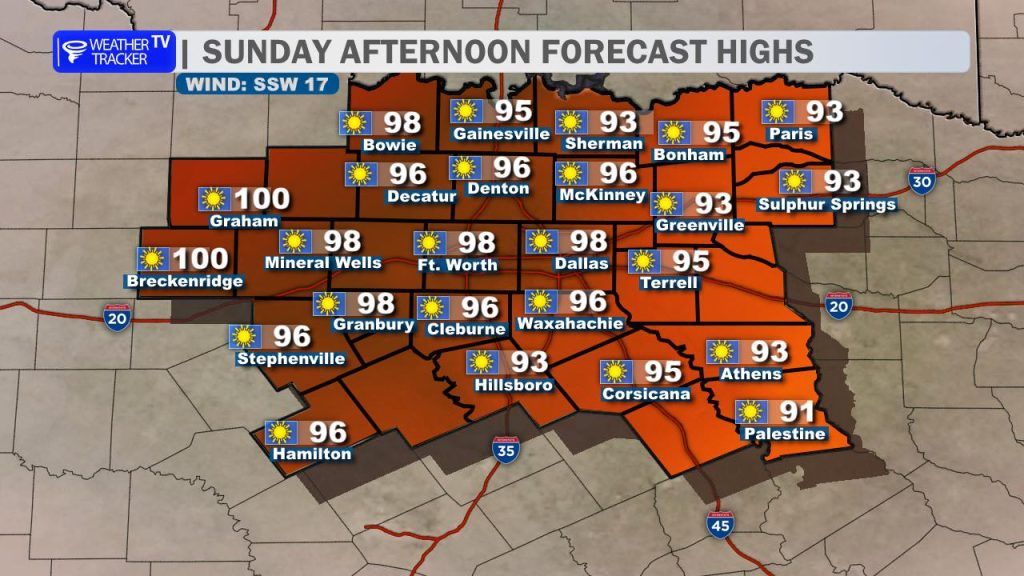
As we head into the weekend, the heat intensifies. Saturday will be hot, but Sunday looks to be the peak of this stretch. High temperatures may approach or even reach 100 degrees in parts of western North Texas and the Big Country, with mid to upper 90s elsewhere. If you have outdoor plans, be sure to stay hydrated and take breaks from the heat.
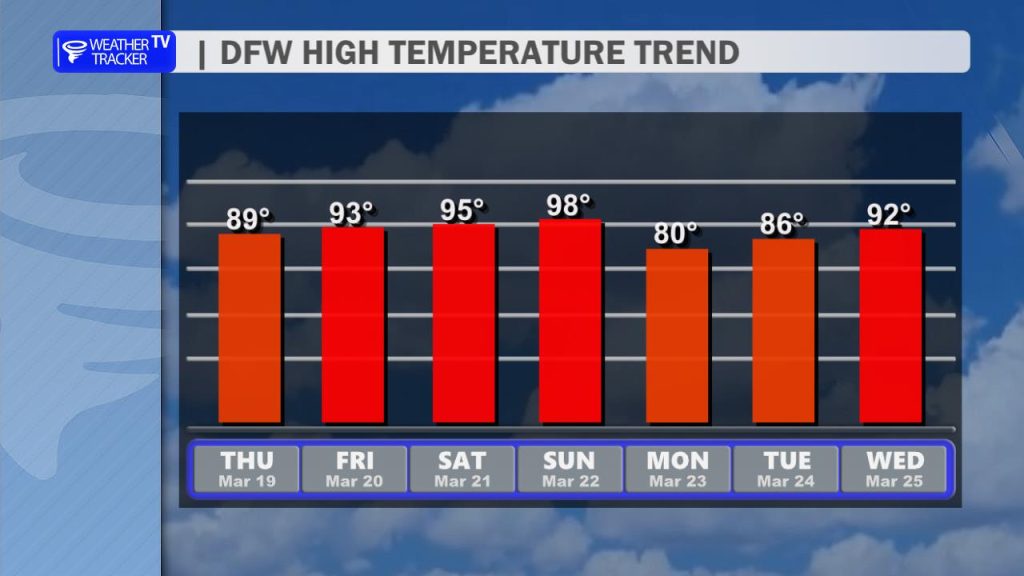
A cold front is expected to arrive late Sunday, bringing at least some relief. While rain chances look limited at this time, the front will help knock temperatures down heading into early next week.
By Monday, highs fall back into the 80s with slightly cooler mornings—offering a noticeable break from the weekend heat.