Good Monday morning North Texas!
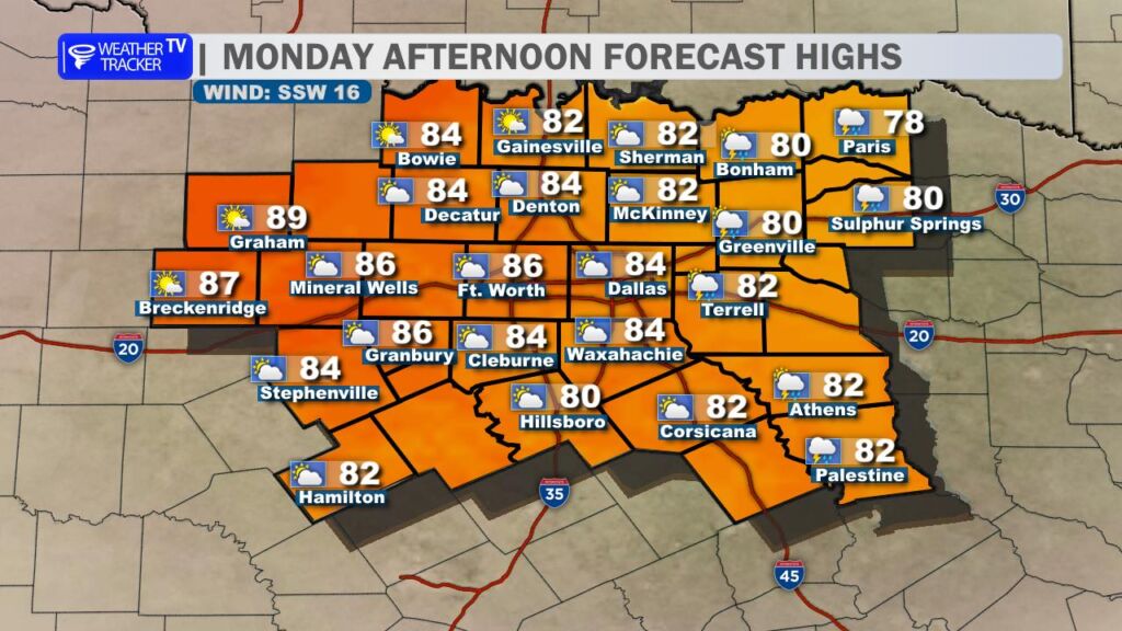
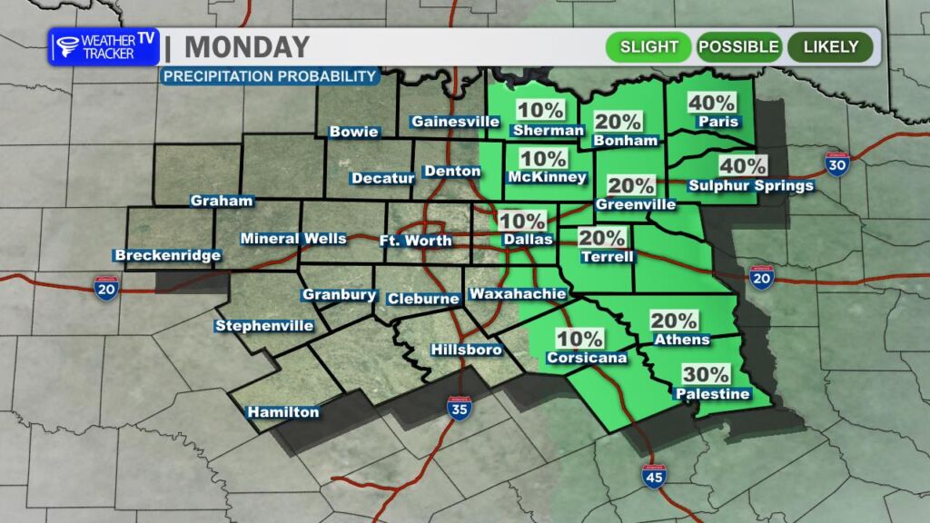
It’s a warm and increasingly humid start to the day across the region, and those muggy conditions will stick around through the afternoon. Expect mostly cloudy skies for much of the day with a mix of clouds and occasional breaks of sun. While most locations will stay dry, a stray shower or thunderstorm cannot be ruled out in our far eastern counties through the early afternoon hours.
Temperatures today will climb well above normal for early March, with afternoon highs pushing into the 80s across North Texas. A steady south wind will continue to pull moisture northward from the Gulf, setting the stage for a more active weather pattern heading into Tuesday.
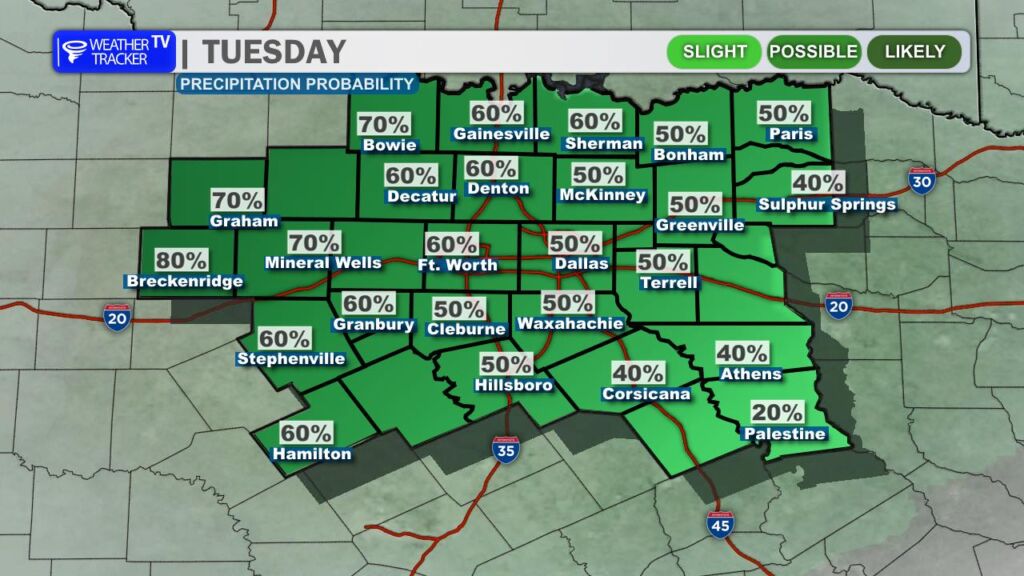
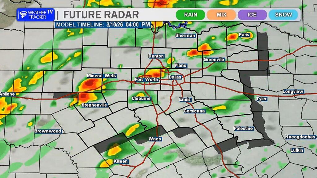
That active pattern arrives tomorrow as rain and thunderstorm chances increase across the region. A few scattered showers could develop during the Tuesday morning commute, but the greater concern for stronger storms will come later in the day.
As we head into the afternoon and evening hours Tuesday, a dryline developing across West Texas will become the primary focus for thunderstorm development. Storms are expected to form along that boundary and move east toward North Texas through the evening.
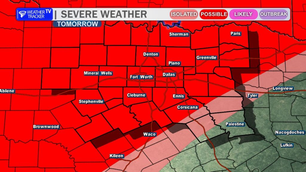
Some of these storms could become severe, bringing the threat of large hail, damaging wind gusts, and possibly a tornado or two Tuesday evening. In addition, storms will have access to abundant Gulf moisture, meaning locally heavy rainfall could accompany the stronger activity.
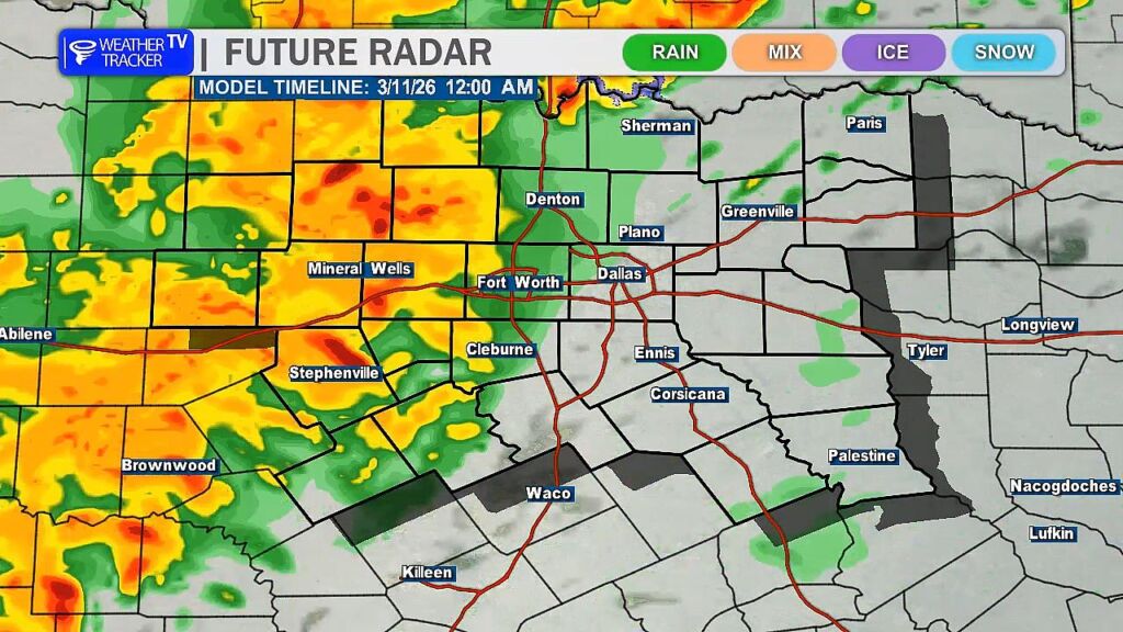
We are also monitoring a secondary window for storm development ahead of the main line. If isolated storms are able to form east of the dryline after about 4 PM, they could quickly become supercells capable of producing severe weather before the main line of storms arrives later in the evening.
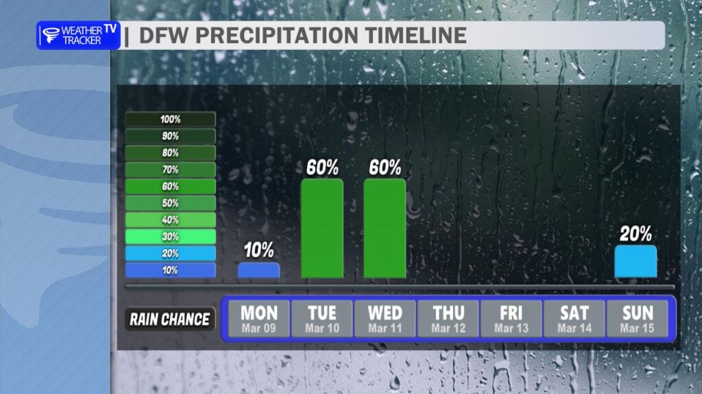
Rain and storm chances may linger into Wednesday, though the overall threat for severe weather should gradually decrease as the system moves east of the region.
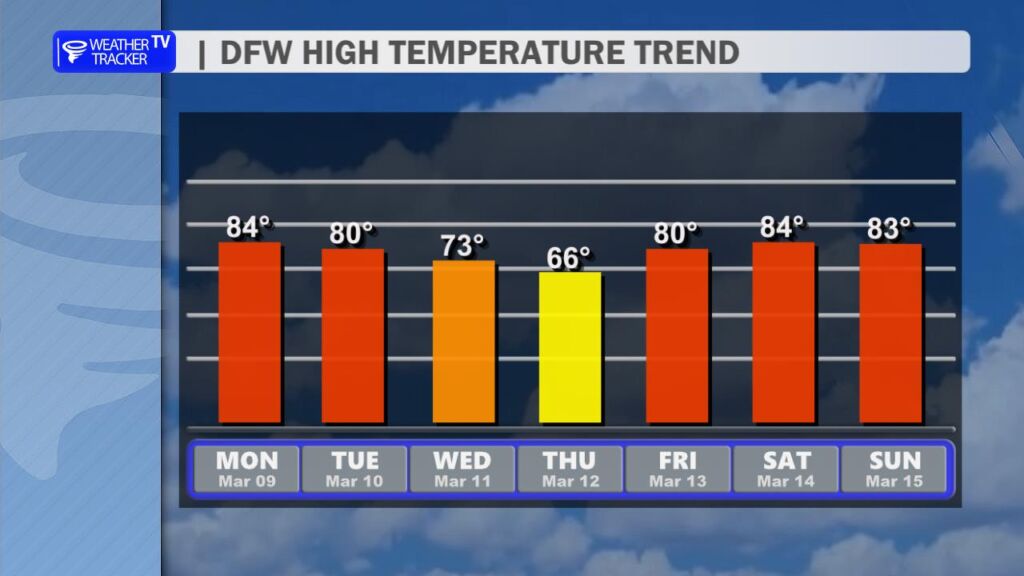
Behind this midweek weather maker, drier and calmer conditions return for the second half of the work week. Temperatures will cool slightly, with highs dropping back into the 60s by Thursday, before a quick warm-up returns by the weekend with 80s making a comeback across North Texas.