Good Sunday morning, North Texas!
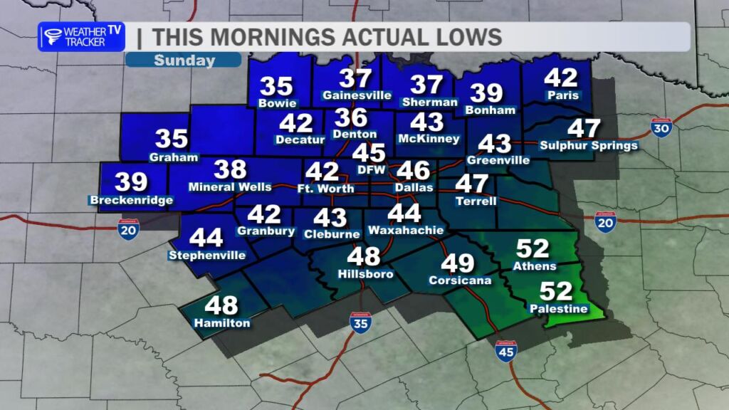
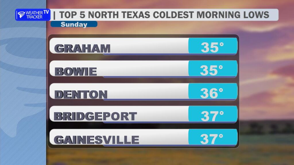
After an active stretch of weather across the region over the past couple of days, North Texas gets a well-deserved break today. A cold front pushed through the area yesterday, and you could certainly feel the difference this morning. Temperatures started the day noticeably cooler, with most locations waking up in the 40s and a few spots northwest of the Dallas–Fort Worth Metroplex dipping into the upper 30s.

Despite the cool start, today will turn out to be a very pleasant day across the region. Expect plenty of sunshine through the afternoon with highs climbing into the 70s. Winds will remain light and variable, making for a comfortable day across North Texas.
Enjoy the quiet weather while it lasts, because the pattern turns more active again as we head into the upcoming work week.
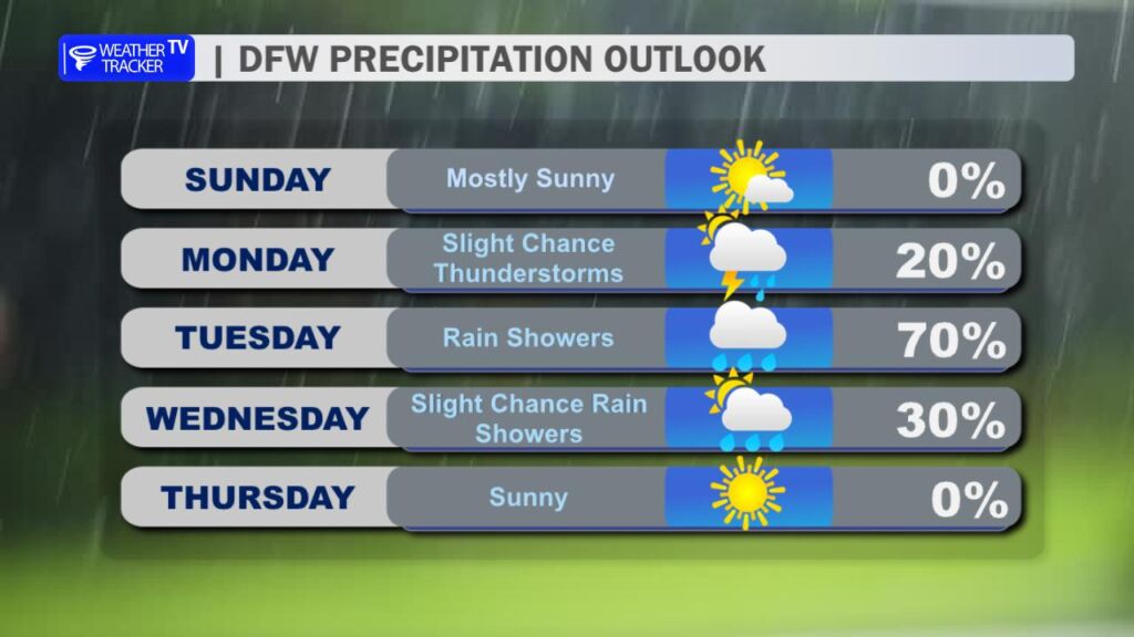
Rain and thunderstorm chances begin increasing late Monday night and especially into Tuesday afternoon, Tuesday night, and early Wednesday. A strong upper-level storm system moving out of the Southwest will interact with warm, humid air returning from the Gulf, creating favorable conditions for widespread showers and thunderstorms.
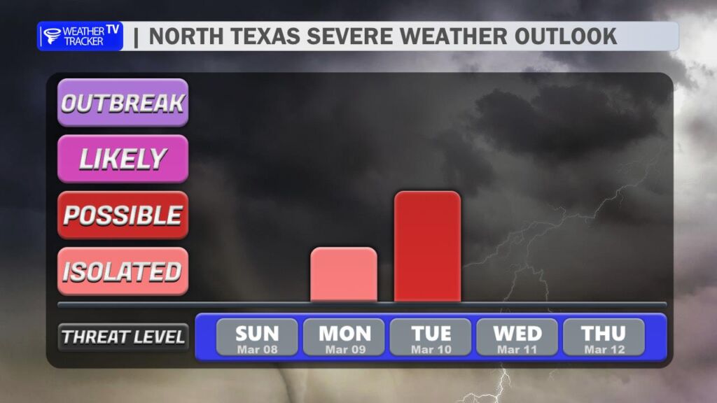
Periods of heavy rain will be possible, and there is also the potential for severe weather Tuesday afternoon and evening. At this point, all modes of severe weather appear possible, including large hail, damaging wind gusts, and a lower-end tornado risk. It will be something to keep an eye on as we move closer to midweek.
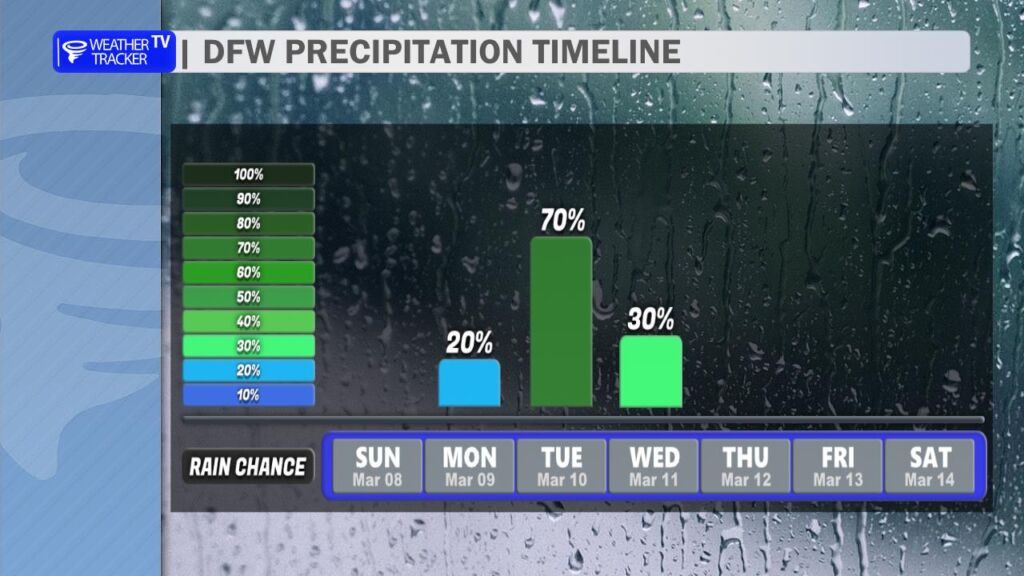
Once this storm system moves out of the region by Wednesday, rain and storm chances begin to taper off for the remainder of the week. Cooler air will settle in behind the system with highs falling back into the 60s on Thursday.
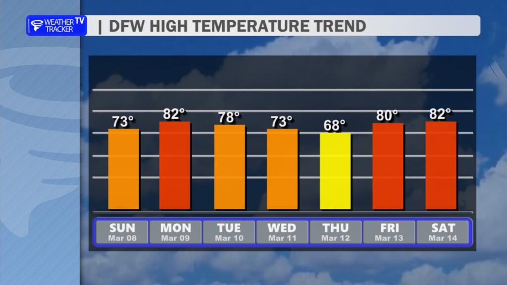
The cooler weather won’t last long, however. Temperatures rebound quickly late in the week and heading into next weekend, with highs climbing back into the 80s across North Texas.