Good Monday Morning, North Texas!
We’re kicking off a more active weather pattern this week – but today is fairly quiet compared to what’s ahead.
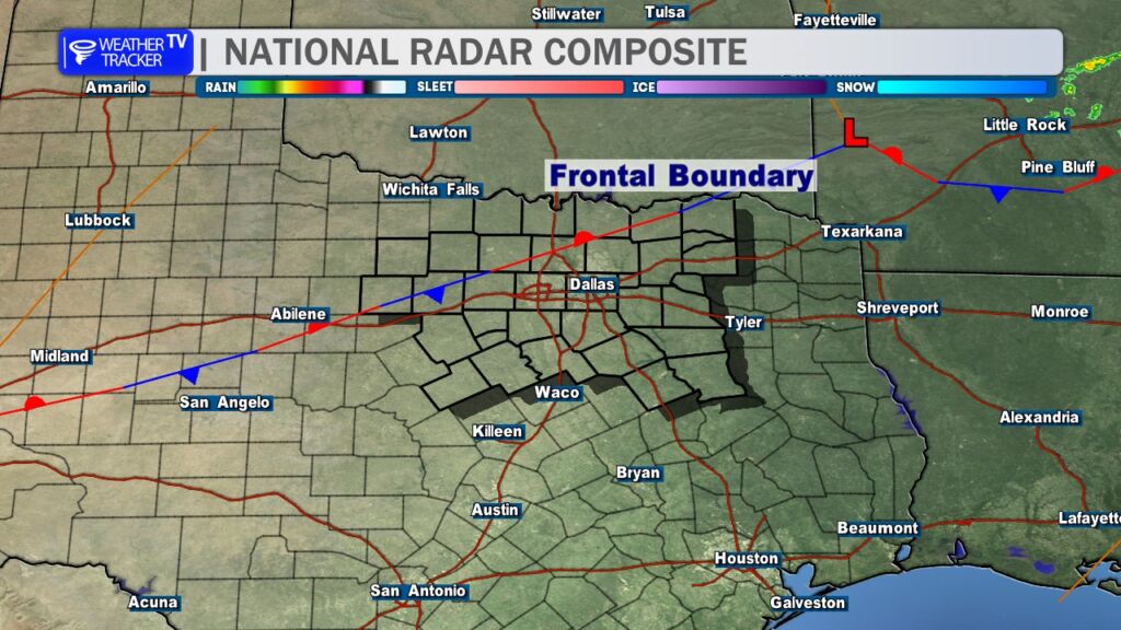
A stalled frontal boundary is draped across our northwestern counties this morning. That boundary will create a noticeable temperature contrast across the region this afternoon, with slightly cooler air northwest and warmer conditions southeast.
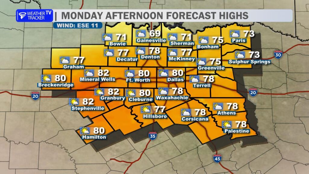
We’re starting the day with areas of low clouds, but those will gradually thin out through late morning, giving way to some sun this afternoon – still expect a mostly cloudy afternoon. South winds will continue to pull in more moisture, so you’ll notice humidity levels creeping up compared to the past few days. Afternoon highs will range from the mid 70s in our northwest counties to around 80 degrees across much of North Texas.
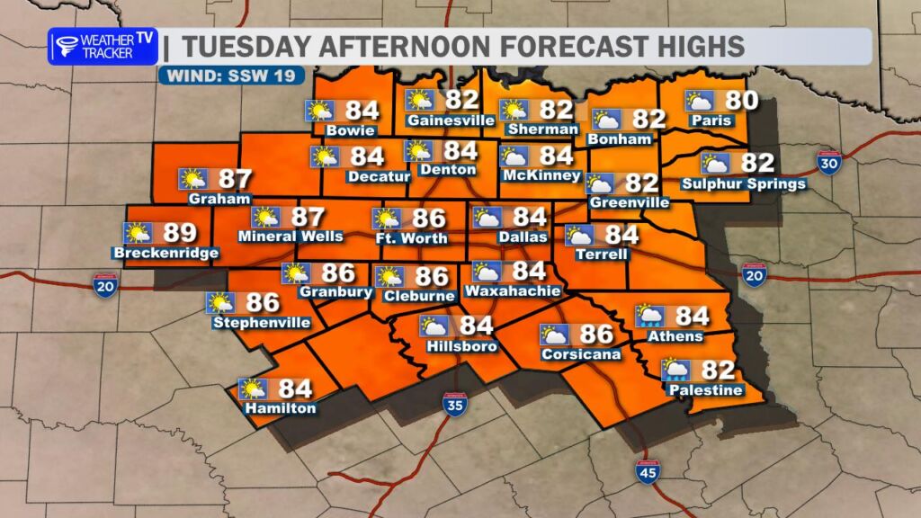
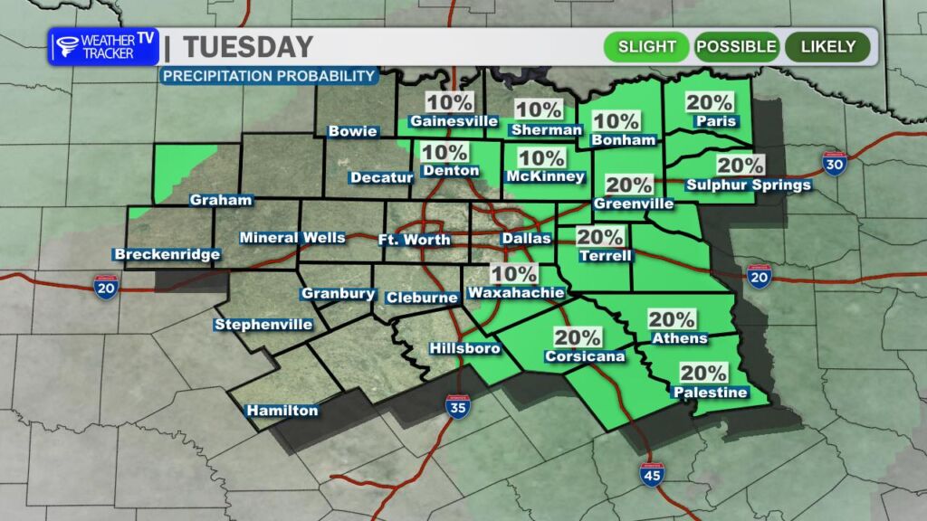
Tuesday brings a similar setup. Morning clouds will once again give way to afternoon sunshine, and temperatures will be a touch warmer – most locations climbing into the 80s. A very isolated shower can’t be ruled out east and northwest of the Dallas–Fort Worth area, but most of us will stay dry.
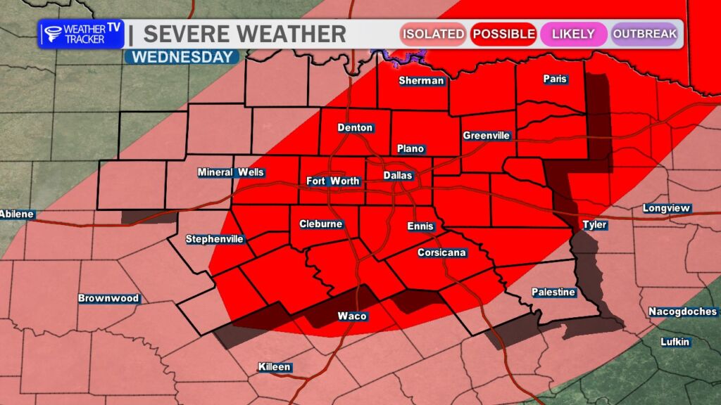
By Wednesday, the pattern turns more unsettled. Scattered showers and thunderstorms become increasingly likely through the day. Some storms could be strong to severe, with hail and gusty winds as the primary threats. The severe weather risk may linger across North Texas through Friday as multiple disturbances move through the region.
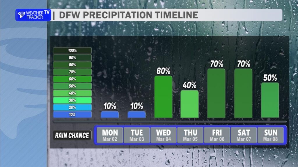
On Friday, a dryline will approach from the west and could serve as a focus for additional scattered storm development. Then on Saturday, a cold front pushes through the area, bringing a better chance for more widespread rain and thunderstorms. With repeated rounds of rain possible, heavy rainfall and localized flooding may become concerns by the end of the week.
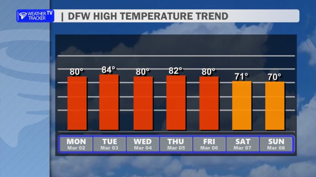
Temperatures stay unseasonably warm through midweek with highs in the 80s, before trending back into the 70s behind the weekend cold front.
We’ll fine-tune the timing and severity details over the next couple of days, so be sure to stay updated as we head deeper into this active stretch. -William