Good Thursday Morning, North Texas!
It’s been a foggy start across parts of the area this morning, with some pockets of reduced visibility during the early commute. The good news is the fog will continue to lift and thin out through mid-morning as drier air works in.
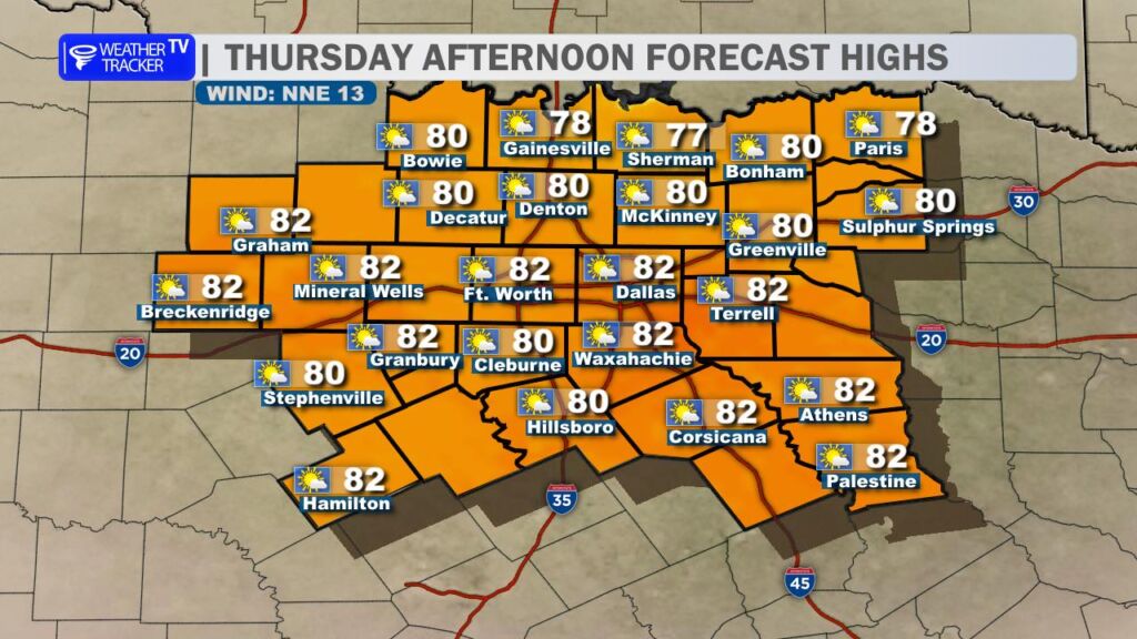
A breezy cold front is sliding through the region this morning. This is not a strong blast of cold air, but it will trim temperatures back just a few degrees compared to yesterday’s warmth. Winds will shift around behind the front and remain a bit breezy at times, helping clear us out for a mostly sunny afternoon. Highs will top out in the upper 70s to lower 80s – still well above average for late February.
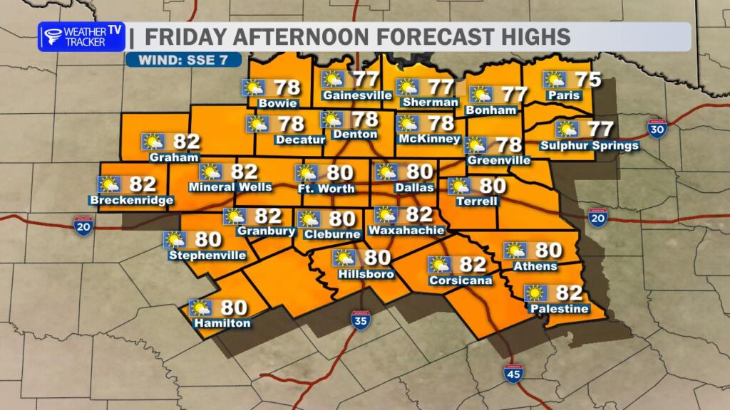
Friday looks like almost a carbon copy forecast. Winds turn light out of the south, skies stay mostly sunny, and afternoon highs once again climb into the upper 70s and lower 80s. It’s a very quiet and warm stretch of weather for North Texas.
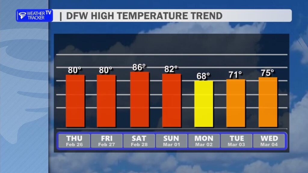
The warmth continues into the weekend with highs solidly in the 80s both Saturday and Sunday. It will feel more like early April than early March.
A slight cool-down arrives Monday as temperatures settle back into the 60s, giving us a brief reminder that it’s still technically winter.
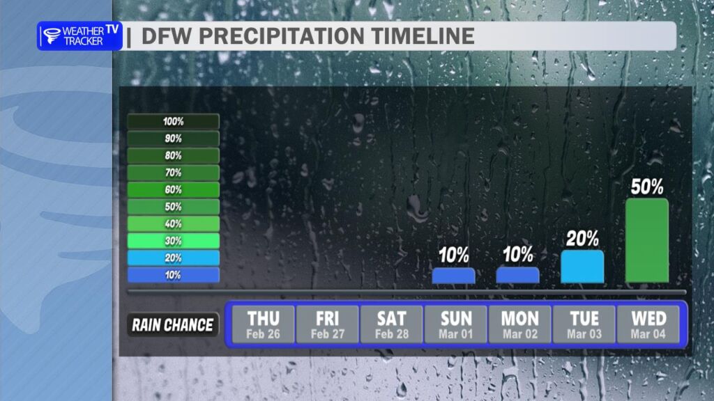
Looking ahead, a noticeable pattern change begins as we move into the first week of March. Rain and thunderstorm chances will be on the upswing. Some storms could be strong, and locally heavy rainfall may become a concern depending on how the system evolves. We’ll start to fine-tune the timing and strength of those storm chances as we head into the weekend and get better clarity in the data.
Stay tuned, and enjoy the warm stretch while it lasts! -William