Good Wednesday Morning, North Texas!
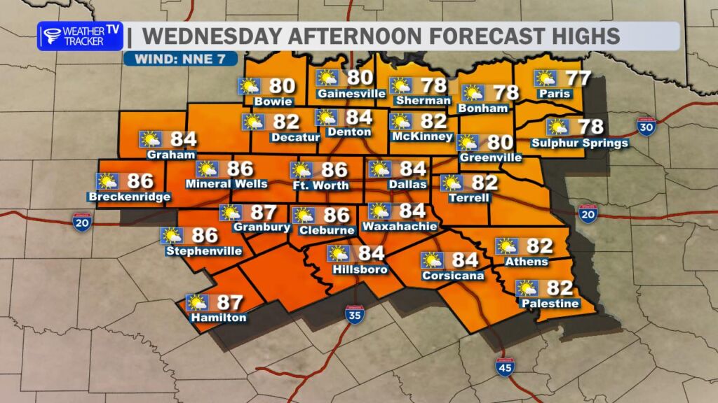
We are in for another unseasonably warm day across the region. Afternoon highs will soar into the mid and upper 80s – more typical of late April than late February. For perspective, our average high this time of year is around 63 degrees, so we’re running more than 20 degrees above normal. Skies will be mostly sunny with just a few thin, high-level cirrus clouds drifting overhead.
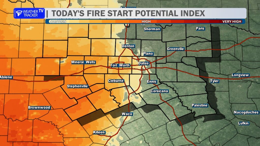
It will be breezy at times, and that combination of warm temperatures, low humidity, and gusty winds will keep wildfire danger elevated through the afternoon. Any outdoor burning is strongly discouraged, and it’s important to avoid activities that could create sparks. Fires that start in these conditions can spread quickly.
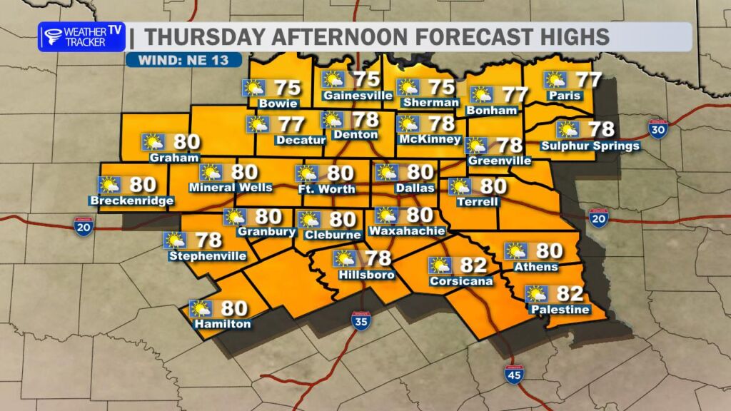
A weak cold front slides through tomorrow. While it won’t bring rain, it will knock temperatures down slightly and shift winds to the northeast. Highs Thursday will range from the 70s to near 80 degrees – still well above average for this time of year. Winds may remain breezy enough to keep fire concerns elevated, especially during the afternoon hours.
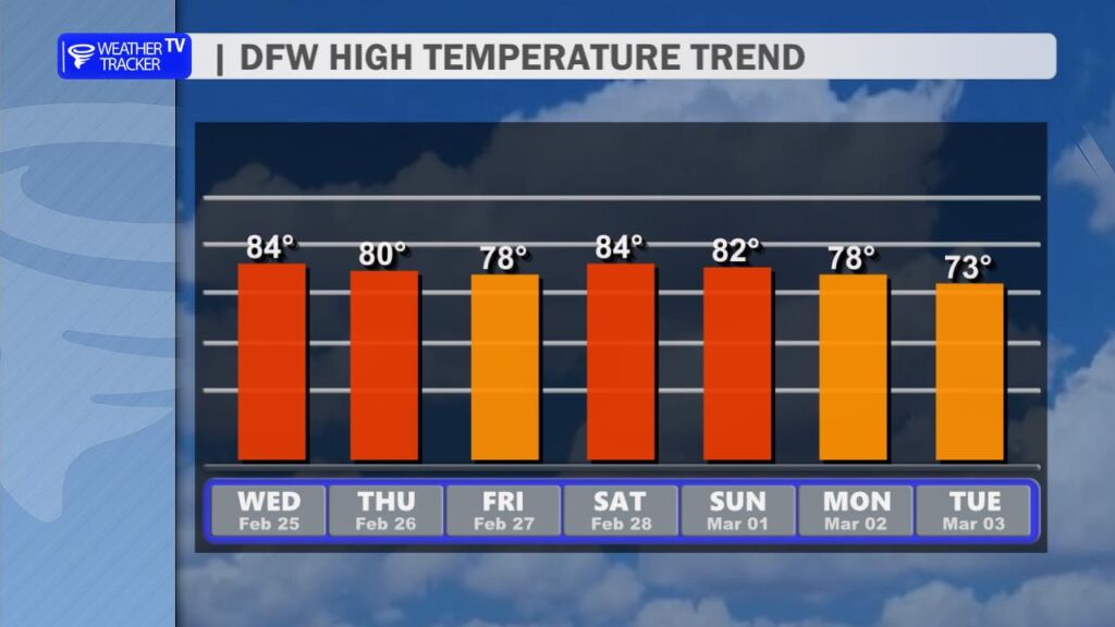
The above-normal warmth continues into the weekend, with highs near or above 80 degrees both Saturday and Sunday. Expect a good deal of sunshine and dry conditions to stick around.
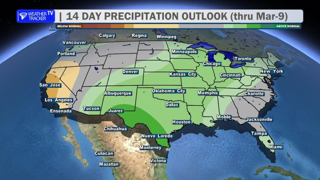
Looking ahead, there are increasing signals in the longer-range data that rain chances could return to North Texas by the middle to latter part of next week. It’s too early to talk specifics on timing or coverage, but we’ll continue to watch the trends closely and fine-tune those details as we get closer.
Enjoy the warmth – just stay mindful of the elevated fire danger. -William