Good Tuesday Morning, North Texas!
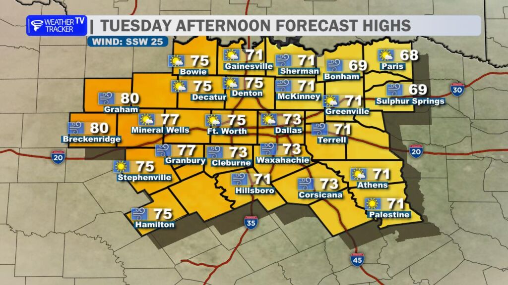
Get ready for a warm and windy day across the region. Sunshine will dominate the sky this afternoon, helping temperatures climb into the 70s for most communities. Out west in the Big Country, a few spots could even flirt with the low 80s.
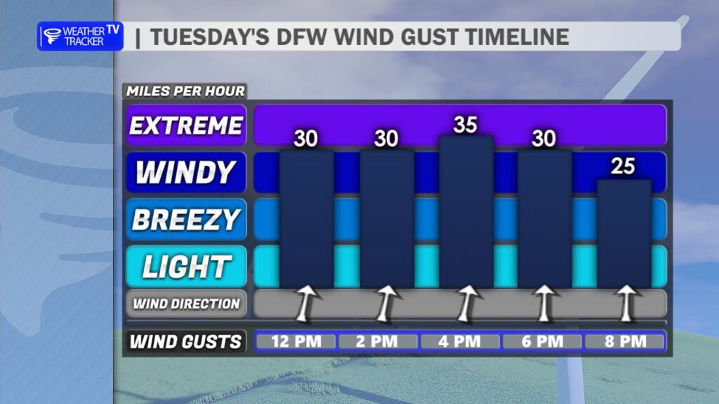
The bigger story today will be the wind. A strong southwest breeze will increase through the late morning and afternoon, with gusts frequently topping 35 mph and possibly pushing closer to 40 mph at times before sunset.
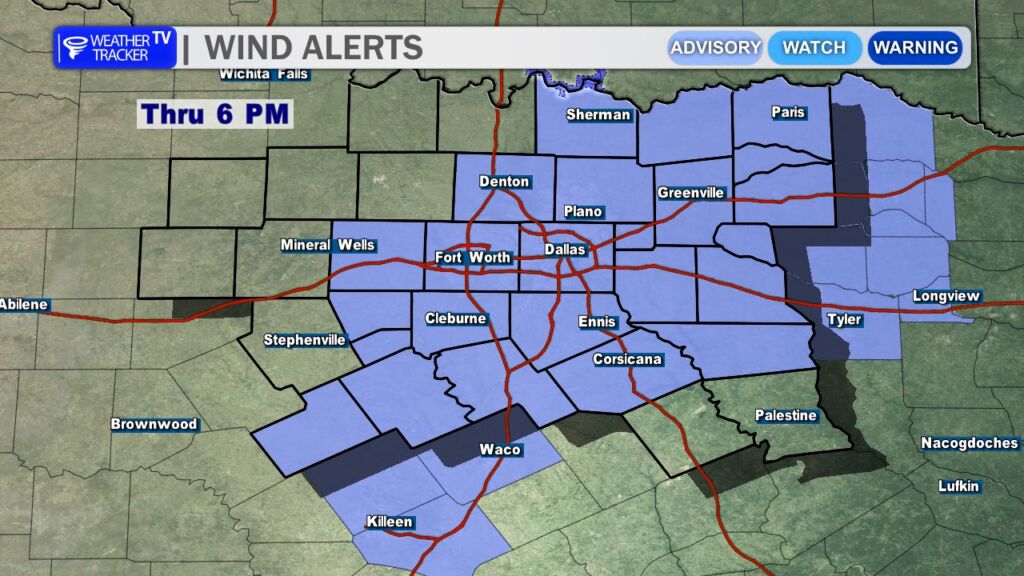
Because of those gusty conditions, a Wind Advisory remains in effect until 6 PM for much of North Texas. Loose outdoor items may be blown around, and high-profile vehicles could have difficulty on east-west roadways.

The combination of warm temperatures, strong southwest winds, and dropping humidity levels will also elevate fire danger across the area. Any outdoor burning is strongly discouraged today. Even small sparks – from equipment, welding, or dragging trailer chains – could quickly spread under these conditions.
Looking Ahead
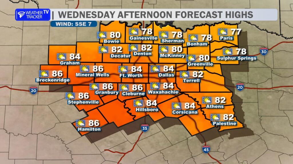
The warming trend continues into Wednesday. Winds ease up and shift more southeasterly, but temperatures climb even higher – with afternoon highs pushing into the 80s area-wide.
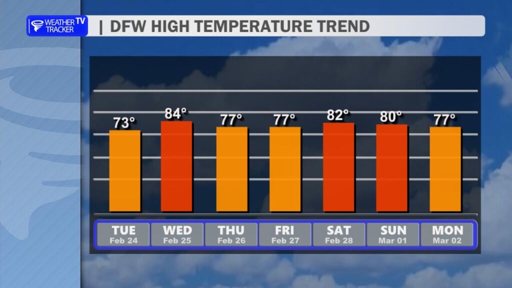
Warm conditions hold into the end of the week and through the weekend, with highs generally in the 70s to near 80 by Saturday. The overall pattern remains dry for at least the next seven days.
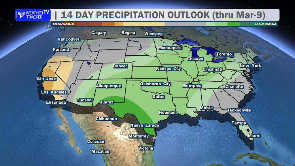
However, there are early signals that the weather pattern may become more active as we head into the first week of March. It’s too early for specifics, but rain chances could begin to return as we transition into a more unsettled setup.
We’ll keep watching it closely. -William