Good Monday Morning, North Texas –
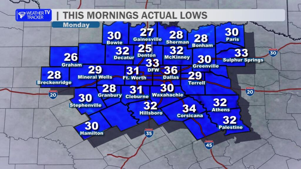
It’s another cold start across the region, with many communities waking up to temperatures at or below freezing – including several spots right here in the Metroplex. After a string of chilly mornings, that early bite in the air is certainly noticeable.
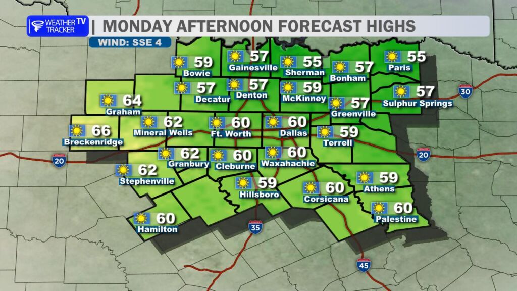
Sunshine returns in full force this afternoon. Expect bright blue skies with highs climbing into the mid to upper 50s, with a few spots touching 60 degrees. Winds will gradually shift around to the southeast and remain fairly light, helping take the edge off compared to the weekend.
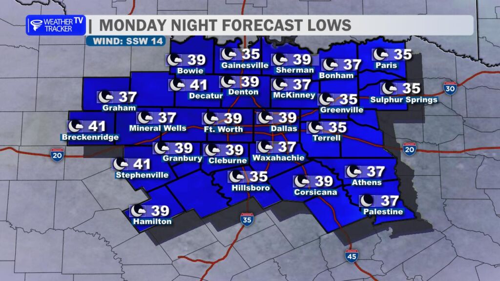
Tonight will be cold once again, but not quite as harsh. Overnight lows settle back into the 30s for most of North Texas. While a few of our typically colder rural locations could briefly flirt with freezing, the majority of the area should stay just above that mark.
A big warm-up gets underway Tuesday.
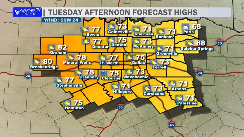
A gusty, warming southwesterly wind will kick in during the day, sending temperatures soaring into the 70s area-wide. A few western counties – especially toward the Big Country – could even see the first 80s of the week. Skies stay mostly sunny with just a thin veil of high-level cirrus clouds drifting overhead.
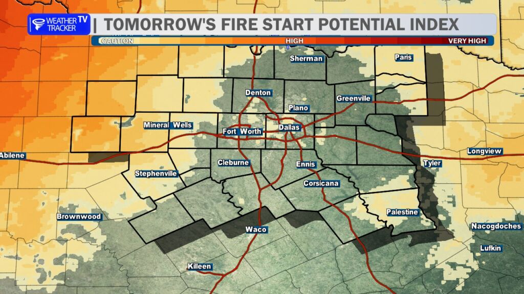
With the warmer temperatures, gusty winds, and very dry air in place Tuesday afternoon, fire danger will increase. If you’re in a rural area, avoid outdoor burning and anything that could create sparks. Even small fires could spread quickly under these conditions.
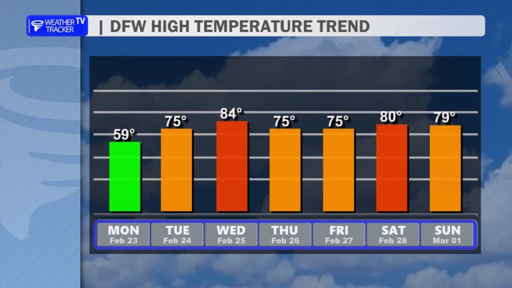
The warming trend continues into Wednesday with widespread 80s across North Texas – a big change from this morning’s freeze. It will feel much more like spring.
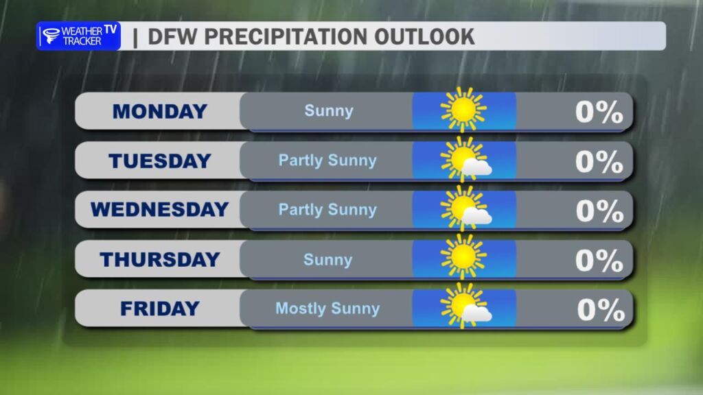
A weak cold front slips through Thursday, trimming temperatures back into the 70s. It won’t bring rain, just a modest cool-down and a wind shift. For now, the forecast remains dry through the end of the week.
Enjoy the sunshine today – and get ready for a rapid transition from winter chill to spring warmth over the next 48 hours. -William