Good Monday morning North Texas!
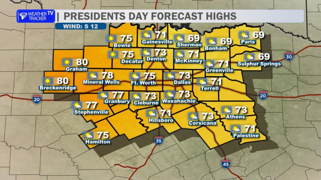
We’re kicking off what looks to be a beautiful stretch of weather across the region. Early morning clouds and areas of patchy fog will gradually lift through mid-morning, giving way to increasing sunshine by the afternoon. Once the sun breaks through, temperatures will respond quickly – climbing into the 70s area-wide. A warming south breeze will pick up at times, with gusts near 15 mph adding to that spring-like feel.
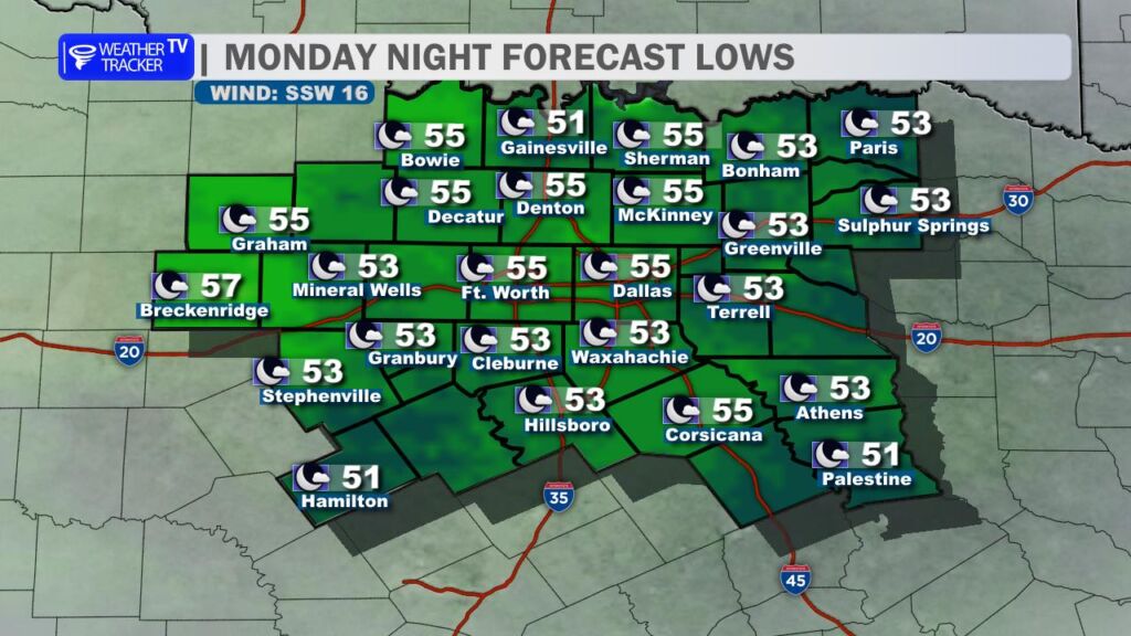
Tonight stays quiet and milder than recent nights. Under mostly clear skies and lighter winds, overnight lows will only dip into the 50s.
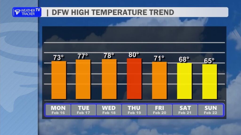
As we move through the workweek, temperatures continue trending upward. Afternoon highs will steadily climb through the 70s, with many locations in the Dallas–Fort Worth area pushing close to 80 degrees by Thursday. For mid-February, that’s running well above average.
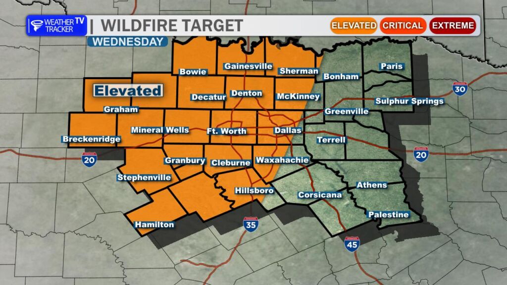
With the warmer air in place, we’ll also see increasing south winds and gradually lowering humidity levels. That combination will elevate fire weather concerns – especially Wednesday into Thursday. In our more rural communities, it would be wise to postpone any outdoor burning and avoid activities that could create sparks. Even small ignitions can spread quickly under these conditions.
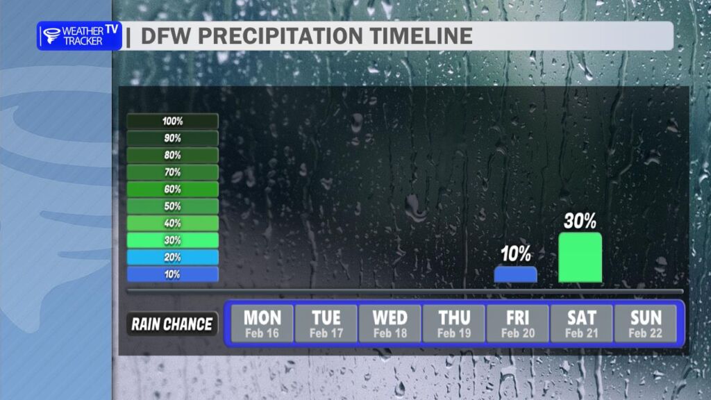
Looking ahead, we are monitoring our next opportunity for rain. An upper-level system is forecast to move in from the west Friday into Saturday, bringing the chance for scattered showers and a few thunderstorms. At this point, coverage and overall probabilities do not look particularly impressive, but we’ll continue refining that part of the forecast as newer data comes in over the next couple of days.
Overall, enjoy the warm and quiet stretch – it’s shaping up to be a very pleasant week across North Texas. -William